Ceylon, Minnesota
| Ceylon, Minnesota | |
|---|---|
| City | |
 Location of Ceylon, Minnesota | |
| Coordinates: 43°31′58″N 94°38′1″W / 43.53278°N 94.63361°W | |
| Country | United States |
| State | Minnesota |
| County | Martin |
| Government | |
| • Mayor | John Gibeau |
| Area[1] | |
| • Total | 0.65 sq mi (1.68 km2) |
| • Land | 0.65 sq mi (1.68 km2) |
| • Water | 0 sq mi (0 km2) |
| Elevation | 1,260 ft (384 m) |
| Population (2010)[2] | |
| • Total | 369 |
| • Estimate (2012[3]) | 360 |
| • Density | 567.7/sq mi (219.2/km2) |
| Time zone | Central (CST) (UTC-6) |
| • Summer (DST) | CDT (UTC-5) |
| ZIP code | 56121 |
| Area code(s) | 507 |
| FIPS code | 27-10792[4] |
| GNIS feature ID | 0641085[5] |
Ceylon is a city in Martin County, Minnesota, United States. The population was 369 at the 2010 census.[6]
History
Ceylon was platted in 1899.[7] It was named after the island of Ceylon,[7] known today as Sri Lanka. A post office has been in operation in Ceylon since 1899.[8]
Geography
According to the United States Census Bureau, the city has a total area of 0.65 square miles (1.68 km2), all of it land.[1]
Demographics
| Historical population | |||
|---|---|---|---|
| Census | Pop. | %± | |
| 1910 | 330 | — | |
| 1920 | 543 | 64.5% | |
| 1930 | 475 | −12.5% | |
| 1940 | 549 | 15.6% | |
| 1950 | 618 | 12.6% | |
| 1960 | 554 | −10.4% | |
| 1970 | 487 | −12.1% | |
| 1980 | 543 | 11.5% | |
| 1990 | 461 | −15.1% | |
| 2000 | 413 | −10.4% | |
| 2010 | 369 | −10.7% | |
| Est. 2015 | 356 | [9] | −3.5% |
2010 census
As of the census[2] of 2010, there were 369 people, 153 households, and 100 families residing in the city. The population density was 567.7 inhabitants per square mile (219.2/km2). There were 183 housing units at an average density of 281.5 per square mile (108.7/km2). The racial makeup of the city was 97.0% White, 0.3% Native American, 1.6% from other races, and 1.1% from two or more races. Hispanic or Latino of any race were 4.9% of the population.
There were 153 households of which 30.1% had children under the age of 18 living with them, 54.9% were married couples living together, 7.2% had a female householder with no husband present, 3.3% had a male householder with no wife present, and 34.6% were non-families. 27.5% of all households were made up of individuals and 13% had someone living alone who was 65 years of age or older. The average household size was 2.41 and the average family size was 2.98.
The median age in the city was 42.1 years. 25.7% of residents were under the age of 18; 4.8% were between the ages of 18 and 24; 21.5% were from 25 to 44; 30.6% were from 45 to 64; and 17.3% were 65 years of age or older. The gender makeup of the city was 52.3% male and 47.7% female.
2000 census
As of the census[4] of 2000, there were 413 people, 175 households, and 121 families residing in the city. The population density was 635.8 people per square mile (245.3/km²). There were 189 housing units at an average density of 291.0 per square mile (112.3/km²). The racial makeup of the city was 98.55% White, 0.24% Pacific Islander, and 1.21% from two or more races. Hispanic or Latino of any race were 2.18% of the population.
There were 175 households out of which 28.0% had children under the age of 18 living with them, 59.4% were married couples living together, 6.3% had a female householder with no husband present, and 30.3% were non-families. 24.6% of all households were made up of individuals and 11.4% had someone living alone who was 65 years of age or older. The average household size was 2.36 and the average family size was 2.80.
In the city the population was spread out with 24.2% under the age of 18, 7.3% from 18 to 24, 22.5% from 25 to 44, 24.7% from 45 to 64, and 21.3% who were 65 years of age or older. The median age was 41 years. For every 100 females there were 105.5 males. For every 100 females age 18 and over, there were 101.9 males.
The median income for a household in the city was $31,100, and the median income for a family was $32,708. Males had a median income of $23,889 versus $23,125 for females. The per capita income for the city was $15,607. About 9.6% of families and 17.6% of the population were below the poverty line, including 42.9% of those under age 18 and 13.3% of those age 65 or over.
Notable people
- Walter Mondale (born 1928), former Vice President of the United States, United States Senator, Minnesota Attorney General, and presidential nominee was born in Ceylon.
- John D. Gibeau, was elected Mayor in 1998 at the age of 21 years. He is Minnesota's youngest elected Mayor ever.
References
- 1 2 "US Gazetteer files 2010". United States Census Bureau. Archived from the original on 2012-01-24. Retrieved 2012-11-13.
- 1 2 "American FactFinder". United States Census Bureau. Retrieved 2012-11-13.
- ↑ "Population Estimates". United States Census Bureau. Archived from the original on 2013-06-17. Retrieved 2013-05-28.
- 1 2 "American FactFinder". United States Census Bureau. Archived from the original on 2013-09-11. Retrieved 2008-01-31.
- ↑ "US Board on Geographic Names". United States Geological Survey. 2007-10-25. Retrieved 2008-01-31.
- ↑ "2010 Census Redistricting Data (Public Law 94-171) Summary File". American FactFinder. United States Census Bureau. Archived from the original on 21 July 2011. Retrieved 27 April 2011.
- 1 2 Chicago and North Western Railway Company (1908). A History of the Origin of the Place Names Connected with the Chicago & North Western and Chicago, St. Paul, Minneapolis & Omaha Railways. p. 54.
- ↑ "Martin County". Jim Forte Postal History. Retrieved 28 February 2015.
- ↑ "Annual Estimates of the Resident Population for Incorporated Places: April 1, 2010 to July 1, 2015". Retrieved July 2, 2016.
- ↑ "Census of Population and Housing". Census.gov. Archived from the original on May 11, 2015. Retrieved June 4, 2015.
Municipalities and communities of Martin County, Minnesota, United States | ||
|---|---|---|
| Cities | 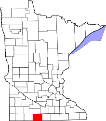 | |
| Townships | ||
| Unincorporated community | ||
| Footnotes | ‡This populated place also has portions in an adjacent county or counties | |
Coordinates: 43°32′01″N 94°37′54″W / 43.53361°N 94.63167°W