Château de Vincennes (Paris Métro)
Château de Vincennes | |||||||||||
|---|---|---|---|---|---|---|---|---|---|---|---|
| Paris Métro station | |||||||||||
.jpg) | |||||||||||
| Location |
14, av. de Paris 7, av. de Nogent 11, av. de Nogent Château de Vincennes Bus station Vincennes Île-de-France France | ||||||||||
| Coordinates | 48°50′40″N 2°26′24″E / 48.84444°N 2.44000°ECoordinates: 48°50′40″N 2°26′24″E / 48.84444°N 2.44000°E | ||||||||||
| Owned by | RATP | ||||||||||
| Operated by | RATP | ||||||||||
| Other information | |||||||||||
| Fare zone | 2 | ||||||||||
| History | |||||||||||
| Opened | 24 March 1934 | ||||||||||
| Services | |||||||||||
| |||||||||||
| Location | |||||||||||
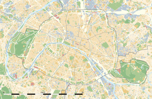 Château de Vincennes Location within Paris | |||||||||||
Château de Vincennes is a station of the Paris Métro. It is the eastern terminus of line 1 and serves the Château de Vincennes. It lies on the border between the commune of Vincennes and the Bois de Vincennes, which is part of the 12th arrondissement of Paris.
Station layout
| G | Street level | Exit/Entrance |
| M | Mezzanine for platform connection | Faregates |
| P Platforms |
Platform 3 | ← |
| Platform 1 | ← | |
| Platform 2 | | |
| Platform 4 | | |
Gallery
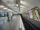 Island platform at Château de Vincennes
See also
| Wikimedia Commons has media related to Château de Vincennes (Paris Metro). |
References
- Roland, Gérard (2003). Stations de métro. D’Abbesses à Wagram. Éditions Bonneton.
This article is issued from Wikipedia - version of the 11/18/2016. The text is available under the Creative Commons Attribution/Share Alike but additional terms may apply for the media files.