Chamberlayne, Virginia
| Chamberlane, Virginia | |
|---|---|
| Census-designated place | |
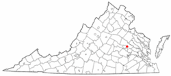 Location of Chamberlane, Virginia | |
| Coordinates: 37°37′51″N 77°26′16″W / 37.63083°N 77.43778°WCoordinates: 37°37′51″N 77°26′16″W / 37.63083°N 77.43778°W | |
| Country |
|
| State |
|
| County |
|
| Area | |
| • Total | 3.7 sq mi (9.5 km2) |
| • Land | 3.4 sq mi (8.7 km2) |
| • Water | 0.3 sq mi (0.9 km2) |
| Elevation | 164 ft (50 m) |
| Population (2010) | |
| • Total | 5,456 |
| • Density | 1,500/sq mi (570/km2) |
| Time zone | Eastern (EST) (UTC-5) |
| • Summer (DST) | EDT (UTC-4) |
| FIPS code | 51-14544[1] |
| GNIS feature ID | 1867586[2] |
Chamberlayne is a census-designated place (CDP) in Henrico County, Virginia. The population was 5,456 at the 2010 United States Census.[3]
Geography
Chamberlayne is located at 37°37′51″N 77°26′16″W / 37.63083°N 77.43778°W (37.630794, -77.437807).[4]
According to the United States Census Bureau, the CDP has a total area of 3.7 square miles (9.5 km2), of which 3.4 square miles (8.7 km2) is land and 0.35 square miles (0.9 km2), or 8.99%, is water.[5]
Demographics
As of the census[1] of 2000, there were 4,380 people, 1,884 households, and 1,352 families residing in the CDP. The population density was 1,163.5 people per square mile (449.8/km²). There were 1,916 housing units at an average density of 509.0/sq mi (196.7/km²). The racial makeup of the CDP was 47.83% White, 49.20% African American, 0.16% Native American, 1.12% Asian, 0.09% Pacific Islander, 0.39% from other races, and 1.21% from two or more races. Hispanic or Latino of any race were 0.84% of the population.
There were 1,884 households out of which 19.5% had children under the age of 18 living with them, 58.4% were married couples living together, 10.0% had a female householder with no husband present, and 28.2% were non-families. 24.2% of all households were made up of individuals and 12.1% had someone living alone who was 65 years of age or older. The average household size was 2.32 and the average family size was 2.73.
In the CDP the population was spread out with 16.6% under the age of 18, 4.5% from 18 to 24, 22.2% from 25 to 44, 32.4% from 45 to 64, and 24.2% who were 65 years of age or older. The median age was 49 years. For every 100 females there were 89.0 males. For every 100 females age 18 and over, there were 86.2 males.
The median income for a household in the CDP was $54,022, and the median income for a family was $60,425. Males had a median income of $40,858 versus $32,422 for females. The per capita income for the CDP was $28,405. About 1.9% of families and 3.3% of the population were below the poverty line, including 2.7% of those under age 18 and 2.3% of those age 65 or over.
Population history
- 1980....5,136
- 1990....4,577
- 2000....4,380
- 2010....5,456
Source U.S. Census Bureau
References
- 1 2 "American FactFinder". United States Census Bureau. Archived from the original on 2013-09-11. Retrieved 2008-01-31.
- ↑ "US Board on Geographic Names". United States Geological Survey. 2007-10-25. Retrieved 2008-01-31.
- ↑ "Profile of General Population and Housing Characteristics: 2010 Demographic Profile Data (DP-1): Chamberlayne CDP, Virginia". U.S. Census Bureau, American Factfinder. Archived from the original on September 11, 2013. Retrieved August 6, 2012.
- ↑ "US Gazetteer files: 2010, 2000, and 1990". United States Census Bureau. 2011-02-12. Retrieved 2011-04-23.
- ↑ "Geographic Identifiers: 2010 Demographic Profile Data (G001): Chamberlayne CDP, Virginia". U.S. Census Bureau, American Factfinder. Archived from the original on September 11, 2013. Retrieved August 6, 2012.
External links
Municipalities and communities of Henrico County, Virginia, United States | ||
|---|---|---|
| CDPs |  | |
| Unincorporated communities | ||