Changrabandha railway station
Changrabandha | |
|---|---|
| Indian Railway Station | |
| Location |
Vill: Changrabandha, PS: Mekhliganj, Distt: Cooch Behar, West Bengal India |
| Coordinates | 26°24′47″N 88°55′09″E / 26.4131°N 88.9193°ECoordinates: 26°24′47″N 88°55′09″E / 26.4131°N 88.9193°E |
| Owned by | Indian Railways |
| Operated by | Northeast Frontier Railway |
| Line(s) | New Mal Jn - Changrabandha Line |
| Platforms | 1 |
| Tracks | New Mal Jn - Changrabandha Line |
| Other information | |
| Status | Line converted to broad gauge |
| Station code | CBD |
| Zone(s) | Northeast Frontier Railway |
| Division(s) | Alipurduar |
| History | |
| Electrified | no |
| Previous names | Bengal Dooars Railway |
| Location | |
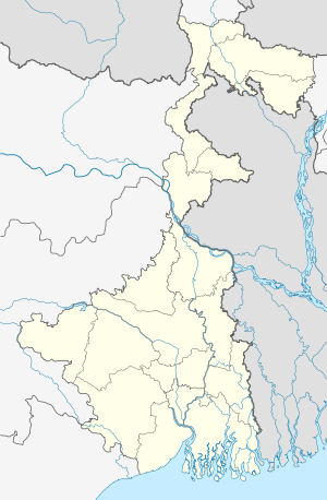 Changrabandha Location in West Bengal | |
Domohani-Lalmonirhat line | ||||||||||||||||||||||||||||||||||||||||||||||||||||||||||||||||||||||||||||||||||||||||||||||||||||||||||||||||||||||||||||||||||||||||||||||||
|---|---|---|---|---|---|---|---|---|---|---|---|---|---|---|---|---|---|---|---|---|---|---|---|---|---|---|---|---|---|---|---|---|---|---|---|---|---|---|---|---|---|---|---|---|---|---|---|---|---|---|---|---|---|---|---|---|---|---|---|---|---|---|---|---|---|---|---|---|---|---|---|---|---|---|---|---|---|---|---|---|---|---|---|---|---|---|---|---|---|---|---|---|---|---|---|---|---|---|---|---|---|---|---|---|---|---|---|---|---|---|---|---|---|---|---|---|---|---|---|---|---|---|---|---|---|---|---|---|---|---|---|---|---|---|---|---|---|---|---|---|---|---|---|---|
Legend
| ||||||||||||||||||||||||||||||||||||||||||||||||||||||||||||||||||||||||||||||||||||||||||||||||||||||||||||||||||||||||||||||||||||||||||||||||
Changrabandha (Bengali: চ্যাংড়াবান্ধা ) is a land border crossing point and a defunct rail transit point on the India-Bangladesh border in Cooch Behar district in the Indian state of West Bengal. The corresponding point on the Bangladesh side is Burimari in Lalmonirhat District.[1][2]
The headquarters of Mekhliganj community development block is located at Changrabandha.[3]
History
The Lalmonirhat-Malbazar metre gauge line was developed by the Bengal Dooars Railway in the closing years of the nineteenth century.[4] With the partition of India in 1947, the Indian side of the line terminated at Changrabandha and the Pakistani side, later Bangladeshi side, at Burimari.[5]
Present status
The line between New Mal Jn. and Changrabandha is now (2016) converted to Broad Gauge. The introduction of the train services were delayed as a result of delay in environmental clearance. However a pair of DMUs have been introduced on this route from Siliguri to Changrabandha via New Mal Jn from 20 January 2016.[6]
The Bangladeshi side of the line is still functional but the track is in bad shape with frequent derailments. There are two local trains in a day running at a limited speed of 8–14 km per hour (as against 45 km per hour in normal sections).[7][8] Bangladesh Railway has planned for rehabilitation of the line.[9]
Direct buses are available between Siliguri and Changrabandha, and between Dhaka and Burimari.[10]
References
- ↑ "Introducing Burimari". lonely planet. Retrieved 2011-12-10.
- ↑ "Notification No. 63/94-Cus. (N.T.) dtd 21/11/1994 with amendments - Land Customs Stations and Routes for import and export of goods by land or inland water ways". Retrieved 2012-03-15.
- ↑ "Contact details of Block Development Officers". Cooch Behar district. West Bengal Government. Retrieved 2011-03-20.
- ↑ "Bengal Dooars Railway". Fibis. Retrieved 2011-11-20.
- ↑ "Geography - International". IRFCA. Retrieved 2011-12-10.
- ↑ "Train running on the newly converted New Mal Junction-Changrabandha to start". North East Frontier Railway. Retrieved 20 January 2016.
- ↑ "Lalmonirhat-burimari Route -45 trains derail in 5 months - Lack of sleepers, stone makes the run-down track risky". The Daily Star, 7 February 2009. Retrieved 2011-12-10.
- ↑ "For better railway between Lalmonirhat and Burimari". The Financial Express, 10 August 2009. Retrieved 2011-12-10.
- ↑ "Tk 14,531 crore BR projects to double capacity". Priyo Internet Life. Retrieved 2011-12-10.
- ↑ "North East India". p 299. lonely planet / Google Books. Retrieved 2011-12-10.