Chata Kalikapur
| Chata Kalikapur ছোট কালিকাপুর | |
|---|---|
| town | |
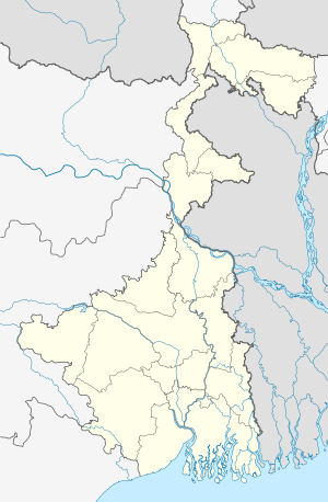 Chata Kalikapur  Chata Kalikapur Location in West Bengal, India | |
| Coordinates: 22°28′N 88°16′E / 22.47°N 88.26°ECoordinates: 22°28′N 88°16′E / 22.47°N 88.26°E | |
| Country |
|
| State | West Bengal |
| District | South 24 Parganas |
| Population (2011) | |
| • Total | 24,985 |
| Languages | |
| • Official | Bengali, English |
| Time zone | IST (UTC+5:30) |
| Vehicle registration | WB |
| Website |
s24pgs |
Chata Kalikapur is a census town in Thakurpukur Mahestala CD Block under Maheshtala police station in Alipore subdivision in South 24 Parganas district in the state of West Bengal, India.[1]
Geography
Chata Kalikapur is located at 22°28′N 88°16′E / 22.47°N 88.26°E.[2]
Demographics
As per 2011 Census of India Chata Kalikapur had a total population of 24,985, of which 12,709 (51%) were males and 12,276 (49%) were females. Population below 6 years was 3,318. The total number of literates in Chata Kalikapur was 16,715 (77.15 % of the population over 6 years). [3]
The following Municipalities and Census Towns in South 24 Parganas district were part of Kolkata Urban Agglomeration in 2011 census: Maheshtala (M), Joka (CT), Balarampur (CT), Chata Kalikapur (CT), Budge Budge (M), Nischintapur (CT), Uttar Raypur (CT), Pujali (M), and Rajpur Sonarpur (M).[4]
As of 2001 India census,[5] Chata Kalikapur had a population of 20,087. Males constitute 51% of the population and females 49%. Chata Kalikapur has an average literacy rate of 57%, lower than the national average of 59.5%; with male literacy of 63% and female literacy of 52%. 15% of the population is under 6 years of age.
References
- ↑ "Census of India". District-wise list of stautory towns. Directorate of census operations, West Bengal. Archived from the original on 2007-08-09. Retrieved 2007-09-02.
- ↑ "Yahoo maps location of Chata Kalikapur". Yahoo maps. Retrieved 2008-12-07.
- ↑ "C.D. Block Wise Primary Census Abstract Data(PCA)". 2011 census: West Bengal – District-wise CD Blocks. Registrar General and Census Commissioner, India. Retrieved 26 April 2016.
- ↑ "Provisional Population Totals, Census of India 2011" (PDF). Constituents of Urban Agglomeration Having Population Above 1 Lakh. Census of India 2011. Retrieved 26 April 2016.
- ↑ "Census of India 2001: Data from the 2001 Census, including cities, villages and towns (Provisional)". Census Commission of India. Archived from the original on 2004-06-16. Retrieved 2008-11-01.
Cities, towns and locations in South 24 Parganas district | |||||||||||||||||||
|---|---|---|---|---|---|---|---|---|---|---|---|---|---|---|---|---|---|---|---|
| Cities, municipal and census towns |
| ||||||||||||||||||
| Locations other than cities and towns | |||||||||||||||||||
| Related topics |
| ||||||||||||||||||