Chebrolu mandal
| Chebrolu mandal చేఁబ్రోలు మండలం | |
|---|---|
| Mandal | |
|
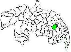
Mandal map of Guntur district showing Chebrolu mandal (in green) | |
 Chebrolu mandal Location in Andhra Pradesh, India | |
| Coordinates: 16°11′48″N 80°31′30″E / 16.19667°N 80.52500°ECoordinates: 16°11′48″N 80°31′30″E / 16.19667°N 80.52500°E | |
| Country | India |
| State | Andhra Pradesh |
| District | Guntur |
| Revenue Division | Tenali |
| Headquarters | Chebrolu |
| Government | |
| • Body | Mandal Parishad |
| • Tehsildar | S.Jagan Mohan Rao |
| Area[1] | |
| • Total | 134.18 km2 (51.81 sq mi) |
| Population (2011)[2] | |
| • Total | 72,141 |
| • Density | 540/km2 (1,400/sq mi) |
| Languages | |
| • Official | Telugu |
| Time zone | IST (UTC+5:30) |
Chebrolu mandal is one of the 57 mandals in Guntur district of the Indian state of Andhra Pradesh. It is under the administration of Tenali revenue division and the headquarters are located at Chebrolu.[3][1] The mandal is bounded by Guntur, Pedakakani, Tenali, Vatticherukuru, Tsundur and Ponnur mandals.[4]
Administration
The mandal is also a part of the Andhra Pradesh Capital Region under the jurisdiction of APCRDA.[5] The mandal is under the control of a tahsildar and the present tahsildar is S.Jagan Mohan Rao.[6] Chebrolu mandal is one of the 3 mandals under Ponnur (Assembly constituency), which in turn represents Guntur (Lok Sabha constituency) of Andhra Pradesh.[7]
Towns and villages
As of 2011 census, the mandal has 19 settlements. It includes 1 town and 11 villages.[8][3]
The settlements in the mandal are listed below:
See also
References
- 1 2 "District Census Handbook - Guntur" (PDF). Census of India. pp. 14,414. Retrieved 4 May 2016.
- ↑ "Census 2011". The Registrar General & Census Commissioner, India. Retrieved 27 May 2014.
- 1 2 "Guntur District Mandals" (PDF). Census of India. pp. 88,110. Retrieved 19 January 2015.
- ↑ "Mandals in Guntur district". aponline.gov.in. Retrieved 27 May 2015.
- ↑ "District wise mandals and villages covered in Krishna and Guntur districts" (PDF). Andhra Pradesh Capital Region Development Authority. Government of Andhra Pradesh. Retrieved 23 September 2015.
- ↑ "List of Tahsildars working in Guntur District as on 19.06.2014" (PDF). Guntur District Official Website. National Informatics Centre. p. 2. Retrieved 23 January 2015.
- ↑ "Delimitation of Parliamentary and Assembly Constituencies Order, 2008" (pdf). Election Commission of India. p. 22. Retrieved 11 October 2014.
- ↑ "Sub-District Details of Guntur District". The Registrar General & Census Commissioner, India. Retrieved 24 May 2014.