Clarin, Misamis Occidental
| Clarin | |
|---|---|
| Municipality | |
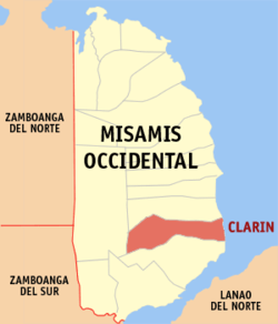 Map of Misamis Occidental with Clarin highlighted | |
.svg.png) Clarin Location within the Philippines | |
| Coordinates: 08°12′N 123°51′E / 8.200°N 123.850°ECoordinates: 08°12′N 123°51′E / 8.200°N 123.850°E | |
| Country | Philippines |
| Region | Northern Mindanao (Region X) |
| Province | Misamis Occidental |
| District | 2nd district of Misamis Occidental |
| Founded | February 21, 1921 |
| Barangays | 29 |
| Government[1] | |
| • Mayor | Elsa Navarro |
| Area[2] | |
| • Total | 84.50 km2 (32.63 sq mi) |
| Population (2010)[3] | |
| • Total | 35,573 |
| • Density | 420/km2 (1,100/sq mi) |
| Time zone | PST (UTC+8) |
| ZIP code | 7201 |
| Dialing code | +63 (0)88 |
| Income class | 4th |
Clarin is a fourth class municipality in the province of Misamis Occidental, Philippines. According to the 2010 census, it has a population of 35,573 people.[3]
Barangays
Clarin is politically subdivided into 29 barangays.[2]
- Bernad
- Bito-on
- Cabunga-an
- Canibungan Daku
- Canibungan Putol
- Canipacan
- Dalingap
- Dela Paz
- Dolores
- Gata Daku
- Gata Diot
- Guba (Ozamis)
- Kinangay Norte
- Kinangay Sur
- Lapasan
- Lupagan
- Malibangcao
- Masabud
- Mialen
- Pan-ay
- Penacio
- Poblacion I
- Poblacion II
- Poblacion III
- Poblacion IV
- Segatic Daku
- Segatic Diot
- Sebasi
- Tinacla-an
Demographics
| Population census of Clarin | ||
|---|---|---|
| Year | Pop. | ±% p.a. |
| 1990 | 23,802 | — |
| 1995 | 26,202 | +1.82% |
| 2000 | 29,712 | +2.73% |
| 2007 | 33,299 | +1.58% |
| 2010 | 35,573 | +2.43% |
| Source: National Statistics Office[3] | ||
Economy
Most of the town's people earned their living through farming and fishing. Farming involves many rice fields that had been cultivated for the past years. Fishing provides both a lot of fishes and sea shells that were hiding in the deep areas of Panguil Bay.
References
- ↑ "Official City/Municipal 2013 Election Results". Intramuros, Manila, Philippines: Commission on Elections (COMELEC). 1 July 2013. Retrieved 5 September 2013.
- 1 2 "Province: MISAMIS OCCIDENTAL". PSGC Interactive. Makati City, Philippines: National Statistical Coordination Board. Archived from the original on 1 January 1970. Retrieved 14 July 2014.
- 1 2 3 "Total Population by Province, City, Municipality and Barangay: as of May 1, 2010" (PDF). 2010 Census of Population and Housing. National Statistics Office. Archived from the original (PDF) on 20 March 2013. Retrieved 14 July 2014.
External links
- Philippine Standard Geographic Code
- Philippine Census Information
- Local Governance Performance Management System
 |
Tudela | | ||
| Don V. Chiongbian | |
Iligan Bay | ||
| ||||
| | ||||
| Ozamiz |
Oroquieta (capital) | |
| Municipalities | |
| Component cities | |
This article is issued from Wikipedia - version of the 11/25/2016. The text is available under the Creative Commons Attribution/Share Alike but additional terms may apply for the media files.