Clay Township, Cass County, Indiana
| Clay Township | |
|---|---|
| Township | |
|
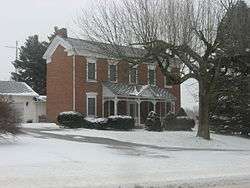
The Thompson Barnett House, a historic site in the township | |
 Location of Clay Township in Cass County | |
| Coordinates: 40°48′04″N 86°18′02″W / 40.80111°N 86.30056°WCoordinates: 40°48′04″N 86°18′02″W / 40.80111°N 86.30056°W | |
| Country | United States |
| State | Indiana |
| County | Cass |
| Government | |
| • Type | Indiana township |
| Area | |
| • Total | 20.11 sq mi (52.1 km2) |
| • Land | 19.93 sq mi (51.6 km2) |
| • Water | 0.18 sq mi (0.5 km2) |
| Elevation[1] | 728 ft (222 m) |
| Population (2010) | |
| • Total | 2,817 |
| • Density | 141.4/sq mi (54.6/km2) |
| FIPS code | 18-13006[2] |
| GNIS feature ID | 453206 |
Clay Township is one of fourteen townships in Cass County, Indiana, and one of the seventeen townships sharing the name in the state. As of the 2010 census, its population was 2,817.[3]
History
Clay Township was organized in 1832.[4] It was named for Henry Clay, three-term Speaker of the House of Representatives and Secretary of State.[5]
Thompson Barnett House was listed on the National Register of Historic Places in 1986.[6]
Geography
According to the 2010 census, the township has a total area of 20.11 square miles (52.1 km2), of which 19.93 square miles (51.6 km2) (or 99.10%) is land and 0.18 square miles (0.47 km2) (or 0.90%) is water.[3]
Cities and towns
- Logansport (northeast edge)
Unincorporated towns
Adjacent townships
Major highways
Cemeteries
The township contains two cemeteries: Bethel and Wilson.
References
- "Clay Township, Cass County, Indiana". Geographic Names Information System. United States Geological Survey. Retrieved 2009-09-24.
- United States Census Bureau cartographic boundary files
- ↑ "US Board on Geographic Names". United States Geological Survey. 2007-10-25. Retrieved 2008-01-31.
- ↑ "American FactFinder". United States Census Bureau. Archived from the original on 2013-09-11. Retrieved 2008-01-31.
- 1 2 "Geographic Identifiers: 2010 Demographic Profile Data (G001): Clay township, Cass County, Indiana". U.S. Census Bureau, American Factfinder. Retrieved January 15, 2013.
- ↑ Powell, Jehu Z. (1913). History of Cass County Indiana: From Its Earliest Settlement to the Present Time. Lewis Publishing Company. p. 520.
- ↑ Helm, Thomas B. (1878). History of Cass County, Indiana. Kingman Bros. p. 37.
- ↑ National Park Service (2010-07-09). "National Register Information System". National Register of Historic Places. National Park Service.
External links
Municipalities and communities of Cass County, Indiana, United States | ||
|---|---|---|
| City | ||
| Towns | ||
| Townships | ||
| CDP | ||
| Other unincorporated communities | ||
| Footnotes | ‡This populated place also has portions in an adjacent county or counties | |
This article is issued from Wikipedia - version of the 11/26/2016. The text is available under the Creative Commons Attribution/Share Alike but additional terms may apply for the media files.