Clay Township, Scioto County, Ohio
| Clay Township, Scioto County, Ohio | |
|---|---|
| Township | |
|
Christ's Brethren Church at Rubyville | |
 Location of Clay Township in Scioto County | |
| Coordinates: 38°47′32″N 82°58′6″W / 38.79222°N 82.96833°WCoordinates: 38°47′32″N 82°58′6″W / 38.79222°N 82.96833°W | |
| Country | United States |
| State | Ohio |
| County | Scioto |
| Area | |
| • Total | 22.1 sq mi (57.3 km2) |
| • Land | 21.6 sq mi (56.1 km2) |
| • Water | 0.5 sq mi (1.3 km2) |
| Elevation[1] | 978 ft (298 m) |
| Population (2010) | |
| • Total | 3,690 |
| • Density | 170/sq mi (64/km2) |
| Time zone | Eastern (EST) (UTC-5) |
| • Summer (DST) | EDT (UTC-4) |
| FIPS code | 39-15560[2] |
| GNIS feature ID | 1086924[1] |

Clay Township is one of the sixteen townships of Scioto County, Ohio, United States. The 2010 census counted 3,690 people in the township.[3]
Geography
Located in the center of the county, it borders the following townships:
- Valley Township - north, west of Jefferson Township
- Jefferson Township - north, east of Valley Township
- Harrison Township - east
- Porter Township - southeast
- Washington Township - southwest
- Rush Township - northwest
No municipalities are located in Clay Township, although the city of Portsmouth (the county seat of Scioto County) has incorporated much of the southern part of the township. The census-designated place of Rosemount lies in the center of the township, along with the unincorporated communities of Eden Park, Rubyville, and Twin Valley.
Name and history
Clay Township was organized on June 7, 1826.[4] The township was named after Henry Clay, the Kentucky statesman.[5] It is one of nine Clay Townships statewide.[6]
Government
The township is governed by a three-member board of trustees, who are elected in November of odd-numbered years to a four-year term beginning on the following January 1. Two are elected in the year after the presidential election and one is elected in the year before it. There is also an elected township fiscal officer,[7] who serves a four-year term beginning on April 1 of the year after the election, which is held in November of the year before the presidential election. Vacancies in the fiscal officership or on the board of trustees are filled by the remaining trustees.
The current township trustees are Jack Blevins, Tim Hines, and Howard Richard. Rick Vournazos is the township clerk.[8]
Public services

Residents are served by the Clay Local School District (Clay High School, Rubyville Elementary School, and Rosemount Primary School). The district is bordered by State Route 139 on the east and by U.S. Route 23 and the Scioto River on the west. Volunteer fire departments are operated in the communities of Rosemount and Rubyville.
References
- 1 2 "US Board on Geographic Names". United States Geological Survey. 2007-10-25. Retrieved 2008-01-31.
- ↑ "American FactFinder". United States Census Bureau. Archived from the original on 2013-09-11. Retrieved 2008-01-31.
- ↑ "Profile of General Population and Housing Characteristics: 2010 Demographic Profile Data (DP-1): Clay township, Scioto County, Ohio". U.S. Census Bureau, American Factfinder. Archived from the original on September 11, 2013. Retrieved March 29, 2012.
- ↑ "Portsmouth Area Resource Guide, 2007-2008". The Community Common. 2007-07-29. p. 6.
- ↑ Bannon, Henry Towne (1927). Stories Old and Often Told, Being Chronicles of Scioto County, Ohio. Baltimore: Waverly Press. p. 273.
- ↑ "Detailed map of Ohio" (PDF). United States Census Bureau. 2000. Retrieved 2007-02-16.
- ↑ §503.24, §505.01, and §507.01 of the Ohio Revised Code. Accessed 4/30/2009.
- ↑ Teresa Knittel, Director Board of Elections. "Scioto County Board of Elections". Retrieved 2008-10-07.
External links
Municipalities and communities of Scioto County, Ohio, United States | ||
|---|---|---|
| City | 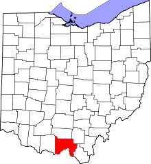 | |
| Villages | ||
| Townships | ||
| CDPs | ||
| Unincorporated communities | ||
| Footnotes | ‡This populated place also has portions in an adjacent county or counties | |