Clements, Kansas
| Clements, Kansas | |
|---|---|
| Unincorporated community | |
|
1886 Clements Stone Arch Bridge over Cottonwood River (2006) | |
 KDOT map of Chase County (legend) | |
 Clements  Clements | |
| Coordinates: 38°18′00″N 96°44′27″W / 38.30000°N 96.74083°WCoordinates: 38°18′00″N 96°44′27″W / 38.30000°N 96.74083°W | |
| Country | United States |
| State | Kansas |
| County | Chase |
| Township | Cottonwood |
| Founded |
18?? (Crawfordsville) 1884 (Clements) |
| Government | |
| • Type | Unincorporated |
| Elevation | 1,227 ft (374 m) |
| Time zone | Central (CST) (UTC-6) |
| • Summer (DST) | CDT (UTC-5) |
| Area code | 620 |
| FIPS code | 20-14000 [1] |
| GNIS feature ID | 0477389 [1] |

Clements is an unincorporated community in Chase County, Kansas, United States.
History
Early history
For many millennia, the Great Plains of North America was inhabited by nomadic Native Americans. From the 16th century to 18th century, the Kingdom of France claimed ownership of large parts of North America. In 1762, after the French and Indian War, France secretly ceded New France to Spain, per the Treaty of Fontainebleau.
19th century
In 1802, Spain returned most of the land to France. In 1803, most of the land for modern day Kansas was acquired by the United States from France as part of the 828,000 square mile Louisiana Purchase for 2.83 cents per acre.
In 1806, Zebulon Pike led the Pike expedition westward from St Louis, Missouri, of which part of their journey followed the Cottonwood River through Chase County near the current community of Clements.[2]
In 1854, the Kansas Territory was organized, then in 1861 Kansas became the 34th U.S. state. In 1859, Chase County was established within the Kansas Territory, which included the land for modern day Clements.
In 1862, a post office opened in nearby Silver Creek (an extinct town).
In 1871, the Atchison, Topeka and Santa Fe Railway built a main line east-west through the community.[3] In 1996, it merged with Burlington Northern Railroad and renamed to the current BNSF Railway. Most locals still refer to this railroad as the "Santa Fe".
In 1881, the post office from Silver Creek was moved to the rail community of Crawfordsville, which was renamed in 1884 to Clements. The post office was discontinued in 1988.[4]
In 1887, the nearby Clements Stone Arch Bridge was completed over the Cottonwood River.
20th century
There have been numerous floods during the history of Clements. In June and July 1951, due to heavy rains, rivers and streams flooded numerous cities in Kansas, including Clements. Many reservoirs and levees were built in Kansas as part of a response to the Great Flood of 1951.
Geography
Clements is located at 38°18′0″N 96°44′27″W / 38.30000°N 96.74083°W (38.3000159, -96.7408481), in the scenic Flint Hills of the Great Plains. The Cottonwood River runs through the south part of the community.
Area attractions
Clements has one listing on the National Register of Historic Places (NRHP).
- Clements Stone Arch Bridge[5] (NRHP)[6] crosses the Cottonwood River. It was built in 1887 of native limestone. The two-span bridge with a main span of 57.1 feet and a length of 126.9 feet is now open only to pedestrians.[7]
Education
Primary and secondary education
Cottonwood Falls is part of Unified School District 284.[8][9] All students attend schools in Cottonwood Falls.
- Chase County Junior/Senior High School, 600 Main St in Cottonwood Falls.
- Chase County Elementary School, 401 Maple St in Cottonwood Falls.
Infrastructure

Transportation
U.S. Route 50 highway and BNSF Railway pass through Clements.
Utilities
- Internet
- TV
- Satellite TV is provided by DirecTV, Dish Network.
- Free over-the-air ATSC digital TV.
See also
- La Junta Subdivision, branch of the BNSF Railway
- National Register of Historic Places listings in Chase County, Kansas
- Clements Stone Arch Bridge
- William C. & Jane Shaft House
- Cottonwood River and Great Flood of 1951
Further reading
References
- 1 2 "US Board on Geographic Names". United States Geological Survey. 2007-10-25. Retrieved 2008-01-31.
- ↑ 1806 Pike Expedition map through Chase County.
- ↑ Santa Fe Rail History
- ↑ "Kansas Post Offices, 1828-1961 (archived)". Kansas Historical Society. Archived from the original on October 9, 2013. Retrieved 5 June 2014.
- ↑ National Register of Historic Places - Clements Stone Arch Bridge
- ↑ Clements Stone Arch Bridge - Kansas Travel
- ↑ Clements Stone Arch Bridge; Kansas Flint Hills Tourism.
- ↑ USD 284
- ↑ Kansas School District Boundary Map Archived July 21, 2011, at the Wayback Machine.
External links
- Schools
- USD 284, school district for all of Chase County.
- Historical and Photos
- Clements Stone Arch Bridge, archive of official website
- Kansas Photo Tour - Clements Stone Bridge, archive of kansasphototour.com
- Clements - A "Quiet" town of Chase County, Kansas, History and photographs
- Maps
- Chase County Map, KDOT
- Topo Map of Clements / Elmdale area, USGS
| Wikimedia Commons has media related to Clements, Kansas. |
Municipalities and communities of Chase County, Kansas, United States | ||
|---|---|---|
| Cities | 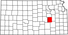 | |
| Unincorporated communities | ||
| Ghost towns | ||
| Townships | ||
| Footnotes | ‡This populated place also has portions in an adjacent county or counties | |