Cleveland, North Dakota
| Cleveland, North Dakota | |
|---|---|
| City | |
|
City Hall in Cleveland | |
 Location of Cleveland, North Dakota | |
| Coordinates: 46°53′27″N 99°7′9″W / 46.89083°N 99.11917°WCoordinates: 46°53′27″N 99°7′9″W / 46.89083°N 99.11917°W | |
| Country | United States |
| State | North Dakota |
| County | Stutsman |
| Area[1] | |
| • Total | 0.18 sq mi (0.47 km2) |
| • Land | 0.18 sq mi (0.47 km2) |
| • Water | 0 sq mi (0 km2) |
| Elevation | 1,864 ft (568 m) |
| Population (2010)[1][2] | |
| • Total | 83 |
| • Estimate (2014)[3] | 82 |
| • Density | 461.1/sq mi (178.0/km2) |
| Time zone | Central (CST) (UTC-6) |
| • Summer (DST) | CDT (UTC-5) |
| ZIP code | 58424 |
| Area code(s) | 701 |
| FIPS code | 38-14660 |
| GNIS feature ID | 1028392[4] |

Cleveland is a city in Stutsman County, North Dakota, United States. The population was 83 at the 2010 census.[1][5]
History
Cleveland was founded in 1882. It was named for Cleveland, Ohio.[6] A post office has been in operation at Cleveland since 1882.[7]
Geography
Cleveland is located at 46°53′27″N 99°7′9″W / 46.89083°N 99.11917°W (46.890961, -99.119189).[8]
According to the United States Census Bureau, the city has a total area of 0.18 square miles (0.47 km2), all of it land.[1]
Demographics
| Historical population | |||
|---|---|---|---|
| Census | Pop. | %± | |
| 1920 | 341 | — | |
| 1930 | 273 | −19.9% | |
| 1940 | 246 | −9.9% | |
| 1950 | 181 | −26.4% | |
| 1960 | 169 | −6.6% | |
| 1970 | 128 | −24.3% | |
| 1980 | 130 | 1.6% | |
| 1990 | 121 | −6.9% | |
| 2000 | 112 | −7.4% | |
| 2010 | 83 | −25.9% | |
| Est. 2015 | 81 | [9] | −2.4% |
| U.S. Decennial Census[10] 2014 Estimate[3] | |||
2010 census
As of the census[2] of 2010, there were 83 people, 40 households, and 21 families residing in the city. The population density was 461.1 inhabitants per square mile (178.0/km2). There were 54 housing units at an average density of 300.0 per square mile (115.8/km2). The racial makeup of the city was 100.0% White.
There were 40 households of which 20.0% had children under the age of 18 living with them, 47.5% were married couples living together, 5.0% had a male householder with no wife present, and 47.5% were non-families. 42.5% of all households were made up of individuals and 15% had someone living alone who was 65 years of age or older. The average household size was 2.08 and the average family size was 2.90.
The median age in the city was 44.5 years. 21.7% of residents were under the age of 18; 2.3% were between the ages of 18 and 24; 26.4% were from 25 to 44; 27.6% were from 45 to 64; and 21.7% were 65 years of age or older. The gender makeup of the city was 56.6% male and 43.4% female.
2000 census
As of the census of 2000, there were 112 people, 52 households, and 34 families residing in the city. The population density was 617.5 people per square mile (240.2/km²). There were 59 housing units at an average density of 325.3 per square mile (126.6/km²). The racial makeup of the city was 99.11% White and 0.89% Native American.
There were 52 households out of which 26.9% had children under the age of 18 living with them, 50.0% were married couples living together, 7.7% had a female householder with no husband present, and 34.6% were non-families. 34.6% of all households were made up of individuals and 13.5% had someone living alone who was 65 years of age or older. The average household size was 2.15 and the average family size was 2.68.
In the city the population was spread out with 25.9% under the age of 18, 4.5% from 18 to 24, 20.5% from 25 to 44, 32.1% from 45 to 64, and 17.0% who were 65 years of age or older. The median age was 42 years. For every 100 females there were 100.0 males. For every 100 females age 18 and over, there were 97.6 males.
The median income for a household in the city was $25,179, and the median income for a family was $26,750. Males had a median income of $27,500 versus $26,875 for females. The per capita income for the city was $13,707. There were 14.3% of families and 15.8% of the population living below the poverty line, including 12.0% of under eighteens and 9.5% of those over 64.
References
- 1 2 3 4 "US Gazetteer files 2010". United States Census Bureau. Retrieved 2015-05-17.
- 1 2 "American FactFinder". United States Census Bureau. Retrieved 2012-06-14.
- 1 2 "Population Estimates". United States Census Bureau. Retrieved July 9, 2015.
- ↑ "US Board on Geographic Names". United States Geological Survey. 2007-10-25. Retrieved 2008-01-31.
- ↑ "2010 Census Redistricting Data (Public Law 94-171) Summary File". American FactFinder. United States Census Bureau. Archived from the original on 21 July 2011. Retrieved 2 May 2011.
- ↑ Federal Writers' Project (1938). North Dakota, a Guide to the Northern Prairie State,. WPA. p. 285. ISBN 978-1-62376-033-5.
- ↑ "Stutsman County". Jim Forte Postal History. Retrieved 22 October 2015.
- ↑ "US Gazetteer files: 2010, 2000, and 1990". United States Census Bureau. 2011-02-12. Retrieved 2011-04-23.
- ↑ "Annual Estimates of the Resident Population for Incorporated Places: April 1, 2010 to July 1, 2015". Retrieved July 2, 2016.
- ↑ United States Census Bureau. "Census of Population and Housing". Archived from the original on May 11, 2015. Retrieved October 31, 2013.
Municipalities and communities of Stutsman County, North Dakota, United States | ||
|---|---|---|
| Cities | 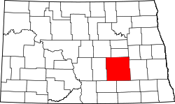 | |
| Townships |
| |
| CDPs | ||
| Unorganized territories |
| |
| Unincorporated communities | ||