College, Alaska
| College, Alaska | |
|---|---|
| CDP | |
|
The intersection of Alumni Drive/College Road with Farmers Loop Road/University Avenue is the historic and commercial center of the College community. Photo taken June 2011 from the side of Troth Yeddha' (College Hill), upon which the University of Alaska Fairbanks campus sits. | |
 Location within Fairbanks North Star Borough and the state of Alaska | |
| Coordinates: 64°50′54″N 147°49′38″W / 64.84833°N 147.82722°W | |
| Country | United States |
| State | Alaska |
| Borough | Fairbanks North Star |
| Government | |
| • Borough mayor | Karl Kassel |
| • State senators |
Click Bishop (R) John Coghill (R) |
| • State reps. |
David Guttenberg (D) Adam Wool (D) |
| Area | |
| • Total | 19.1 sq mi (49.4 km2) |
| • Land | 18.7 sq mi (48.4 km2) |
| • Water | 0.4 sq mi (1.1 km2) |
| Elevation | 449 ft (137 m) |
| Population (2010) | |
| • Total | 12,964 Ranked 6th |
| Time zone | Alaska (AKST) (UTC-9) |
| • Summer (DST) | AKDT (UTC-8) |
| ZIP code | 99709 |
| Area code(s) | 907 |
| FIPS code | 02-16750 |
| GNIS feature ID | 1400578 |

College is a census-designated place (CDP) in Fairbanks North Star Borough, Alaska, United States. It is part of the Fairbanks, Alaska Metropolitan Statistical Area. The population was 12,964 as of the 2010 census.
This community lies adjacent to the city of Fairbanks. The University of Alaska Fairbanks lies within its boundaries and serves as its core. The area is often referred to as part of Fairbanks, and not as a separate entity. The area is served by the University of Alaska Fairbanks for fire protection and ambulance service, and jointly by the University of Alaska Fairbanks Police Department and Alaska State Troopers for police protection.
Geography
College is located at 64°50′54″N 147°49′38″W / 64.84833°N 147.82722°W (64.848302, -147.827194).[1]
According to the United States Census Bureau, the CDP has a total area of 19.1 square miles (49 km2), of which 18.7 square miles (48 km2) is land and 0.4 square miles (1.0 km2) (2.15%) is water.
Demographics
| Historical population | |||
|---|---|---|---|
| Census | Pop. | %± | |
| 1940 | 234 | — | |
| 1950 | 424 | 81.2% | |
| 1960 | 1,755 | 313.9% | |
| 1970 | 3,434 | 95.7% | |
| 1980 | 4,043 | 17.7% | |
| 1990 | 11,249 | 178.2% | |
| 2000 | 11,402 | 1.4% | |
| 2010 | 12,964 | 13.7% | |
| source:[2][3] | |||
At the 2000 census,[4] there were 11,402 people, 4,104 households and 2,638 families residing in the CDP. The population density was 610.7 per square mile (235.8/km²). There were 4,501 housing units at an average density of 241.1/sq mi (93.1/km²). The racial makeup of the CDP was 77.85% White, 3.11% Black or African American, 8.95% Native American, 3.19% Asian, 0.08% Pacific Islander, 1.09% from other races, and 5.74% from two or more races. 3.47% of the population were Hispanic or Latino of any race.
There were 4,104 households of which 37.1% had children under the age of 18 living with them, 48.0% were married couples living together, 11.0% had a female householder with no husband present, and 35.7% were non-families. 25.7% of all households were made up of individuals and 3.2% had someone living alone who was 65 years of age or older. The average household size was 2.60 and the average family size was 3.13.
26.7% of the population were under the age of 18, 16.8% from 18 to 24, 29.1% from 25 to 44, 22.6% from 45 to 64, and 4.7% who were 65 years of age or older. The median age was 30 years. For every 100 females there were 107.6 males. For every 100 females age 18 and over, there were 109.2 males.
The median household income was $56,560 and the median family income was $69,969. Males had a median income of $47,126 versus $31,495 for females. The per capita income for the CDP was $23,381. About 4.9% of families and 8.2% of the population were below the poverty line, including 8.2% of those under age 18 and 4.8% of those age 65 or over.
Education
Fairbanks North Star Borough School District operates the public schools that serve College CDP.
Yukon-Koyukuk School District, which operates public schools in rural Yukon-Koyukuk, has its headquarters in College CDP.[5][6]
References
- ↑ "US Gazetteer files: 2010, 2000, and 1990". United States Census Bureau. 2011-02-12. Retrieved 2011-04-23.
- ↑ "Annual Estimates of the Population for Incorporated Places in Alaska". United States Census Bureau. July 1, 2008. Retrieved July 13, 2009.
- ↑ Moffatt, Riley. Population History of Western U.S. Cities & Towns, 1850–1990. Lanham: Scarecrow, 1996, 1.
- ↑ "American FactFinder". United States Census Bureau. Archived from the original on 2013-09-11. Retrieved 2008-01-31.
- ↑ Home page. Yukon-Koyukuk School District. Retrieved on June 16, 2016. "4762 Old Airport Way Fairbanks, AK 99709"
- ↑ "2010 CENSUS - CENSUS BLOCK MAP (INDEX): College CDP, AK." (See Map Page 2) U.S. Census Bureau. Retrieved on December 4, 2016.
External links
![]() Media related to College, Alaska at Wikimedia Commons
Media related to College, Alaska at Wikimedia Commons
Coordinates: 64°50′54″N 147°49′38″W / 64.848302°N 147.827194°W
Municipalities and communities of Fairbanks North Star Borough, Alaska, United States | ||
|---|---|---|
| Cities | 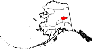 | |
| CDPs | ||
| Unincorporated communities | ||
| Ghost town | ||