Colonel Fabien (Paris Métro)
Colonel Fabien | |||||||||||
|---|---|---|---|---|---|---|---|---|---|---|---|
| Paris Métro station | |||||||||||
 | |||||||||||
| Location |
83, boul. de la Villette 10th arrondissement of Paris Île-de-France France | ||||||||||
| Coordinates | 48°52′38″N 2°22′16″E / 48.877136°N 2.37116°ECoordinates: 48°52′38″N 2°22′16″E / 48.877136°N 2.37116°E | ||||||||||
| Owned by | RATP | ||||||||||
| Operated by | RATP | ||||||||||
| Other information | |||||||||||
| Fare zone | 1 | ||||||||||
| History | |||||||||||
| Opened | 31 January 1903 | ||||||||||
| Services | |||||||||||
| |||||||||||
| Location | |||||||||||
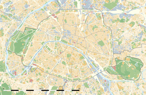 Colonel Fabien Location within Paris | |||||||||||
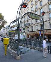
Colonel Fabien is a station on Paris Métro Line 2, on the border of the 10th and 19th arrondissements under the Boulevard de la Vilette.
The station was opened on 31 January 1903 as part of the extension of line 2 from Anvers to Bagnolet (now called Alexandre Dumas). It was originally named Combat after the Place du Combat, which was named after the Barrière du Combat, a gate built for the collection of taxation as part of the Wall of the Farmers-General; the gate was built between 1784 and 1788 and demolished after the Paris Commune of 1871. Its name reflected the animal fighting held there between 1778 and 1850. On 19 August 1945 the Place and station were renamed after Colonel Pierre-Georges Fabien, who shot a German soldier to death at Barbès – Rochechouart metro station, marking the beginning of the armed French Resistance in Paris.
Station layout
| G Street Level | ||
| M | Mezzanine for platform connection | |
| P Platform level |
||
| Platform 1 | ← | |
| Platform 2 | | |