Columbus, Montana
| Columbus, Montana | |
|---|---|
| Town | |
|
Business district of Columbus | |
 Location of Columbus, Montana | |
| Coordinates: 45°38′N 109°15′W / 45.633°N 109.250°WCoordinates: 45°38′N 109°15′W / 45.633°N 109.250°W | |
| Country | United States |
| State | Montana |
| County | Stillwater |
| Area[1] | |
| • Total | 1.35 sq mi (3.50 km2) |
| • Land | 1.32 sq mi (3.42 km2) |
| • Water | 0.03 sq mi (0.08 km2) |
| Elevation | 3,586 ft (1,093 m) |
| Population (2010)[2] | |
| • Total | 1,893 |
| • Estimate (2015)[3] | 2,042 |
| • Density | 1,434.1/sq mi (553.7/km2) |
| Time zone | Mountain (MST) (UTC-7) |
| • Summer (DST) | MDT (UTC-6) |
| ZIP code | 59019 |
| Area code(s) | 406 |
| FIPS code | 30-16825 |
| GNIS feature ID | 0770043 |

Columbus is a town in and the county seat of Stillwater County, Montana, United States.[4] The population was 1,893 at the 2010 census.
History
The community originated as a stagecoach station on the Yellowstone River.
The original name was Sheep Dip, then changed to Stillwater, but because of a Stillwater, Minnesota on the Northern Pacific RR, the mail presented a problem. Then came the name Columbus, Montana.
Geography and climate
Columbus is located at 45°38′N 109°15′W / 45.64°N 109.25°W (45.64, -109.25).[5]
According to the United States Census Bureau, the town has a total area of 1.35 square miles (3.50 km2), of which, 1.32 square miles (3.42 km2) is land and 0.03 square miles (0.08 km2) is water.[1]
Columbus is located between the Yellowstone River, the old Yellowstone Trail, Highway 10, and now Interstate 90.
| Climate data for Columbus, Montana (1981–2010) | |||||||||||||
|---|---|---|---|---|---|---|---|---|---|---|---|---|---|
| Month | Jan | Feb | Mar | Apr | May | Jun | Jul | Aug | Sep | Oct | Nov | Dec | Year |
| Average high °F (°C) | 38.9 (3.8) |
42.8 (6) |
52.0 (11.1) |
60.8 (16) |
69.7 (20.9) |
78.3 (25.7) |
87.2 (30.7) |
85.9 (29.9) |
75.3 (24.1) |
62.2 (16.8) |
47.1 (8.4) |
37.0 (2.8) |
61.4 (16.3) |
| Average low °F (°C) | 12.3 (−10.9) |
15.6 (−9.1) |
23.7 (−4.6) |
31.1 (−0.5) |
39.7 (4.3) |
47.3 (8.5) |
52.6 (11.4) |
50.4 (10.2) |
41.3 (5.2) |
31.9 (−0.1) |
21.5 (−5.8) |
11.9 (−11.2) |
31.6 (−0.2) |
| Average precipitation inches (mm) | 0.58 (14.7) |
0.64 (16.3) |
1.02 (25.9) |
1.89 (48) |
2.71 (68.8) |
2.21 (56.1) |
1.23 (31.2) |
0.89 (22.6) |
1.23 (31.2) |
1.30 (33) |
0.62 (15.7) |
0.56 (14.2) |
14.89 (378.2) |
| Average snowfall inches (cm) | 5.5 (14) |
6.0 (15.2) |
6.7 (17) |
3.2 (8.1) |
1.6 (4.1) |
0.0 (0) |
0.0 (0) |
0.0 (0) |
0.5 (1.3) |
2.7 (6.9) |
3.7 (9.4) |
5.6 (14.2) |
35.6 (90.4) |
| Source: NOAA[6] | |||||||||||||
Demographics
| Historical population | |||
|---|---|---|---|
| Census | Pop. | %± | |
| 1910 | 521 | — | |
| 1920 | 987 | 89.4% | |
| 1930 | 834 | −15.5% | |
| 1940 | 962 | 15.3% | |
| 1950 | 1,097 | 14.0% | |
| 1960 | 1,281 | 16.8% | |
| 1970 | 1,173 | −8.4% | |
| 1980 | 1,439 | 22.7% | |
| 1990 | 1,573 | 9.3% | |
| 2000 | 1,748 | 11.1% | |
| 2010 | 1,893 | 8.3% | |
| Est. 2015 | 2,042 | [7] | 7.9% |
| U.S. Decennial Census[8][9] 2015 Estimate[3] | |||
2010 census
As of the census[2] of 2010, there were 1,893 people, 767 households, and 517 families residing in the town. The population density was 1,434.1 inhabitants per square mile (553.7/km2). There were 843 housing units at an average density of 638.6 per square mile (246.6/km2). The racial makeup of the town was 96.5% White, 0.1% African American, 0.6% Native American, 0.4% Asian, 0.4% from other races, and 2.1% from two or more races. Hispanic or Latino of any race were 2.7% of the population.
There were 767 households of which 33.9% had children under the age of 18 living with them, 55.9% were married couples living together, 9.0% had a female householder with no husband present, 2.5% had a male householder with no wife present, and 32.6% were non-families. 28.3% of all households were made up of individuals and 13.8% had someone living alone who was 65 years of age or older. The average household size was 2.41 and the average family size was 2.97.
The median age in the town was 40.4 years. 26% of residents were under the age of 18; 6.1% were between the ages of 18 and 24; 23.8% were from 25 to 44; 27.4% were from 45 to 64; and 16.7% were 65 years of age or older. The gender makeup of the town was 48.5% male and 51.5% female.
2000 census
As of the census[10] of 2000, there were 1,748 people, 709 households, and 455 families residing in the town. The population density was 1,449.6 people per square mile (557.8/km2). There were 762 housing units at an average density of 631.9 per square mile (243.1/km2). The racial makeup of the town was 96.62% White, 0.23% African American, 1.26% Native American, 0.11% Asian, 0.11% from other races, and 1.66% from two or more races. Hispanic or Latino of any race were 1.60% of the population.
There were 709 households out of which 33.3% had children under the age of 18 living with them, 54.0% were married couples living together, 7.1% had a female householder with no husband present, and 35.7% were non-families. 31.0% of all households were made up of individuals and 12.6% had someone living alone who was 65 years of age or older. The average household size was 2.37 and the average family size was 2.98.
In the town the population was spread out with 26.7% under the age of 18, 5.9% from 18 to 24, 28.2% from 25 to 44, 22.5% from 45 to 64, and 16.6% who were 65 years of age or older. The median age was 38 years. For every 100 females there were 97.3 males. For every 100 females age 18 and over, there were 91.5 males.
The median income for a household in the town was $33,750, and the median income for a family was $46,103. Males had a median income of $37,750 versus $20,417 for females. The per capita income for the town was $17,689. About 9.8% of families and 13.6% of the population were below the poverty line, including 15.6% of those under age 18 and 15.7% of those age 65 or over.
Notable residents
- Annie Duke, professional poker player, lived here with her husband.
- Dwan Edwards, professional football player, attended high school here.
- Jack Vaughn, Assistant Secretary of State, Ambassador to Panama and Colombia, and Director of the Peace Corps from 1966 to 1969, was born in Columbus.
References
- 1 2 "US Gazetteer files 2010". United States Census Bureau. Archived from the original on 2012-01-24. Retrieved 2012-12-18.
- 1 2 "American FactFinder". United States Census Bureau. Retrieved 2012-12-18.
- 1 2 "Population Estimates". United States Census Bureau. Retrieved July 19, 2016.
- ↑ "Find a County". National Association of Counties. Archived from the original on 2011-05-31. Retrieved 2011-06-07.
- ↑ "US Gazetteer files: 2010, 2000, and 1990". United States Census Bureau. 2011-02-12. Retrieved 2011-04-23.
- ↑ "NOWData - NOAA Online Weather Data". National Oceanic and Atmospheric Administration. Retrieved May 4, 2013.
- ↑ "Annual Estimates of the Resident Population for Incorporated Places: April 1, 2010 to July 1, 2015". Retrieved July 2, 2016.
- ↑ "Census of Population and Housing". Census.gov. Archived from the original on May 11, 2015. Retrieved June 4, 2015.
- ↑ "Census & Economic Information Center". Retrieved July 3, 2015.
- ↑ "American FactFinder". United States Census Bureau. Archived from the original on 2013-09-11. Retrieved 2008-01-31.
External links
Municipalities and communities of Stillwater County, Montana, United States | ||
|---|---|---|
| Town | 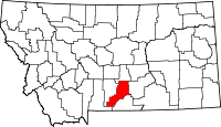 | |
| CDPs | ||
| Unincorporated communities | ||
| Ghost towns | ||