Combine, Texas
| Combine, Texas | |
|---|---|
| City | |
 Location of Combine in Kaufman County, Texas | |
| Coordinates: 32°35′18″N 96°30′56″W / 32.58833°N 96.51556°WCoordinates: 32°35′18″N 96°30′56″W / 32.58833°N 96.51556°W | |
| Country | United States |
| State | Texas |
| Counties | Kaufman, Dallas |
| Area | |
| • Total | 7.0 sq mi (18.1 km2) |
| • Land | 6.7 sq mi (17.3 km2) |
| • Water | 0.3 sq mi (0.8 km2) |
| Elevation | 413 ft (126 m) |
| Population (2010) | |
| • Total | 1,942 |
| • Density | 280/sq mi (110/km2) |
| Time zone | Central (CST) (UTC-6) |
| • Summer (DST) | CDT (UTC-5) |
| ZIP code | 75159 |
| Area code(s) | 972 |
| FIPS code | 48-16216[1] |
| GNIS feature ID | 1378147[2] |
| Website | http://combinetx.com |
Combine is a city in Dallas and Kaufman counties in the U.S. state of Texas. The population was 1,942 at the 2010 census.[3]
Geography
Combine is located at 32°35′18″N 96°30′56″W / 32.58833°N 96.51556°W (32.588374, -96.515584).[4]
According to the United States Census Bureau, the city has a total area of 7.0 square miles (18.1 km2), of which 6.7 square miles (17.3 km2) is land and 0.31 square miles (0.8 km2), or 4.16%, is water.[5]
Demographics
| Historical population | |||
|---|---|---|---|
| Census | Pop. | %± | |
| 1970 | 249 | — | |
| 1980 | 688 | 176.3% | |
| 1990 | 1,329 | 93.2% | |
| 2000 | 1,788 | 34.5% | |
| 2010 | 1,942 | 8.6% | |
| Est. 2015 | 2,107 | [6] | 8.5% |
As of the census[1] of 2000, there were 1,788 people, 590 households, and 523 families residing in the city. The population density was 248.1 people per square mile (95.7/km²). There were 622 housing units at an average density of 86.3 per square mile (33.3/km²). The racial makeup of the city was 94.35% White, 0.50% African American, 0.84% Native American, 0.06% Asian, 2.63% from other races, and 1.62% from two or more races. Hispanic or Latino of any race were 5.31% of the population.
There were 590 households out of which 39.5% had children under the age of 18 living with them, 76.9% were married couples living together, 7.3% had a female householder with no husband present, and 11.2% were non-families. 9.2% of all households were made up of individuals and 3.6% had someone living alone who was 65 years of age or older. The average household size was 3.03 and the average family size was 3.19.
In the city the population was spread out with 27.5% under the age of 18, 6.7% from 18 to 24, 29.9% from 25 to 44, 27.8% from 45 to 64, and 8.2% who were 65 years of age or older. The median age was 38 years. For every 100 females there were 104.1 males. For every 100 females age 18 and over, there were 103.6 males.
The median income for a household in the city was $59,926, and the median income for a family was $61,563. Males had a median income of $41,532 versus $28,583 for females. The per capita income for the city was $22,610. About 3.0% of families and 5.4% of the population were below the poverty line, including 8.4% of those under age 18 and 11.5% of those age 65 or over.
Education
Combine is served by two school districts:[8] Crandall Independent School District and by Dallas Independent School District. The students in the Crandall portion are zoned to Wilson Elementary School, Crandall Middle School, and Crandall High School, all within the city of Crandall.
The students in the Dallas County portion are zoned to attend Seagoville schools, which are part of the Dallas Independent School District. The area is within the Board of Trustees District 4;[9] as of 2008 Nancy Bingham represents the district. The schools are:
- Seagoville Elementary School[10]
- Seagoville Middle School[11]
- Seagoville High School[12]
Before 2012, students were zoned jointly to Seagoville Elementary School and Central Elementary School, then grades PK-2 and 3-5, respectively.[13][14] The grade alignments of Seagoville schools changed in 2012 with the opening of Seagoville North Elementary School,[15][16] and the DISD portion of Combine was rezoned to Seagoville Elementary for grades PK-5.[17]
References
- 1 2 "American FactFinder". United States Census Bureau. Archived from the original on 2013-09-11. Retrieved 2008-01-31.
- ↑ "US Board on Geographic Names". United States Geological Survey. 2007-10-25. Retrieved 2008-01-31.
- ↑ "Profile of General Population and Housing Characteristics: 2010 Demographic Profile Data (DP-1): Combine city, Texas". U.S. Census Bureau, American Factfinder. Archived from the original on September 11, 2013. Retrieved January 11, 2012.
- ↑ "US Gazetteer files: 2010, 2000, and 1990". United States Census Bureau. 2011-02-12. Retrieved 2011-04-23.
- ↑ "Geographic Identifiers: 2010 Demographic Profile Data (G001): Combine city, Texas". U.S. Census Bureau, American Factfinder. Archived from the original on September 11, 2013. Retrieved January 11, 2012.
- ↑ "Annual Estimates of the Resident Population for Incorporated Places: April 1, 2010 to July 1, 2015". Retrieved July 2, 2016.
- ↑ "Census of Population and Housing". Census.gov. Archived from the original on April 22, 2013. Retrieved June 4, 2015.
- ↑ Maps of Combine. U.S. Census Bureau. Retrieved on June 9, 2016.
- ↑ "Trustee District 4 with School Locations." Dallas Independent School District. Retrieved on November 24, 2008.
- ↑ "2015-16 Seagoville Elementary Attendance Zone Grades PK-5." Dallas Independent School District. Retrieved on June 8, 2016.
- ↑ "2015-16 Seagoville Middle Attendance Zone Grades 6-8." Dallas Independent School District. Retrieved on June 8, 2016.
- ↑ "2015-16 Seagoville High School Attendance Zone Grades 9-12." Dallas Independent School District. Retrieved on June 8, 2016.
- ↑ "Fall 2011 Seagoville Elementary Attendance Zone Grades PK-2." Dallas Independent School District. Retrieved on June 8, 2016.
- ↑ "Fall 2011 Central Elementary Attendance Zone Grades 3-5." Dallas Independent School District. Retrieved on June 8, 2016.
- ↑ "2012-13 Seagoville North Elementary Attendance Zone Grades PK-5." Dallas Independent School District. Retrieved on June 8, 2016.
- ↑ "2012-13 Central Elementary Attendance Zone Grades PK-5." Dallas Independent School District. Retrieved on June 8, 2016.
- ↑ "2012-13 Seagoville Elementary Attendance Zone Grades PK-5." Dallas Independent School District. Retrieved on June 8, 2016.
External links
- City of Combine official website
- Combine Fire Department
- Handbook of Texas Online article on Combine
Municipalities and communities of Dallas County, Texas, United States | ||
|---|---|---|
| Cities | 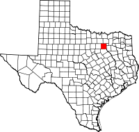 | |
| Towns | ||
| Unincorporated communities | ||
| Historical communities | ||
| Footnotes | ‡This populated place also has portions in an adjacent county or counties | |
Municipalities and communities of Kaufman County, Texas, United States | ||
|---|---|---|
| Cities | 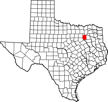 | |
| Towns | ||
| Villages | ||
| CDPs | ||
| Unincorporated communities | ||
| Footnotes | ‡This populated place also has portions in an adjacent county or counties | |