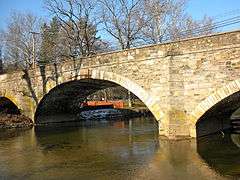
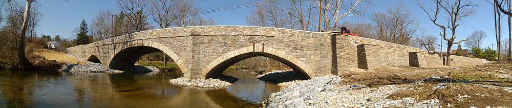
Cope's Bridge
|
Cope's Bridge | |
 | |
  | |
| Nearest city | Marshallton, Pennsylvania |
|---|---|
| Area | 1 acre (0.40 ha) |
| Built | 1807 |
| Architectural style | Stone arch bridge |
| NRHP Reference # | 85000465[1] |
| Added to NRHP | March 7, 1985 |
The Cope's Bridge is a stone arch bridge which carries Strasburg Road (Pennsylvania Route 162) across the East Branch Brandywine Creek in West Bradford Township, Chester County, Pennsylvania. The bridge is listed on the National Register of Historic Places and is located at 39°57′31.9″N 75°39′19.3″W / 39.958861°N 75.655361°WCoordinates: 39°57′31.9″N 75°39′19.3″W / 39.958861°N 75.655361°W. It is in the Taylor-Cope Historic District.
Before the construction of a bridge here, the site was known as Taylor's Ford. The original bridge at the site was probably timber, built about 1770, and funded by subscription. This was replaced by another wooden bridge in 1789. A petition to the Court of Chester County in 1804 complained of the decay of the bridge, and asked the county to erect a stone bridge instead. The bridge was built in 1807 and cost $26,911.03[2][3] It continues to carry traffic today.[4]
References
- ↑ National Park Service (2010-07-09). "National Register Information System". National Register of Historic Places. National Park Service.
- ↑ Jane Davidson, 1984, NRHP Nomination Form for Cope's Bridge
- ↑ Historic American Buildings Survey (HABS), Cope's Bridge, Photographs, Historical and Descriptive Data.
- ↑ MacElree, Wilmer W. (1906). Down the Eastern and Up the Black Brandywine. F.S. Hickman. pp. 144–149.
| Topics |   | |
|---|---|---|
| Lists by county |
| |
| Lists by city | ||
| Other lists | ||
| ||