| [3] |
Name on the Register |
Image |
Date listed[4] |
Location |
Municipality |
Description |
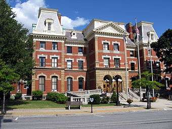
|---|
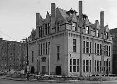
| 1 |
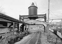
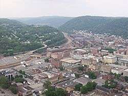
Allegheny Portage Railroad National Historic Site |
|
000000001966-10-15-0000October 15, 1966
(#66000648) |
U.S. Route 22
40°24′47″N 78°27′37″W / 40.413056°N 78.460278°W / 40.413056; -78.460278 (Allegheny Portage Railroad National Historic Site) |
Conemaugh and Cresson Townships |
Extends into Allegheny Township in Blair County
|
| 2 |
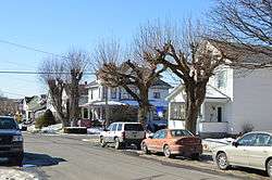
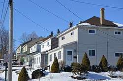
Berwind-White Mine 40 Historic District |
|
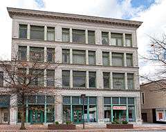
000000001992-04-28-0000April 28, 1992
(#92000392) |
Roughly bounded by the boney pile, the Eureka No. 40 mine site, the Scalp Level borough line, and the Berwind-White Farmstead
40°15′13″N 78°50′21″W / 40.253611°N 78.839167°W / 40.253611; -78.839167 (Berwind-White Mine 40 Historic District) |
Richland Township and Scalp Level |
|
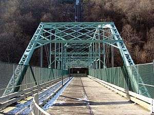
| 3 |
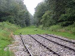
Bridge in Johnstown City |
|
000000001988-06-22-0000June 22, 1988
(#88000805) |
State Route 3022 spur over the Stonycreek River
40°19′33″N 78°55′33″W / 40.325833°N 78.925833°W / 40.325833; -78.925833 (Bridge in Johnstown City) |
Johnstown |
|
| 4 |
Bridge in Portage Township |
|
000000001988-06-22-0000June 22, 1988
(#88000782) |
Pennsylvania Route 53 over Bens Creek
40°24′08″N 78°38′24″W / 40.402222°N 78.64°W / 40.402222; -78.64 (Bridge in Portage Township) |
Portage Township |
|
| 5 |
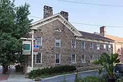
A.W. Buck House |
|
000000001995-05-12-0000May 12, 1995
(#95000521) |
615 North Center Street
40°29′22″N 78°43′31″W / 40.489444°N 78.725278°W / 40.489444; -78.725278 (A.W. Buck House) |
Ebensburg |
|
| 6 |
Cambria City Historic District |
|
000000001991-11-14-0000November 14, 1991
(#91001706) |
Roughly bounded by Broad Street, Tenth Avenue, and the Conemaugh River
40°20′27″N 78°55′46″W / 40.340833°N 78.929444°W / 40.340833; -78.929444 (Cambria City Historic District) |
Johnstown |
|
| 7 |
Cambria County Courthouse |
|
000000001980-06-30-0000June 30, 1980
(#80003449) |
Center Street
40°29′01″N 78°43′29″W / 40.483611°N 78.724722°W / 40.483611; -78.724722 (Cambria County Courthouse) |
Ebensburg |
|
| 8 |
Cambria County Jail |
|
000000001980-06-30-0000June 30, 1980
(#80003450) |
North Center and Sample Streets
40°29′11″N 78°43′34″W / 40.486389°N 78.726111°W / 40.486389; -78.726111 (Cambria County Jail) |
Ebensburg |
|
| 9 |
Cambria Iron Company |
|
000000001989-06-22-0000June 22, 1989
(#89001101) |
Along the Conemaugh River in the vicinity of Johnstown
40°19′42″N 78°55′13″W / 40.328264°N 78.920278°W / 40.328264; -78.920278 (Cambria Iron Company) |
Johnstown |
|
| 10 |
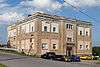
Cambria Public Library Building |
|
000000001972-06-19-0000June 19, 1972
(#72001100) |
304 Washington Street
40°19′40″N 78°55′15″W / 40.327778°N 78.920833°W / 40.327778; -78.920833 (Cambria Public Library Building) |
Johnstown |
|
| 11 |
Colver Historic District |
|
000000001994-06-03-0000June 3, 1994
(#94000521) |
Roughly bounded by Ninth Avenue, the Ebensburg Coal Company Power Building, and Bakerville, in Colver
40°32′36″N 78°47′46″W / 40.543333°N 78.796111°W / 40.543333; -78.796111 (Colver Historic District) |
Barr, Blacklick, and Cambria Townships |
|
| 12 |
Downtown Johnstown Historic District |
|
000000001992-08-07-0000August 7, 1992
(#92000941) |
Bounded by Washington, Clinton, Bedford, Vine, Market, Locust, and Walnut Streets
40°19′30″N 78°55′07″W / 40.325°N 78.918611°W / 40.325; -78.918611 (Downtown Johnstown Historic District) |
Johnstown |
|
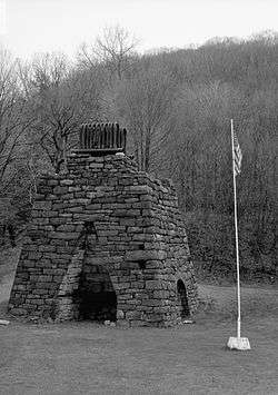
| 13 |
Eliza Furnace |
|
000000001991-09-06-0000September 6, 1991
(#91001138) |
Lower Main Street
40°29′03″N 78°55′20″W / 40.484167°N 78.922222°W / 40.484167; -78.922222 (Eliza Furnace) |
Vintondale |
Extends into Indiana County
|
| 14 |
Grand Army of the Republic Hall |
|
000000001980-04-17-0000April 17, 1980
(#80003451) |
132 Park Place
40°19′34″N 78°55′07″W / 40.326223°N 78.918579°W / 40.326223; -78.918579 (Grand Army of the Republic Hall) |
Johnstown |
|
| 15 |
Johnstown Flood National Memorial |
|
000000001966-10-15-0000October 15, 1966
(#66000656) |
Junction of U.S. Route 219 and Pennsylvania Route 869, St. Michael-Sidman
40°20′46″N 78°46′14″W / 40.3461103°N 78.7706215°W / 40.3461103; -78.7706215 (Johnstown Flood National Memorial) |
Adams and Croyle Townships |
|
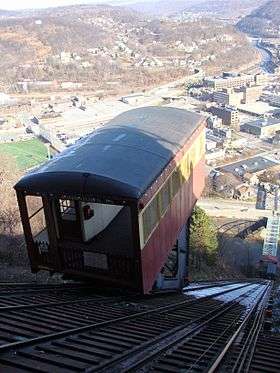
| 16 |
Johnstown Inclined Railway |
|
000000001973-06-18-0000June 18, 1973
(#73001597) |
Between Johns Street and Edgehill Drive
40°19′32″N 78°55′43″W / 40.325556°N 78.928611°W / 40.325556; -78.928611 (Johnstown Inclined Railway) |
Johnstown |
|
| 17 |
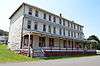
Benjamin F. Jones Cottage |
|
000000001995-02-24-0000February 24, 1995
(#95000125) |
Third Street
40°27′27″N 78°35′30″W / 40.4575°N 78.591667°W / 40.4575; -78.591667 (Benjamin F. Jones Cottage) |
Cresson Township |
|
| 18 |
Lilly Bridge |
|
000000001988-06-22-0000June 22, 1988
(#88000785) |
Pennsylvania Route 53 over Burgoon Run
40°25′26″N 78°37′08″W / 40.4239°N 78.61887°W / 40.4239; -78.61887 (Lilly Bridge) |
Lilly |
|
| 19 |
Minersville Historic District |
|
000000001995-04-27-0000April 27, 1995
(#95000522) |
Roughly along Connelly Avenue, Honan Avenue, Garvey Place, and Iron Street
40°20′34″N 78°55′35″W / 40.342807°N 78.926391°W / 40.342807; -78.926391 (Minersville Historic District) |
Johnstown and West Taylor Township |
|
| 20 |
Moxham Historic District |
|
000000001999-03-12-0000March 12, 1999
(#99000324) |
Roughly bounded by Dupont Street, Linden Avenue, Village Street, and Park and Coleman Avenues
40°17′52″N 78°54′30″W / 40.297778°N 78.908333°W / 40.297778; -78.908333 (Moxham Historic District) |
Johnstown |
|
| 21 |
Nathan's Department Store |
|
000000001979-08-10-0000August 10, 1979
(#79002178) |
426–432 Main St.
40°19′31″N 78°55′08″W / 40.325278°N 78.918889°W / 40.325278; -78.918889 (Nathan's Department Store) |
Johnstown |
|
| 22 |
Philip Noon House |
|
000000001984-08-23-0000August 23, 1984
(#84003179) |
114 East High Street
40°29′05″N 78°43′29″W / 40.484722°N 78.724722°W / 40.484722; -78.724722 (Philip Noon House) |
Ebensburg |
|
| 23 |
Old Conemaugh Borough Historic District |
|
000000001995-11-07-0000November 7, 1995
(#95001253) |
Roughly bounded by Railroad, Adams, and Steel Streets, and Church Avenue
40°19′37″N 78°54′39″W / 40.326944°N 78.910833°W / 40.326944; -78.910833 (Old Conemaugh Borough Historic District) |
Johnstown |
|
| 24 |
Patton Historic District |
|
000000001996-06-28-0000June 28, 1996
(#96000714) |
Roughly bounded by 5th, Beech, 6th, and Palmer Avenues and Terra Cotta Street
40°38′10″N 78°39′04″W / 40.636111°N 78.651111°W / 40.636111; -78.651111 (Patton Historic District) |
Patton |
|
| 25 |
Portage Historic District |
|
000000001995-07-21-0000July 21, 1995
(#95000890) |
Roughly bounded by North Railroad Avenue, Prospect Street, Johnson Avenue, and Vine Street
40°23′07″N 78°40′23″W / 40.385278°N 78.673056°W / 40.385278; -78.673056 (Portage Historic District) |
Portage |
|
| 26 |
Revloc Historic District |
|
000000001995-05-11-0000May 11, 1995
(#95000520) |
Roughly bounded by Highland Avenue, Fourth Street, Penn Avenue, and Eighth Street in Revloc
40°29′27″N 78°45′52″W / 40.490833°N 78.764444°W / 40.490833; -78.764444 (Revloc Historic District) |
Cambria Township |
|
| 27 |
South Fork Fishing and Hunting Club Historic District |
|
000000001986-07-31-0000July 31, 1986
(#86002091) |
Roughly bounded by Fortieth, Main, and Lake Streets
40°20′17″N 78°46′24″W / 40.338056°N 78.773333°W / 40.338056; -78.773333 (South Fork Fishing and Hunting Club Historic District) |
Adams Township |
|
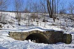
| 28 |
Staple Bend Tunnel |
|
000000001994-04-19-0000April 19, 1994
(#94001187) |
Junction of Legislative Route 3035 and Mineral Point
40°21′33″N 78°51′19″W / 40.359167°N 78.855278°W / 40.359167; -78.855278 (Staple Bend Tunnel) |
Conemaugh Township |
|
| 29 |
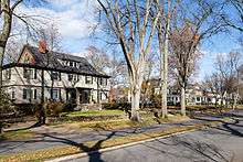
Westmont Historic District |
|
000000001995-02-24-0000February 24, 1995
(#95000131) |
Roughly bounded by Clarion Street, Edgehill Drive, Blair and Wayne Streets, Diamond Boulevard, and Stackhouse Park
40°19′20″N 78°56′19″W / 40.322222°N 78.938611°W / 40.322222; -78.938611 (Westmont Historic District) |
Westmont |
|
| 30 |
Windber Historic District |
|
000000001991-11-14-0000November 14, 1991
(#91001705) |
Roughly bounded by the borough line, Cambria Avenue, 28th Street, and Big Paint Creek
40°14′10″N 78°49′55″W / 40.236111°N 78.831944°W / 40.236111; -78.831944 (Windber Historic District) |
Scalp Level |
Extends into Somerset County |
.jpg)
_Front.jpg)
.jpg)