Copperville, Alaska
| Copperville, Alaska | |
|---|---|
| Former Census-designated place (CDP) | |
 Copperville, Alaska Location within the state of Alaska | |
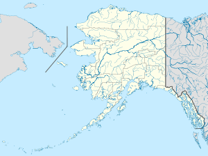
| Coordinates: 62°04′19″N 145°24′53″W / 62.07194°N 145.41472°WCoordinates: 62°04′19″N 145°24′53″W / 62.07194°N 145.41472°W[1] | |
| Country | United States |
| State | Alaska |
| Census Area | Valdez-Cordova |
| Government | |
| • State senator | Click Bishop (R) |
| • State rep. | Dave Talerico (R) |
| Area | |
| • Total | 1.4 sq mi (3.6 km2) |
| • Land | 1.4 sq mi (3.6 km2) |
| • Water | 0 sq mi (0 km2) |
| Elevation[2] | 1,214 ft (370 m) |
| Population (2000)[1] | |
| • Total | 179 |
| Time zone | Alaska (AKST) (UTC-9) |
| • Summer (DST) | AKDT (UTC-8) |
| Area code(s) | 907 |
| FIPS code | 02-17380 |
| GNIS feature ID | 1866937 |
Copperville is an unincorporated community and former census-designated place in the Valdez-Cordova Census Area of the U.S. state of Alaska. The population was 179 at the 2000 United States Census,[1] but it was not included in the 2010 census.[3]
Geography
Copperville is located at 62°04′19″N 145°24′53″W / 62.071928°N 145.414629°W.[1] According to the United States Census Bureau, the CDP has a total area of 1.4 square miles (3.6 km2), all of it land.[1]
Demographics
As of the census[4] of 2000, there were 179 people, 61 households, and 50 families residing in the CDP. The population density was 128.3 people per square mile (49.7/km²). There were 77 housing units at an average density of 55.2/sq mi (21.4/km²). The racial makeup of the CDP was 77.09% White, 13.97% Native American, 1.68% Asian, and 7.26% from two or more races.
There were 61 households out of which 44.3% had children under the age of 18 living with them, 60.7% were married couples living together, 14.8% had a female householder with no husband present, and 16.4% were non-families. 16.4% of all households were made up of individuals and 3.3% had someone living alone who was 65 years of age or older. The average household size was 2.93 and the average family size was 3.24.
In the CDP the population was spread out with 34.6% under the age of 18, 5.6% from 18 to 24, 28.5% from 25 to 44, 26.8% from 45 to 64, and 4.5% who were 65 years of age or older. The median age was 34 years. For every 100 females there were 121.0 males. For every 100 females age 18 and over, there were 116.7 males.
The median income for a household in the CDP was $53,125, and the median income for a family was $49,286. Males had a median income of $46,563 versus $30,625 for females. The per capita income for the CDP was $21,733. About 11.7% of families and 7.1% of the population were below the poverty line, including 3.1% of those under the age of eighteen and none of those sixty five or over.
References
- 1 2 3 4 5 "Places (2000)". 2000 Census Gazetteer Files. United States Census Bureau. Archived from the original (TXT) on October 24, 2006. Retrieved January 25, 2013. External link in
|work=(help) - ↑ "Copperville". Geographic Names Information System. United States Geological Survey. Retrieved January 25, 2013.
- ↑ "Places (2010): Alaska" (TXT). 2010 Census Gazetteer Files. United States Census Bureau. Retrieved January 25, 2013. External link in
|work=(help) - ↑ "American FactFinder". United States Census Bureau. Archived from the original on 2013-09-11. Retrieved 2008-01-31.
Municipalities and communities of Valdez–Cordova Census Area, Alaska, United States | ||
|---|---|---|
| Cities | 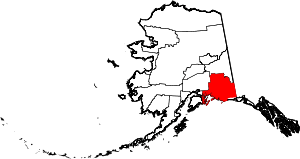 | |
| CDPs | ||
| Unincorporated communities | ||
| Ghost towns | ||