Cora Lynn, Victoria
| Cora Lynn Victoria | |
|---|---|
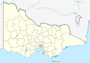 Cora Lynn Location in Victoria | |
| Coordinates | 38°08′43″S 145°36′21″E / 38.14528°S 145.60583°ECoordinates: 38°08′43″S 145°36′21″E / 38.14528°S 145.60583°E |
| Population | 236 (2011 census)[1] |
| Postcode(s) | 3814 |
| LGA(s) | Shire of Cardinia |
| State electorate(s) | Narracan |
| Federal Division(s) | Flinders |
Cora Lynn is a bounded rural locality in Victoria, Australia. Its local government area is the Shire of Cardinia. At the 2011 Census, Cora Lynn had a population of 236.[2]
History
Cora Lynn Post Office opened on 1 July 1907 and closed in 1999.[3] The Cora Lynn State School opened in January 1907 and was originally called Koo-Wee-Rup West. The School closed and became part of Pakenham Consolidated School when it opened in May 1951.[4] The now demolished, Cora Lynn Hall (known as Keast Hall) was opened in 1911. The official opening of June 13 was abandoned as the hall was flooded with three feet of water[5]
Today
Cora Lynn has an Australian Rules football team playing in the Ellinbank & District Football League.[6]
References
- ↑ "2011 Census QuickStats: Cora Lynn". Australia Bureau of Statistics. Retrieved 17 December 2012.
- ↑ "2011 Census QuickStats: Cora Lynn". Australia Bureau of Statistics. Retrieved 17 December 2012.
- ↑ Premier Postal History, Post Office List, retrieved 2008-04-11
- ↑ Blake, L.J (1973). Vision and Realisation: a centenary history of State Education in Victoria. Victoria - Education Department.
- ↑ "Swamp settlers suffer".
- ↑ Full Points Footy, Cora Lynn, retrieved 2009-04-15
This article is issued from Wikipedia - version of the 11/2/2016. The text is available under the Creative Commons Attribution/Share Alike but additional terms may apply for the media files.