Corbières, Alpes-de-Haute-Provence
| Corbières | ||
|---|---|---|
|
The old village, the industrial area and the agricultural plain | ||
| ||
 Corbières | ||
|
Location within Provence-A.-C.d'A. region 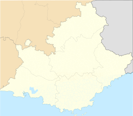 Corbières | ||
| Coordinates: 43°45′43″N 5°45′07″E / 43.7619°N 5.7519°ECoordinates: 43°45′43″N 5°45′07″E / 43.7619°N 5.7519°E | ||
| Country | France | |
| Region | Provence-Alpes-Côte d'Azur | |
| Department | Alpes-de-Haute-Provence | |
| Arrondissement | Forcalquier | |
| Canton | Manosque-Sud-Est | |
| Intercommunality | Sud 4 | |
| Government | ||
| • Mayor (2008–2014) | Jean-Claude Castel | |
| Area1 | 19.06 km2 (7.36 sq mi) | |
| Population (2008)2 | 957 | |
| • Density | 50/km2 (130/sq mi) | |
| Time zone | CET (UTC+1) | |
| • Summer (DST) | CEST (UTC+2) | |
| INSEE/Postal code | 04063 / 04220 | |
| Elevation |
256–531 m (840–1,742 ft) (avg. 300 m or 980 ft) | |
|
1 French Land Register data, which excludes lakes, ponds, glaciers > 1 km² (0.386 sq mi or 247 acres) and river estuaries. 2 Population without double counting: residents of multiple communes (e.g., students and military personnel) only counted once. | ||


Corbières is a commune in the Alpes-de-Haute-Provence department in southeastern France.
Population
| Historical population | ||
|---|---|---|
| Year | Pop. | ±% |
| 1765 | 282 | — |
| 1793 | 434 | +53.9% |
| 1800 | 455 | +4.8% |
| 1806 | 505 | +11.0% |
| 1821 | 571 | +13.1% |
| 1831 | 585 | +2.5% |
| 1836 | 620 | +6.0% |
| 1841 | 635 | +2.4% |
| 1846 | 657 | +3.5% |
| 1851 | 704 | +7.2% |
| 1856 | 672 | −4.5% |
| 1861 | 657 | −2.2% |
| 1866 | 593 | −9.7% |
| 1872 | 571 | −3.7% |
| 1876 | 591 | +3.5% |
| 1881 | 533 | −9.8% |
| 1886 | 591 | +10.9% |
| 1891 | 530 | −10.3% |
| 1896 | 481 | −9.2% |
| 1901 | 484 | +0.6% |
| 1906 | 482 | −0.4% |
| 1911 | 503 | +4.4% |
| 1921 | 700 | +39.2% |
| 1926 | 435 | −37.9% |
| 1931 | 457 | +5.1% |
| 1936 | 377 | −17.5% |
| 1946 | 397 | +5.3% |
| 1954 | 403 | +1.5% |
| 1962 | 441 | +9.4% |
| 1968 | 633 | +43.5% |
| 1975 | 483 | −23.7% |
| 1982 | 660 | +36.6% |
| 1990 | 786 | +19.1% |
| 1999 | 791 | +0.6% |
| 2008 | 957 | +21.0% |
See also
References
| Wikimedia Commons has media related to Corbières, Alpes-de-Haute-Provence. |
This article is issued from Wikipedia - version of the 3/15/2016. The text is available under the Creative Commons Attribution/Share Alike but additional terms may apply for the media files.