Cowgill, Missouri
| Cowgill, Missouri | |
|---|---|
| City | |
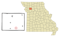 Location of Cowgill, Missouri | |
| Coordinates: 39°33′43″N 93°55′34″W / 39.56194°N 93.92611°WCoordinates: 39°33′43″N 93°55′34″W / 39.56194°N 93.92611°W | |
| Country | United States |
| State | Missouri |
| County | Caldwell |
| Area[1] | |
| • Total | 0.24 sq mi (0.62 km2) |
| • Land | 0.24 sq mi (0.62 km2) |
| • Water | 0 sq mi (0 km2) |
| Elevation | 971 ft (296 m) |
| Population (2010)[2] | |
| • Total | 188 |
| • Estimate (2012[3]) | 183 |
| • Density | 783.3/sq mi (302.4/km2) |
| Time zone | Central (CST) (UTC-6) |
| • Summer (DST) | CDT (UTC-5) |
| ZIP code | 64637 |
| Area code(s) | 660 |
| FIPS code | 29-16984[4] |
| GNIS feature ID | 0730076[5] |
Cowgill is a city in Caldwell County, Missouri, United States. The population was 188 at the 2010 census.
History
Cowgill was laid out in 1887. It was named for Judge James Cowgill, a prominent local resident.[6]
Geography
Cowgill is located at 39°33′43″N 93°55′34″W / 39.56194°N 93.92611°W (39.561828, -93.925991).[7]
According to the United States Census Bureau, the city has a total area of 0.24 square miles (0.62 km2), all of it land.[1]
Demographics
| Historical population | |||
|---|---|---|---|
| Census | Pop. | %± | |
| 1900 | 357 | — | |
| 1910 | 363 | 1.7% | |
| 1920 | 381 | 5.0% | |
| 1930 | 368 | −3.4% | |
| 1940 | 338 | −8.2% | |
| 1950 | 241 | −28.7% | |
| 1960 | 259 | 7.5% | |
| 1970 | 232 | −10.4% | |
| 1980 | 267 | 15.1% | |
| 1990 | 257 | −3.7% | |
| 2000 | 247 | −3.9% | |
| 2010 | 188 | −23.9% | |
| Est. 2015 | 180 | [8] | −4.3% |
2010 census
As of the census[2] of 2010, there were 188 people, 82 households, and 49 families residing in the city. The population density was 783.3 inhabitants per square mile (302.4/km2). There were 103 housing units at an average density of 429.2 per square mile (165.7/km2). The racial makeup of the city was 95.7% White, 0.5% African American, 0.5% Asian, 2.7% from other races, and 0.5% from two or more races. Hispanic or Latino of any race were 3.2% of the population.
There were 82 households of which 29.3% had children under the age of 18 living with them, 41.5% were married couples living together, 11.0% had a female householder with no husband present, 7.3% had a male householder with no wife present, and 40.2% were non-families. 31.7% of all households were made up of individuals and 14.6% had someone living alone who was 65 years of age or older. The average household size was 2.29 and the average family size was 2.92.
The median age in the city was 39 years. 23.4% of residents were under the age of 18; 8% were between the ages of 18 and 24; 25.5% were from 25 to 44; 23.4% were from 45 to 64; and 19.7% were 65 years of age or older. The gender makeup of the city was 50.5% male and 49.5% female.
2000 census
As of the census[4] of 2000, there were 247 people, 96 households, and 64 families residing in the city. The population density was 1,060.7 people per square mile (414.6/km²). There were 113 housing units at an average density of 485.2 per square mile (189.7/km²). The racial makeup of the city was 97.57% White, 0.40% African American, 1.21% from other races, and 0.81% from two or more races.
There were 96 households out of which 31.3% had children under the age of 18 living with them, 58.3% were married couples living together, 8.3% had a female householder with no husband present, and 32.3% were non-families. 30.2% of all households were made up of individuals and 15.6% had someone living alone who was 65 years of age or older. The average household size was 2.57 and the average family size was 3.26.
In the city the population was spread out with 30.0% under the age of 18, 5.3% from 18 to 24, 26.7% from 25 to 44, 22.3% from 45 to 64, and 15.8% who were 65 years of age or older. The median age was 34 years. For every 100 females there were 114.8 males. For every 100 females age 18 and over, there were 96.6 males.
The median income for a household in the city was $21,563, and the median income for a family was $24,444. Males had a median income of $28,125 versus $28,125 for females. The per capita income for the city was $11,356. About 21.2% of families and 21.9% of the population were below the poverty line, including 25.0% of those under the age of eighteen and 12.8% of those sixty five or over.
Notable people
- Herb Conyers, former professional baseball player for the Cleveland Indians
References
- 1 2 "US Gazetteer files 2010". United States Census Bureau. Archived from the original on January 24, 2012. Retrieved 2012-07-08.
- 1 2 "American FactFinder". United States Census Bureau. Retrieved 2012-07-08.
- ↑ "Population Estimates". United States Census Bureau. Archived from the original on June 17, 2013. Retrieved 2013-05-30.
- 1 2 "American FactFinder". United States Census Bureau. Archived from the original on September 11, 2013. Retrieved 2008-01-31.
- ↑ "US Board on Geographic Names". United States Geological Survey. 2007-10-25. Retrieved 2008-01-31.
- ↑ Eaton, David Wolfe (1916). How Missouri Counties, Towns and Streams Were Named. The State Historical Society of Missouri. p. 266.
- ↑ "US Gazetteer files: 2010, 2000, and 1990". United States Census Bureau. 2011-02-12. Retrieved 2011-04-23.
- ↑ "Annual Estimates of the Resident Population for Incorporated Places: April 1, 2010 to July 1, 2015". Retrieved July 2, 2016.
- ↑ "Census of Population and Housing". Census.gov. Archived from the original on May 11, 2015. Retrieved June 4, 2015.
External links
- Historic maps of Cowgill in the Sanborn Maps of Missouri Collection at the University of Missouri
Municipalities and communities of Caldwell County, Missouri, United States | ||
|---|---|---|
| Cities |  | |
| Townships | ||
| Unincorporated communities | ||
| Ghost town | ||