Crane Township, Paulding County, Ohio
| Crane Township, Paulding County, Ohio | |
|---|---|
| Township | |
|
Farmland between Cecil and the Maumee River | |
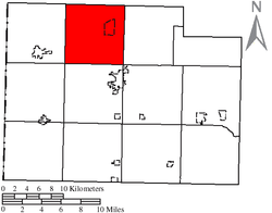 Location of Crane Township in Paulding County | |
| Coordinates: 41°12′36″N 84°37′30″W / 41.21000°N 84.62500°WCoordinates: 41°12′36″N 84°37′30″W / 41.21000°N 84.62500°W | |
| Country | United States |
| State | Ohio |
| County | Paulding |
| Area | |
| • Total | 36.5 sq mi (94.5 km2) |
| • Land | 36.0 sq mi (93.2 km2) |
| • Water | 0.5 sq mi (1.3 km2) |
| Elevation[1] | 719 ft (219 m) |
| Population (2000) | |
| • Total | 1,530 |
| • Density | 42.5/sq mi (16.4/km2) |
| Time zone | Eastern (EST) (UTC-5) |
| • Summer (DST) | EDT (UTC-4) |
| FIPS code | 39-19176[2] |
| GNIS feature ID | 1086771[1] |

Crane Township is one of the twelve townships of Paulding County, Ohio, United States. The 2000 census found 1,530 people in the township, 1,314 of whom lived in the unincorporated portions of the township.[3]
Geography
Located in the northern part of the county, it borders the following townships:
- Mark Township, Defiance County - north
- Delaware Township, Defiance County - northeast corner
- Emerald Township - east
- Jackson Township - southeast corner
- Paulding Township - south
- Harrison Township - southwest corner
- Carryall Township - west
- Hicksville Township, Defiance County - northwest corner
The village of Cecil is located in northeastern Crane Township.
Name and history
Crane Township was named for Oliver Crane, a pioneer settler.[4] Statewide, the only other Crane Township is located in Wyandot County.[5]
Government
The township is governed by a three-member board of trustees, who are elected in November of odd-numbered years to a four-year term beginning on the following January 1. Two are elected in the year after the presidential election and one is elected in the year before it. There is also an elected township fiscal officer,[6] who serves a four-year term beginning on April 1 of the year after the election, which is held in November of the year before the presidential election. Vacancies in the fiscal officership or on the board of trustees are filled by the remaining trustees.
References
- 1 2 "US Board on Geographic Names". United States Geological Survey. 2007-10-25. Retrieved 2008-01-31.
- ↑ "American FactFinder". United States Census Bureau. Archived from the original on 2013-09-11. Retrieved 2008-01-31.
- ↑ Paulding County, Ohio — Population by Places Estimates Ohio State University, 2007. Accessed 15 May 2007.
- ↑ Miller, Ray (April 5, 1953). "Paulding Communities Cut Out Of Great Forests". Toledo Blade. pp. 7–3. Retrieved 30 April 2015.
- ↑ "Detailed map of Ohio" (PDF). United States Census Bureau. 2000. Retrieved 2007-02-16.
- ↑ §503.24, §505.01, and §507.01 of the Ohio Revised Code. Accessed 4/30/2009.
External links
Municipalities and communities of Paulding County, Ohio, United States | ||
|---|---|---|
| Villages | 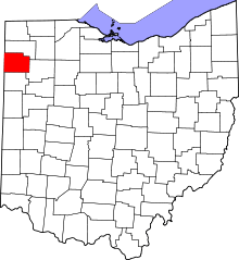 | |
| Townships | ||
| Unincorporated communities | ||
| Footnotes | ‡This populated place also has portions in an adjacent county or counties | |