Cresco, Iowa
| Cresco, Iowa | |
|---|---|
| City | |
|
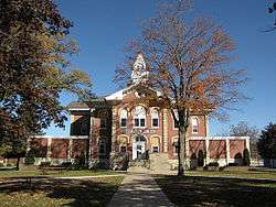
Howard County Courthouse in Cresco | |
| Motto: "Iowa's Year Round Play Ground"[1] | |
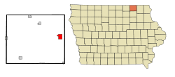 Location of Cresco, Iowa | |
| Coordinates: 43°22′28″N 92°6′54″W / 43.37444°N 92.11500°WCoordinates: 43°22′28″N 92°6′54″W / 43.37444°N 92.11500°W | |
| Country | United States |
| State | Iowa |
| County | Howard |
| Incorporated | June 6, 1868[2] |
| Government | |
| • Mayor | Mark Bohle |
| Area[3] | |
| • Total | 3.35 sq mi (8.68 km2) |
| • Land | 3.35 sq mi (8.68 km2) |
| • Water | 0 sq mi (0 km2) |
| Elevation | 1,293 ft (394 m) |
| Population (2010)[4] | |
| • Total | 3,868 |
| • Estimate (2012[5]) | 3,886 |
| • Density | 1,154.6/sq mi (445.8/km2) |
| Time zone | Central (CST) (UTC-6) |
| • Summer (DST) | CDT (UTC-5) |
| ZIP code | 52136 |
| Area code(s) | 563 |
| FIPS code | 19-17220 |
| GNIS feature ID | 0455712 |
| Website | Cresco Iowa Website |
Cresco is a city in Howard County, Iowa, United States. The population was 3,868 in the 2010 census, a decline from 3,905 in 2000 census.[6] It is the county seat of Howard County.[7][8]
History
Cresco was platted in 1866 at the time the railroad was expanding into the area.[9] Cresco is a Latin phrase meaning "I grow".[8] Cresco was incorporated on June 6, 1868,[10]
Geography
Cresco's longitude and latitude coordinates in decimal form are 43.374491, −92.115121.[11]
According to the United States Census Bureau, the city has a total area of 3.35 square miles (8.68 km2), all of it land.[3]
Climate
Cresco experiences a humid continental climate (Köppen Dfb) with long, cold, snowy winters and very warm, humid summers.
| Climate data for Cresco | |||||||||||||
|---|---|---|---|---|---|---|---|---|---|---|---|---|---|
| Month | Jan | Feb | Mar | Apr | May | Jun | Jul | Aug | Sep | Oct | Nov | Dec | Year |
| Record high °F (°C) | 54 (12) |
63 (17) |
83 (28) |
91 (33) |
91 (33) |
100 (38) |
102 (39) |
101 (38) |
98 (37) |
92 (33) |
75 (24) |
62 (17) |
102 (39) |
| Average high °F (°C) | 21.5 (−5.8) |
27.6 (−2.4) |
40.0 (4.4) |
55.6 (13.1) |
68.7 (20.4) |
78.3 (25.7) |
81.9 (27.7) |
79.7 (26.5) |
71.6 (22) |
59.2 (15.1) |
41.4 (5.2) |
26.7 (−2.9) |
54.35 (12.42) |
| Average low °F (°C) | 2.8 (−16.2) |
9.4 (−12.6) |
21.9 (−5.6) |
34.0 (1.1) |
45.8 (7.7) |
55.5 (13.1) |
59.6 (15.3) |
57.3 (14.1) |
47.9 (8.8) |
36.2 (2.3) |
23.5 (−4.7) |
9.4 (−12.6) |
33.61 (0.89) |
| Record low °F (°C) | −35 (−37) |
−36 (−38) |
−29 (−34) |
−1 (−18) |
23 (−5) |
34 (1) |
40 (4) |
34 (1) |
24 (−4) |
10 (−12) |
−16 (−27) |
−30 (−34) |
−36 (−38) |
| Average precipitation inches (mm) | 1.02 (25.9) |
0.88 (22.4) |
2.21 (56.1) |
3.52 (89.4) |
3.92 (99.6) |
4.65 (118.1) |
4.54 (115.3) |
5.17 (131.3) |
3.69 (93.7) |
2.40 (61) |
2.36 (59.9) |
1.27 (32.3) |
35.63 (905) |
| Average snowfall inches (cm) | 10.0 (25.4) |
6.9 (17.5) |
6.4 (16.3) |
2.5 (6.4) |
trace | 0 (0) |
0 (0) |
0 (0) |
0 (0) |
0.4 (1) |
4.9 (12.4) |
9.0 (22.9) |
40.1 (101.9) |
| Source: NOAA[12] | |||||||||||||
Demographics
| Historical population | |||
|---|---|---|---|
| Census | Pop. | %± | |
| 1870 | 912 | — | |
| 1880 | 1,875 | 105.6% | |
| 1890 | 2,018 | 7.6% | |
| 1900 | 2,806 | 39.0% | |
| 1910 | 2,658 | −5.3% | |
| 1920 | 3,195 | 20.2% | |
| 1930 | 3,069 | −3.9% | |
| 1940 | 3,530 | 15.0% | |
| 1950 | 3,638 | 3.1% | |
| 1960 | 3,809 | 4.7% | |
| 1970 | 3,927 | 3.1% | |
| 1980 | 3,860 | −1.7% | |
| 1990 | 3,669 | −4.9% | |
| 2000 | 3,905 | 6.4% | |
| 2010 | 3,868 | −0.9% | |
| Est. 2015 | 3,833 | [13] | −0.9% |
2010 census
As of the census[4] of 2010, there were 3,868 people, 1,660 households, and 962 families residing in the city. The population density was 1,154.6 inhabitants per square mile (445.8/km2). There were 1,821 housing units at an average density of 543.6 per square mile (209.9/km2). The racial makeup of the city was 97.3% White, 0.4% African American, 0.1% Native American, 0.4% Asian, 0.7% from other races, and 1.1% from two or more races. Hispanic or Latino of any race were 1.6% of the population.
There were 1,660 households of which 29.3% had children under the age of 18 living with them, 45.1% were married couples living together, 9.0% had a female householder with no husband present, 3.9% had a male householder with no wife present, and 42.0% were non-families. 36.3% of all households were made up of individuals and 17.3% had someone living alone who was 65 years of age or older. The average household size was 2.26 and the average family size was 2.95.
The median age in the city was 39.8 years. 25.1% of residents were under the age of 18; 7.4% were between the ages of 18 and 24; 24.2% were from 25 to 44; 23.6% were from 45 to 64; and 19.7% were 65 years of age or older. The gender makeup of the city was 48.0% male and 52.0% female.
2000 census
As of the census[15] of 2000, there were 3,905 people, 1,652 households, and 1,004 families residing in the city. The population density was 1,184.1 people per square mile (456.9/km²). There were 1,791 housing units at an average density of 543.1 per square mile (209.5/km²). The racial makeup of the city was 98.77% White, 0.23% African American, 0.15% Native American, 0.15% Asian, 0.03% from other races, and 0.67% from two or more races. Hispanic or Latino of any race were 0.72% of the population.
There were 1,652 households out of which 30.5% had children under the age of 18 living with them, 49.0% were married couples living together, 8.1% had a female householder with no husband present, and 39.2% were non-families. 35.0% of all households were made up of individuals and 19.5% had someone living alone who was 65 years of age or older. The average household size was 2.27 and the average family size was 2.95.
Age spread: 25.6% under the age of 18, 7.1% from 18 to 24, 26.1% from 25 to 44, 18.5% from 45 to 64, and 22.8% who were 65 years of age or older. The median age was 39 years. For every 100 females there were 88.6 males. For every 100 females age 18 and over, there were 87.0 males.
The median income for a household in the city was $32,236, and the median income for a family was $43,682. Males had a median income of $30,088 versus $21,444 for females. The per capita income for the city was $18,190. About 2.1% of families and 6.8% of the population were below the poverty line, including 5.2% of those under age 18 and 5.9% of those age 65 or over.
Arts and culture
Museums and other points of interest
The Mighty Howard County Fair is held annually in Cresco every June. 2014 was the 121st year that the fair was held.[16]
Cresco Community Theatre is a non-profit organization open to anyone with an idea or the desire to contribute. The decision of which shows to be produced on the Cresco stage are reached by the contributing members, and range from famously named productions to the locally written plays.[17]
Cresco is home to the Glen Brand Wrestling Hall of Fame of Iowa that had its first inductee banquet in 1970. As of April 2010 there are 97 members who have made outstanding contributions to the sport of amateur wrestling.[18]
Although Cresco is no longer on a railroad line, it is home to a restored Milwaukee Road FP7 diesel engine which is known as the Heritage Train and displayed in Beadle Park at the center of the city on Highway 9. Cresco is also headquarters for Featherlite Trailers.
The Cresco post office contains a mural, Iowa Farming, painted in 1937 by Richard Haines. Murals were produced from 1934 to 1943 in the United States through the Section of Painting and Sculpture, later called the Section of Fine Arts, of the Treasury Department. The mural recalls his earliest days in Marion, Iowa depicting a farm scene with horses, cows, pigs, chickens, and family members performing chores as a mother reads a letter just delivered by the postal service.[19]
Media
The city newspaper is the weekly Cresco Times Plain Dealer, published on Wednesdays.
KCZQ 102.3 FM is a radio station licensed to Cresco. The studios are located just off Elm Street, next to Dollar General and across from Fareway Grocery. It is owned by Mega Media LTD and operations began in 1991.
Education
Cresco is home to one of the largest school districts in Iowa in terms of square miles, the Howard-Winneshiek Community School District. The high school is called Crestwood High School. Crestwood Elementary/Junior High School are also in Cresco, Lime Springs/Chester Elementary, in Lime Springs, and Elma Elementary, in Elma. For the 2014–2015 school year, Elma Elementary will be preschool only. Lime Springs/Chester Elementary will only be a fourth-grade center; however, this will include every fourth-grader in the district (even those who would go to Crestwood Elementary, being bused to Lime Springs for class. Every other grade from Elma, Lime Springs, and Chester will be bussed to the Cresco center. This is all due in part to the ending of the"doubling up" classroom policy by the Howard-Winn Community School District. Howard County is mostly rural. These counties are suffering from population decline, which also contributes to the changes. Also beginning with the 2014–2015 school year, children in Elma will have the open enrollment choice: their parents be able to decide if they want them at Howard-Winn, or Riceville. The communities of Ridgeway and Protivin currently have an open enrollment policy that allows kids to go to Howard-Winn. The policy in Ridgeway allows students to go to either Howard-Winn or Decorah. In Protivin, it allows kids to either go to Howard-Winn or Turkey Valley. In both communities, the children are split between choices about half. The Howard-Winn community school district had an Elementary school in Ridgeway that closed its doors after the 2009–2010 school year. Until 2010, Elma, Lime Springs/Chester, and Ridgeway were all K-6 centers. Beginning in 2010, children in Ridgeway obtained the open enrollment choice, and Elma and Lime Springs/Chester were cut back to K-5. Notre Dame Catholic School in Cresco, and Trinity Catholic school in Protivin, offer private education to elementary school students.
Notable people
- Norman Borlaug, Nobel Peace Prize laureate
- Charley Bowers, cartoonist and filmmaker
- Ellen Church, the world's first flight attendant
- Carter Dull, World's O.Kest Guitar Player, and local talent.
- Edward Aloysius Fitzgerald, the fourth Bishop of the Roman Catholic Diocese of Winona
- Edward Howard, Roman Catholic Archbishop of Portland, Oregon
- Edouard Izac, Medal of Honor recipient
- Frank J. Lowry, United States admiral
- Oliver Munson, Wisconsin State Senator
- Harold Nichols, Iowa State University wrestling coach
- Robert E. Smylie, 24th Governor of Idaho; raised in Cresco.[20]
Attractions
References
- ↑ "Cresco Iowa Chamber of Commerce". Cresco Iowa Chamber of Commerce. Retrieved September 25, 2012.
- ↑ "Cresco-Iowa". City-Data. Retrieved March 22, 2011.
- 1 2 "US Gazetteer files 2010". United States Census Bureau. Archived from the original on January 24, 2012. Retrieved 2012-05-11.
- 1 2 "American FactFinder". United States Census Bureau. Retrieved 2012-05-11.
- ↑ "Population Estimates". United States Census Bureau. Archived from the original on June 17, 2013. Retrieved 2013-05-23.
- ↑ "Data from the 2010 Census". State Data Center of Iowa. Archived from the original on July 18, 2011. Retrieved March 22, 2011.
- ↑ "Find a County". National Association of Counties. Archived from the original on May 31, 2011. Retrieved 2011-06-07.
- 1 2 "Profile for Cresco, Iowa, IA". ePodunk. Retrieved September 25, 2012.
- ↑ Fairbairn, Robert Herd (1919). History of Chickasaw and Howard Counties, Iowa, Volume 1. S. J. Clarke Publishing Company. p. 416.
- ↑ "Cresco, Iowa". City-Data.com. Retrieved September 25, 2012.
- ↑ "US Gazetteer files: 2010, 2000, and 1990". United States Census Bureau. 2011-02-12. Retrieved 2011-04-23.
- ↑ "Climatography of the United States NO.20" (PDF). National Oceanic and Atmospheric Administration. Retrieved February 21, 2011.
- ↑ "Annual Estimates of the Resident Population for Incorporated Places: April 1, 2010 to July 1, 2015". Retrieved July 2, 2016.
- ↑ "Census of Population and Housing". Census.gov. Archived from the original on May 11, 2015. Retrieved June 4, 2015.
- ↑ "American FactFinder". United States Census Bureau. Archived from the original on September 11, 2013. Retrieved 2008-01-31.
- ↑ "Mighty Howard County Fair". Howard County Fairgrounds. Retrieved March 22, 2011.
- ↑ "Cresco Community Theatre". CCT. Retrieved March 22, 2011.
- ↑ "Iowa Wrestling Hall of Fame". IROC Web Design. Retrieved March 22, 2011.
- ↑ "Public Library mural, Cresco, Iowa". livingnewdeal.org. Living New Deal. Retrieved 10 October 2015.
- ↑ "Smylie,-Robert-Eben-1". The Basque Museum and Culutral Center. Retrieved September 25, 2012.
External links
| Wikimedia Commons has media related to Cresco, Iowa. |
- Cresco, Iowa Home Page Portal style website, Government, Business, Library, Recreation and more
- Notre Dame Elementary School
- Cresco Times Plain Dealer
- City-Data Comprehensive Statistical Data and more about Cresco
Municipalities and communities of Howard County, Iowa, United States | ||
|---|---|---|
| Cities | ||
| Unincorporated community | ||
| Footnotes | ‡This populated place also has portions in an adjacent county or counties | |