Culdesac, Idaho
| Culdesac, Idaho | |
|---|---|
| City | |
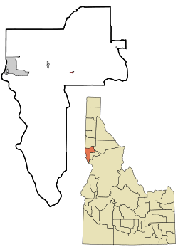 Location of Culdesac, Idaho | |
| Coordinates: 46°22′30″N 116°40′13″W / 46.37500°N 116.67028°WCoordinates: 46°22′30″N 116°40′13″W / 46.37500°N 116.67028°W | |
| Country | United States |
| State | Idaho |
| County | Nez Perce |
| Area[1] | |
| • Total | 0.23 sq mi (0.60 km2) |
| • Land | 0.23 sq mi (0.60 km2) |
| • Water | 0 sq mi (0 km2) |
| Elevation | 1,644 ft (501 m) |
| Population (2010)[2] | |
| • Total | 380 |
| • Estimate (2012[3]) | 379 |
| • Density | 1,652.2/sq mi (637.9/km2) |
| Time zone | Pacific (PST) (UTC-8) |
| • Summer (DST) | PDT (UTC-7) |
| ZIP code | 83524 |
| Area code(s) | 208 |
| FIPS code | 16-19900 |
| GNIS feature ID | 0396352 |
Culdesac is a town in Nez Perce County, Idaho, United States. The population was 380 at the 2010 census. It is part of the Lewiston, ID-WA Metropolitan Statistical Area.
History
Culdesac was named from its location at the end of a railroad line, i.e., a cul de sac.[4]
Geography
Culdesac is located at 46°22′30″N 116°40′13″W / 46.37500°N 116.67028°W (46.374883, -116.670333),[5] at an elevation of 1,644 feet (501 m) above sea level.[6]
According to the United States Census Bureau, the city has a total area of 0.23 square miles (0.60 km2), all of it land.[1]
Demographics
| Historical population | |||
|---|---|---|---|
| Census | Pop. | %± | |
| 1910 | 436 | — | |
| 1920 | 397 | −8.9% | |
| 1930 | 287 | −27.7% | |
| 1940 | 219 | −23.7% | |
| 1950 | 175 | −20.1% | |
| 1960 | 209 | 19.4% | |
| 1970 | 211 | 1.0% | |
| 1980 | 261 | 23.7% | |
| 1990 | 280 | 7.3% | |
| 2000 | 378 | 35.0% | |
| 2010 | 380 | 0.5% | |
| Est. 2015 | 377 | [7] | −0.8% |
2010 census
As of the census[2] of 2010, there were 380 people, 156 households, and 106 families residing in the city. The population density was 1,652.2 inhabitants per square mile (637.9/km2). There were 176 housing units at an average density of 765.2 per square mile (295.4/km2). The racial makeup of the city was 83.4% White, 15.8% Native American, 0.3% from other races, and 0.5% from two or more races. Hispanic or Latino of any race were 5.3% of the population.
There were 156 households of which 32.7% had children under the age of 18 living with them, 43.6% were married couples living together, 14.7% had a female householder with no husband present, 9.6% had a male householder with no wife present, and 32.1% were non-families. 25.0% of all households were made up of individuals and 11.5% had someone living alone who was 65 years of age or older. The average household size was 2.44 and the average family size was 2.85.
The median age in the city was 41 years. 22.9% of residents were under the age of 18; 8.2% were between the ages of 18 and 24; 23.2% were from 25 to 44; 30% were from 45 to 64; and 15.8% were 65 years of age or older. The gender makeup of the city was 50.0% male and 50.0% female.
2000 census
As of the census[9] of 2000, there were 378 people, 152 households, and 107 families residing in the city. The population density was 1,601.4 people per square mile (608.1/km²). There were 171 housing units at an average density of 724.5 per square mile (275.1/km²). The racial makeup of the city was 94.44% White, 0.53% African American, 2.65% Native American, 0.26% Pacific Islander, 0.26% from other races, and 1.85% from two or more races. Hispanic or Latino of any race were 1.59% of the population.
There were 152 households out of which 34.2% had children under the age of 18 living with them, 53.3% were married couples living together, 9.9% had a female householder with no husband present, and 29.6% were non-families. 25.7% of all households were made up of individuals and 10.5% had someone living alone who was 65 years of age or older. The average household size was 2.49 and the average family size was 2.98.
In the city the population was spread out with 28.3% under the age of 18, 5.8% from 18 to 24, 26.7% from 25 to 44, 26.2% from 45 to 64, and 13.0% who were 65 years of age or older. The median age was 37 years. For every 100 females there were 100.0 males. For every 100 females age 18 and over, there were 90.8 males.
The median income for a household in the city was $25,750, and the median income for a family was $31,364. Males had a median income of $27,500 versus $22,083 for females. The per capita income for the city was $11,888. About 14.4% of families and 16.4% of the population were below the poverty line, including 13.0% of those under age 18 and none of those age 65 or over.
References
- 1 2 "US Gazetteer files 2010". United States Census Bureau. Archived from the original on 2012-01-24. Retrieved 2012-12-18.
- 1 2 "American FactFinder". United States Census Bureau. Retrieved 2012-12-18.
- ↑ "Population Estimates". United States Census Bureau. Archived from the original on 2013-06-17. Retrieved 2013-06-03.
- ↑ Phillips, McCandish (Sep 16, 1970). "Origins of strange place names traced". The Day. p. 21. Retrieved 21 October 2015.
- ↑ "US Gazetteer files: 2010, 2000, and 1990". United States Census Bureau. 2011-02-12. Retrieved 2011-04-23.
- ↑ U.S. Geological Survey Geographic Names Information System: Culdesac, Idaho
- ↑ "Annual Estimates of the Resident Population for Incorporated Places: April 1, 2010 to July 1, 2015". Retrieved July 2, 2016.
- ↑ "Census of Population and Housing". Census.gov. Archived from the original on May 11, 2015. Retrieved June 4, 2015.
- ↑ "American FactFinder". United States Census Bureau. Archived from the original on 2013-09-11. Retrieved 2008-01-31.
Municipalities and communities of Nez Perce County, Idaho, United States | ||
|---|---|---|
| Cities | ||
| CDP | ||
| Unincorporated communities | ||