Cunningham Corner, Arkansas
| Cunningham Corner | |
|---|---|
| Unincorporated community | |
 Cunningham Corner Cunningham Corner's position in Arkansas. | |
| Coordinates: 35°11′30″N 90°17′30″W / 35.19167°N 90.29167°WCoordinates: 35°11′30″N 90°17′30″W / 35.19167°N 90.29167°W | |
| County | Crittenden |
| Township | Jackson |
| Elevation | 66 m (217 ft) |
| Time zone | Central (CST) (UTC-6) |
| • Summer (DST) | CDT (UTC-5) |
| Area code(s) | 870 |
| GNIS feature ID | 67798[1] |
Cunningham Corner (formerly Cunningham's Corner) is an unincorporated community in Jackson Township, Crittenden County, Arkansas, United States.[1] It is located on Highway 147 where Highway 128 terminates at the West Memphis city limits.[2]
References
- 1 2 "Cunningham Corner". Geographic Names Information System. United States Geological Survey.
- ↑ Arkansas Atlas and Gazetteer (Map) (Second ed.). DeLorme. § 45.
Municipalities and communities of Crittenden County, Arkansas, United States | ||
|---|---|---|
| Cities | 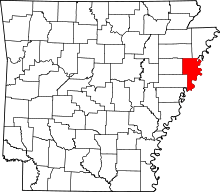 | |
| Towns | ||
| Unincorporated communities |
| |
This article is issued from Wikipedia - version of the 9/26/2014. The text is available under the Creative Commons Attribution/Share Alike but additional terms may apply for the media files.