Czerniaków
For other uses, see Czerniaków (disambiguation).
| Czerniaków | |
|---|---|
| Warsaw Neighborhood | |
 Bernardine church and monastery in Czerniaków | |
| Coordinates: 52°12′27″N 21°03′04″E / 52.207383°N 21.051089°ECoordinates: 52°12′27″N 21°03′04″E / 52.207383°N 21.051089°E | |
| Country |
|
| Voivodeship | Masovian |
| County/City | Warsaw |
| Notable landmarks | Bernardine Monastery and St. Antony of Padua Church, 19th century wooden mansion, Mound of the Warsaw Uprising |
| Time zone | CET (UTC+1) |
| • Summer (DST) | CEST (UTC+2) |
| Area code(s) | +48 22 |
| Website | http://www.czerniakow.com/ |
Czerniaków is a neighbourhood of the city of Warsaw, located within the borough of Mokotów, between the escarpment of the Vistula river and the river itself.

Czerniaków area according to City Information System in Warsaw
Called Czerniakowo since the Middle Ages, it was then merely a small village located well to the south of the Warsaw's Old Town. In the 19th century the area became densely built-up and became populated mostly by factory workers and other lower classes of society, which gave birth to a specific local version of the Warsaw dialect. During the Warsaw Uprising the area was one of the last Polish strongholds.
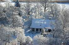
19th-century mansion in Czerniaków on Lake Czerniakowskie shore
Neighbourhoods of Mokotów | ||
|---|---|---|
 | ||
This article is issued from Wikipedia - version of the 3/17/2013. The text is available under the Creative Commons Attribution/Share Alike but additional terms may apply for the media files.