D20 road (Croatia)
| |
|---|---|
| Route information | |
| Length: | 50.4 km (31.3 mi) |
| Major junctions | |
| From: |
|
|
| |
| To: |
|
| Location | |
| Counties: | Međimurje, Koprivnica-Križevci |
| Major cities: | Čakovec, Koprivnica |
| Highway system | |
| State roads in Croatia | |

Čakovec, at the western terminus of the D20 road

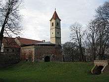
Prelog, on the D20 road route
D20 is a state road in Međimurje and Podravina regions of Croatia connecting Koprivnica to the D3 state road near Čakovec, and the road also serves as a connecting road to the A4 motorway as it forms a junction with the A4 Čakovec interchange.[1][maps 1] The road is 50.4 km (31.3 mi) long.[2]
The road, as well as all other state roads in Croatia, is managed and maintained by Hrvatske ceste, state owned company.[3]
Traffic volume
Traffic is regularly counted and reported by Hrvatske ceste, operator of the road.[4]
| D20 traffic volume | ||||
| Road | Counting site | AADT | ASDT | Notes |
| |
1319 Ivanovec | 5,460 | 6,183 | Between the Ž2232 junction and Čakovec interchange (A4) |
| |
1305 Prelog | 3,776 | 3,921 | Between the Ž2038 and Ž2033 junctions. |
Road junctions and populated areas
| D20 junctions/populated areas | |
| Type | Slip roads/Notes |
| |
The western terminus of the road. |
| |
Ž2022 to Mala Subotica and Orehovica. |
| |
|
| |
Ž2038 to Sveti Križ and Podbrest. |
| |
Prelog Ž2026 to Donji Kraljevec and Goričan. Ž2033 to Sveti Juraj u Trnju (D3) and Otok. |
| |
Cirkovljan |
| |
Draškovec Ž2255 to Donji Kraljevec. Ž2039 to Oporovec. |
| |
Donji Mihaljevec |
| |
Sveta Marija |
| |
Ž2040 to Donji Vidovec and Kotoriba. |
| |
Donja Dubrava Ž2041 to the Ž2040 county road. |
| |
Drava Bridge - 175 m (574 ft) long. |
| |
Ž2076 to Selnica Podravska, Slokovec and Sigetec Ludbreški (D2). |
| |
Ž2081 to Zablatje, Kuzminec and Rasinja. |
| |
Ž2078 to Legrad. The western D20/Ž2078 intersection. The Ž2078 road loops from the D20 to Legrad and back forming 2 intersections with the latter. |
| |
Ž2078 to Legrad. The eastern D20/Ž2078 intersection. |
| |
Đelekovec Ž2082 to Imbriovec. Ž2260 to Drnje (D41). |
| |
Koprivnica The eastern terminus of the road. |
Maps
- ↑ Overview map of the D20 (Map). OpenStreetMap. Retrieved July 22, 2014.
Sources
- 1 2 "Regulation on motorway markings, chainage, interchange/exit/rest area numbers and names". Narodne novine (in Croatian). April 24, 2003.
- ↑ Ministry of Sea, Transport and Infrastructure (Croatia) (June 4, 2013). "Decision on categorization of public roads" (in Croatian). Narodne novine. Retrieved July 22, 2014.
- ↑ "Public Roads Act". Narodne novine (in Croatian). December 14, 2004.
- ↑ "Traffic counting on the roadways of Croatia in 2013 - digest" (PDF). Hrvatske ceste. May 2014. Retrieved 2014-07-20.
- 1 2 "Map of border crossings and customs office areas" (PDF). Customs Administration of the Republic of Croatia (in Croatian). March 6, 2008.
This article is issued from Wikipedia - version of the 7/14/2015. The text is available under the Creative Commons Attribution/Share Alike but additional terms may apply for the media files.