Dawson, Minnesota
| Dawson, Minnesota | |
|---|---|
| City | |
| Motto: "The Small City With The Bright Sunshine"[1] | |
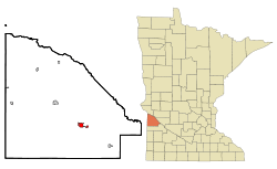 Location of Dawson, Minnesota | |
| Coordinates: 44°55′53″N 96°3′14″W / 44.93139°N 96.05389°W | |
| Country | United States |
| State | Minnesota |
| County | Lac qui Parle |
| Area[2] | |
| • Total | 1.48 sq mi (3.83 km2) |
| • Land | 1.48 sq mi (3.83 km2) |
| • Water | 0 sq mi (0 km2) |
| Elevation | 1,047 ft (319 m) |
| Population (2010)[3] | |
| • Total | 1,540 |
| • Estimate (2012[4]) | 1,504 |
| • Density | 1,040.5/sq mi (401.7/km2) |
| Time zone | Central (CST) (UTC-6) |
| • Summer (DST) | CDT (UTC-5) |
| ZIP code | 56232 |
| Area code(s) | 320 |
| FIPS code | 27-14968[5] |
| GNIS feature ID | 0642657[6] |
| Website | www.dawsonmn.com |
Dawson is a city in Lac qui Parle County, Minnesota, United States. The population was 1,540 at the 2010 census.[7]
History
Dawson was platted in 1884.[8] The city was named for William Dawson, a former mayor of St. Paul, MN, and one of three partners in the Dawson Townsite Company.[9] A post office has been in operation at Dawson since 1884.[10] The city was incorporated in 1885.[8]
Geography
According to the United States Census Bureau, the city has a total area of 1.48 square miles (3.83 km2), all of it land.[2] The West Branch of the Lac qui Parle River flows through the city.[11] The West Branch of The Lac qui Parle River flows into the Lac qui Parle River south of Dawson. U.S. Route 212 serves as a main route in the city.
Demographics
| Historical population | |||
|---|---|---|---|
| Census | Pop. | %± | |
| 1890 | 418 | — | |
| 1900 | 962 | 130.1% | |
| 1910 | 1,318 | 37.0% | |
| 1920 | 1,511 | 14.6% | |
| 1930 | 1,386 | −8.3% | |
| 1940 | 1,646 | 18.8% | |
| 1950 | 1,834 | 11.4% | |
| 1960 | 1,766 | −3.7% | |
| 1970 | 1,699 | −3.8% | |
| 1980 | 1,901 | 11.9% | |
| 1990 | 1,626 | −14.5% | |
| 2000 | 1,539 | −5.4% | |
| 2010 | 1,540 | 0.1% | |
| Est. 2015 | 1,444 | [12] | −6.2% |
| U.S. Decennial Census | |||
2010 census
As of the census[3] of 2010, there were 1,540 people, 682 households, and 412 families residing in the city. The population density was 1,040.5 inhabitants per square mile (401.7/km2). There were 768 housing units at an average density of 518.9 per square mile (200.3/km2). The racial makeup of the city was 97.4% White, 0.4% African American, 0.4% Native American, 0.1% Pacific Islander, 0.6% from other races, and 1.1% from two or more races. Hispanic or Latino of any race were 2.3% of the population.
There were 682 households of which 23.8% had children under the age of 18 living with them, 48.5% were married couples living together, 8.5% had a female householder with no husband present, 3.4% had a male householder with no wife present, and 39.6% were non-families. 36.5% of all households were made up of individuals and 19.8% had someone living alone who was 65 years of age or older. The average household size was 2.16 and the average family size was 2.78.
The median age in the city was 47.8 years. 21.8% of residents were under the age of 18; 4.9% were between the ages of 18 and 24; 19.5% were from 25 to 44; 28% were from 45 to 64; and 25.7% were 65 years of age or older. The gender makeup of the city was 47.2% male and 52.8% female.
2000 census
As of the census[5] of 2000, there were 1,539 people, 677 households, and 398 families residing in the city. The population density was 1,043.4 people per square mile (404.2/km²). There were 756 housing units at an average density of 512.6 per square mile (198.6/km²). The racial makeup of the city was 98.25% White, 0.19% African American, 0.32% Native American, 0.32% Asian, and 0.91% from two or more races. Hispanic or Latino of any race were 0.52% of the population.
There were 677 households out of which 24.4% had children under the age of 18 living with them, 53.5% were married couples living together, 3.4% had a female householder with no husband present, and 41.2% were non-families. 39.1% of all households were made up of individuals and 25.7% had someone living alone who was 65 years of age or older. The average household size was 2.17 and the average family size was 2.88.
In the city the population was spread out with 21.6% under the age of 18, 6.7% from 18 to 24, 21.4% from 25 to 44, 20.5% from 45 to 64, and 29.7% who were 65 years of age or older. The median age was 45 years. For every 100 females there were 87.7 males. For every 100 females age 18 and over, there were 83.0 males.
The median income for a household in the city was $31,442, and the median income for a family was $46,484. Males had a median income of $30,493 versus $18,750 for females. The per capita income for the city was $19,084. About 3.3% of families and 7.4% of the population were below the poverty line, including 5.0% of those under age 18 and 10.7% of those age 65 or over.
Notable people
- Theodore Christianson - 21st Governor of Minnesota from January 6, 1925 until January 6, 1931; resident of Dawson and publisher of the Dawson Sentinel.[13][14]
- Theodore Christianson - Minnesota Supreme Court justice and son of Governor Christianson[15]
- James D. Hodgson - United States Secretary of Labor (1970-1973); born in Dawson
- Carrie Tollefson - Olympian at 1500 meters
- Phyllis Gates - Wife of Hollywood actor Rock Hudson (1955–1958)
- Jeff Nordgaard - Second-round NBA draft pick in 1996
Movies filmed wholly or partially in Dawson
- Sweet Land (2005)
References
- ↑ "City of Dawson Minnesota". City of Dawson Minnesota. Retrieved October 8, 2012.
- 1 2 "US Gazetteer files 2010". United States Census Bureau. Retrieved 2012-11-13.
- 1 2 "American FactFinder". United States Census Bureau. Retrieved 2012-11-13.
- ↑ "Population Estimates". United States Census Bureau. Retrieved 2013-05-28.
- 1 2 "American FactFinder". United States Census Bureau. Retrieved 2008-01-31.
- ↑ "US Board on Geographic Names". United States Geological Survey. 2007-10-25. Retrieved 2008-01-31.
- ↑ "2010 Census Redistricting Data (Public Law 94-171) Summary File". American FactFinder. United States Census Bureau. Retrieved 27 April 2011.
- 1 2 Warren Upham (1920). Minnesota Geographic Names: Their Origin and Historic Significance. Minnesota Historical Society. p. 289.
- ↑ History, The First 100 Years, 1884-1984, p.3.
- ↑ "Lac qui Parle County". Jim Forte Postal History. Retrieved 17 July 2015.
- ↑ Minnesota Atlas & Gazetteer. Yarmouth, Me.: DeLorme. 1994. p. 36. ISBN 0-89933-222-6.
- ↑ "Annual Estimates of the Resident Population for Incorporated Places: April 1, 2010 to July 1, 2015". Retrieved July 2, 2016.
- ↑ "CHRISTIANSON, Theodore, (1883 - 1948)". Biographical Directory of the United States Congress. Retrieved October 8, 2012.
- ↑ History, the First 100 Years, 1884-1984
- ↑ Minnesota State Law Library-Theodore Christianson
External links
| Wikimedia Commons has media related to Dawson, Minnesota. |
- City of Dawson, MN -- Official site
- Dawson-Boyd Schools -- Official site
- Dawson Area Chamber of Commerce -- Official site
- City-Data.com
Municipalities and communities of Lac qui Parle County, Minnesota, United States | ||
|---|---|---|
| Cities | 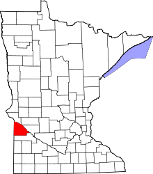 | |
| Townships | ||
| Unincorporated community | ||
| Footnotes | ‡This populated place also has portions in an adjacent county or counties | |
Coordinates: 44°55′58″N 96°03′16″W / 44.93278°N 96.05444°W