Denali Borough, Alaska
| Denali Borough, Alaska | ||
|---|---|---|
| ||
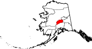 Location in the U.S. state of Alaska | ||
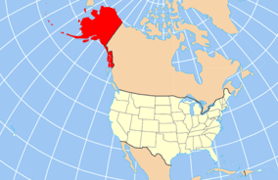 Alaska's location in the U.S. | ||
| Incorporated | December 7, 1990[1] | |
| Named for | Denali | |
| Seat | Healy | |
| Largest city | Healy | |
| Area | ||
| • Total | 12,777 sq mi (33,092 km2) | |
| • Land | 12,751 sq mi (33,025 km2) | |
| • Water | 26 sq mi (67 km2), 0.2% | |
| Population (est.) | ||
| • (2015) | 1,919 | |
| • Density | 0.1/sq mi (0/km²) | |
| Congressional district | at-large | |
| Time zone | Alaska: UTC-9/-8 | |
| Website |
www | |

The Denali Borough is a borough located in the U.S. state of Alaska. As of 2010 the population of the borough was 1,826.[2] The borough seat is Healy,[3] and its only incorporated place is Anderson. The borough was incorporated in 1990.
The area was previously a part of the Unorganized Borough, with the Upper Railbelt School District serving as the region's rural education attendance area (which was replaced by a school district under the borough's umbrella upon incorporation).
Geography
The borough has a total area of 12,777 square miles (33,090 km2), of which 12,751 square miles (33,020 km2) is land and 26 square miles (67 km2) (0.2%) is water.[4]
The borough contains North America's highest point: Denali (formerly Mount McKinley), from which it derives its name, at 6190.5 m (20,310 ft).
National protected area
- Denali National Park and Preserve (part)
- Denali Wilderness (part)
Adjacent boroughs and census areas
- Yukon-Koyukuk Census Area - west/north
- Fairbanks North Star Borough - northeast
- Southeast Fairbanks Census Area - east
- Matanuska-Susitna Borough - south
Demographics
| Historical population | |||
|---|---|---|---|
| Census | Pop. | %± | |
| 2000 | 1,893 | — | |
| 2010 | 1,826 | −3.5% | |
| Est. 2015 | 1,919 | [5] | 5.1% |
| U.S. Decennial Census[6] 1990-2000[7] 2010-2015[2] | |||
As of the census[8] of 2000, there were 1,893 people, 785 households, and 452 families residing in the borough. The population density was 0.148 people per square mile (0.057/km²). There were 1,351 housing units at an average density of 0.106 per square mile (0.041/km²). The racial makeup of the borough was 85.74% White, 1.43% Black or African American, 4.75% Native American, 1.53% Asian, 0.37% Pacific Islander, 0.95% from other races, and 5.23% from two or more races. 2.48% of the population were Hispanic or Latino of any race.
There were 785 households out of which 31.00% had children under the age of 18 living with them, 48.40% were married couples living together, 4.50% had a female householder with no husband present, and 42.30% were non-families. 35.00% of all households were made up of individuals and 1.40% had someone living alone who was 65 years of age or older. The average household size was 2.28 and the average family size was 3.03.
In the borough the population was spread out with 23.80% under the age of 18, 6.70% from 18 to 24, 36.80% from 25 to 44, 29.70% from 45 to 64, and 3.10% who were 65 years of age or older. The median age was 38 years. For every 100 females there were 139.00 males. For every 100 females age 18 and over, there were 147.10 males.
Denali Borough is the 63rd highest-income county in the United States, and highest-income county in Alaska, by personal per capita income as of 2009.[9]
Communities
City
Census-designated places
Unincorporated communities
Popular culture
In the Twilight Saga by Stephenie Meyer, the Denali vampire coven (consisting of Tanya, Kate, Irina, Eleazar and Carmen and later Garrett) lives in Denali because of the lack of sunlight.
See also
- List of airports in the Denali Borough
- National Register of Historic Places listings in Denali Borough, Alaska
References
- ↑ 1996 Alaska Municipal Officials Directory. Juneau: Alaska Municipal League/Alaska Department of Community and Regional Affairs. January 1996. p. 4.
- 1 2 "State & County QuickFacts". United States Census Bureau. Retrieved May 18, 2014.
- ↑ "Find a County". National Association of Counties. Retrieved 2011-06-07.
- ↑ "US Gazetteer files: 2010, 2000, and 1990". United States Census Bureau. 2011-02-12. Retrieved 2011-04-23.
- ↑ "County Totals Dataset: Population, Population Change and Estimated Components of Population Change: April 1, 2010 to July 1, 2015". Retrieved July 2, 2016.
- ↑ "U.S. Decennial Census". United States Census Bureau. Retrieved May 18, 2014.
- ↑ "Census 2000 PHC-T-4. Ranking Tables for Counties: 1990 and 2000" (PDF). United States Census Bureau. Retrieved May 18, 2014.
- ↑ "American FactFinder". United States Census Bureau. Retrieved 2011-05-14.
- ↑ Per capita personal income, 2009
- ↑ Denali Borough Resolution No. 12-32
External links
![]() Media related to Denali Borough, Alaska at Wikimedia Commons
Media related to Denali Borough, Alaska at Wikimedia Commons
 |
Yukon-Koyukuk Census Area | Fairbanks North Star Borough | | |
| Yukon-Koyukuk Census Area | |
Southeast Fairbanks Census Area | ||
| ||||
| | ||||
| Matanuska-Susitna Borough |
Municipalities and communities of Denali Borough, Alaska, United States | ||
|---|---|---|
| City | | |
| CDPs | ||
| Unincorporated communities | ||
Juneau (capital) | ||
| Topics |
|  |
| Society |
| |
| Regions | ||
| Largest cities | ||
| Boroughs | ||
| Census Areas | ||
Coordinates: 63°47′20″N 150°11′30″W / 63.78889°N 150.19167°W