Dharruk, New South Wales
| Dharruk Sydney, New South Wales | |||||||||||||
|---|---|---|---|---|---|---|---|---|---|---|---|---|---|
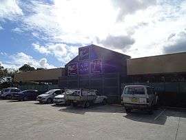 West Tradies club in Dharruk | |||||||||||||
| Population | 2,765 (2011 census)[1] | ||||||||||||
| Postcode(s) | 2770 | ||||||||||||
| Location | 46 km (29 mi) west of Sydney CBD | ||||||||||||
| LGA(s) | City of Blacktown | ||||||||||||
| State electorate(s) | Mount Druitt | ||||||||||||
| Federal Division(s) | Chifley | ||||||||||||
| |||||||||||||
Dharruk is a suburb of Sydney, in the state of New South Wales, Australia. Dharruk is located 46 kilometres west of the Sydney central business district, in the local government area of the City of Blacktown and is part of the Greater Western Sydney region.
Dharruk is chiefly a residential suburb with almost no industry or commercial activity. The only other significant activity in the suburb is education, with the Mount Druitt campus of Chifley College and Dawson Public School occupying much of the suburb. The boundaries of Dharruk are defined by Carlisle Avenue to the east, Popondetta Road to the west, Jersey Road to the north and Woodstock Avenue to the south.[2]
History
Dharruk is derived from the name of the Darug people, an Aboriginal tribe associated with the area west of Sydney.[2] In the 2011 Census, over 5% of the population were recorded as being indigenous Australians.[1]
Housing
Housing is heavily dominated by public housing built throughout the 1960s and 1970s, with a large number of extensive terrace-style complexes and freestanding fibro houses. These are gradually transferring to private ownership and as this continues these government-built premises are being replaced with privately built, modern homes, similar to those being built in other areas of Sydney.
Commercial area
While there are limited commercial and retail outlets within Dharruk, Emerton, Plumpton, and Mount Druitt are all in very close proximity and between these few suburbs offer access to a wide range of supermarkets, banks, and discount department stores.
Schools
Chifley College's Mount Druitt campus is located within the suburb adjacent to the Emerton Village shopping complex. Chifley College is named for Ben Chifley, Australian Prime Minister of Australia from 1945 to 1949. Nearby is Dawson Public School.
References
- 1 2 Australian Bureau of Statistics (31 October 2012). "Dharruk (State Suburb)". 2011 Census QuickStats. Retrieved 1 May 2013.
- 1 2 "Dharruk". Geographical Names Register (GNR) of NSW. Geographical Names Board of New South Wales. Retrieved 4 August 2013.
- The Book of Sydney Suburbs, Compiled by Frances Pollen, Angus & Robertson Publishers, 1990, Published in Australia ISBN 0-207-14495-8
Coordinates: 33°44′53″S 150°48′57″E / 33.74807°S 150.81590°E