Diamond, Missouri
| Diamond, Missouri | |
|---|---|
| City | |
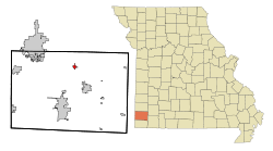 Location of Diamond, Missouri | |
| Coordinates: 36°59′40″N 94°18′50″W / 36.99444°N 94.31389°WCoordinates: 36°59′40″N 94°18′50″W / 36.99444°N 94.31389°W | |
| Country | United States |
| State | Missouri |
| County | Newton |
| Area[1] | |
| • Total | 0.75 sq mi (1.94 km2) |
| • Land | 0.75 sq mi (1.94 km2) |
| • Water | 0 sq mi (0 km2) |
| Elevation | 1,158 ft (353 m) |
| Population (2010)[2] | |
| • Total | 902 |
| • Estimate (2013[3]) | 926 |
| • Density | 1,202.7/sq mi (464.4/km2) |
| Time zone | Central (CST) (UTC-6) |
| • Summer (DST) | CDT (UTC-5) |
| ZIP code | 64840 |
| Area code(s) | 417 |
| FIPS code | 29-19432[4] |
| GNIS feature ID | 0716874[5] |
Diamond is a city in Newton County, Missouri, United States near Joplin, Missouri. The population was 902 at the 2010 census. It is part of the Joplin, Missouri, Metropolitan Statistical Area. Diamond is primarily renowned as the birthplace of George Washington Carver.
History
A post office called Diamond has been in operation since 1883.[6] The area was named for a diamond-shaped tract of land near the original town site.[7] Mining was historically the primary industry in Diamond.[8]
Geography
Diamond is located at 36°59′40″N 94°18′50″W / 36.99444°N 94.31389°W (36.994573, -94.313826).[9]
According to the United States Census Bureau, the city has a total area of 0.75 square miles (1.94 km2), all of it land.[1]
Demographics
| Historical population | |||
|---|---|---|---|
| Census | Pop. | %± | |
| 1950 | 405 | — | |
| 1960 | 453 | 11.9% | |
| 1970 | 608 | 34.2% | |
| 1980 | 766 | 26.0% | |
| 1990 | 775 | 1.2% | |
| 2000 | 808 | 4.3% | |
| 2010 | 902 | 11.6% | |
| Est. 2015 | 925 | [10] | 2.5% |
| U.S. Decennial Census | |||
2010 census
As of the census[2] of 2010, there were 902 people, 372 households, and 250 families residing in the city. The population density was 1,202.7 inhabitants per square mile (464.4/km2). There were 409 housing units at an average density of 545.3 per square mile (210.5/km2). The racial makeup of the city was 94.0% White, 0.7% African American, 1.4% Native American, 0.1% Asian, 1.1% from other races, and 2.7% from two or more races. Hispanic or Latino of any race were 1.9% of the population.
There were 372 households of which 36.0% had children under the age of 18 living with them, 47.8% were married couples living together, 12.4% had a female householder with no husband present, 7.0% had a male householder with no wife present, and 32.8% were non-families. 28.5% of all households were made up of individuals and 12.3% had someone living alone who was 65 years of age or older. The average household size was 2.42 and the average family size was 2.95.
The median age in the city was 35 years. 26.7% of residents were under the age of 18; 9.9% were between the ages of 18 and 24; 23.4% were from 25 to 44; 24.7% were from 45 to 64; and 15.4% were 65 years of age or older. The gender makeup of the city was 49.8% male and 50.2% female.
2000 census
As of the census[4] of 2000, there were 808 people, 320 households, and 234 families residing in the town. The population density was 1,215.2 people per square mile (472.1/km²). There were 350 housing units at an average density of 528.0 per square mile (204.8/km²). The racial makeup of the town was 96.42% White, 0.74% African American, 1.50% Native American, 0.12% Asian, 0.25% from other races, and 1.00% from two or more races. Hispanic or Latino of any race were 1.36% of the population.
There were 320 households out of which 36.4% had children under the age of 18 living with them, 59.6% were married couples living together, 10.4% had a female householder with no husband present, and 26.6% were non-families. 25.4% of all households were made up of individuals and 14.0% had someone living alone who was 65 years of age or older. The average household size was 2.54 and the average family size was 3.02.
In the town the population was spread out with 27.8% under the age of 18, 12.4% from 18 to 24, 26.6% from 25 to 44, 19.6% from 45 to 64, and 13.8% who were 65 years of age or older. The median age was 33 years. For every 100 females there were 120.0 males. For every 100 females age 18 and over, there were 87.5 males.
The median income for a household in the town was $29,000, and the median income for a family was $34,167. Males had a median income of $25,719 versus $20,000 for females. The per capita income for the town was $13,581. About 9.8% of families and 11.6% of the population were below the poverty line, including 19.4% of those under age 18 and 5.8% of those age 65 or over.
Notable people
George Washington Carver, a scientist, botanist, educator, and inventor, was born near Diamond ca. 1864. Carver's boyhood home, the George Washington Carver National Monument, is open to the public.[11]
References
- 1 2 "US Gazetteer files 2010". United States Census Bureau. Retrieved 2012-07-08.
- 1 2 "American FactFinder". United States Census Bureau. Retrieved 2012-07-08.
- ↑ "Population Estimates". United States Census Bureau. Retrieved 2013-05-30.
- 1 2 "American FactFinder". United States Census Bureau. Retrieved 2008-01-31.
- ↑ "US Board on Geographic Names". United States Geological Survey. 2007-10-25. Retrieved 2008-01-31.
- ↑ "Post Offices". Jim Forte Postal History. Retrieved 20 November 2016.
- ↑ "Newton County Place Names, 1928–1945". The State Historical Society of Missouri. Archived from the original on June 24, 2016. Retrieved November 20, 2016.
- ↑ Williams, Walter (1904). The State of Missouri. p. 461.
- ↑ "US Gazetteer files: 2010, 2000, and 1990". United States Census Bureau. 2011-02-12. Retrieved 2011-04-23.
- ↑ "Annual Estimates of the Resident Population for Incorporated Places: April 1, 2010 to July 1, 2015". Retrieved July 2, 2016.
- ↑ "George Washington Carver National Monument Missouri". National Park Service U.S. Department of the Interior. Retrieved 20 November 2016.
Municipalities and communities of Newton County, Missouri, United States | ||
|---|---|---|
| Cities | 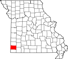 | |
| Villages | ||
| Townships | ||
| Unincorporated communities | ||
| Footnotes | ‡This populated place also has portions in an adjacent county or counties | |