Dover, Racine County, Wisconsin
| Dover, Wisconsin | |
|---|---|
| Town | |
 Location of Dover, Racine County, Wisconsin | |
| Coordinates: 42°42′43″N 88°7′35″W / 42.71194°N 88.12639°WCoordinates: 42°42′43″N 88°7′35″W / 42.71194°N 88.12639°W | |
| Country | United States |
| State | Wisconsin |
| County | Racine |
| Area | |
| • Total | 36.2 sq mi (93.7 km2) |
| • Land | 35.4 sq mi (91.6 km2) |
| • Water | 0.8 sq mi (2.1 km2) |
| Elevation[1] | 810 ft (247 m) |
| Population (2000) | |
| • Total | 3,908 |
| • Density | 110.5/sq mi (42.7/km2) |
| Time zone | Central (CST) (UTC-6) |
| • Summer (DST) | CDT (UTC-5) |
| ZIP code | 53139 |
| Area code(s) | 262 |
| FIPS code | 55-20625[2] |
| GNIS feature ID | 1583094[1] |
| Website | http://townofdoverwi.com/ |
Dover is a town in Racine County, Wisconsin, United States. The population was 3,908 at the 2000 census. The unincorporated communities of Beaumont, Eagle Lake Manor, Eagle Lake Terrace, Kansasville, and Rosewood are located in the town. The census-designated place of Eagle lake is also located in the town.
Geography
According to the United States Census Bureau, the town has a total area of 36.2 square miles (93.7 km²), of which, 35.4 square miles (91.6 km²) of it is land and 0.8 square miles (2.1 km²) of it (2.27%) is water.
Demographics
As of the census[2] of 2000, there were 3,908 people, 1,193 households, and 889 families residing in the town. The population density was 110.5 people per square mile (42.7/km²). There were 1,344 housing units at an average density of 38.0 per square mile (14.7/km²). The racial makeup of the town was 91.38% White, 4.71% African American, 1.07% Native American, 0.51% Asian, 0.03% Pacific Islander, 1.43% from other races, and 0.87% from two or more races. Hispanic or Latino of any race were 3.94% of the population.
There were 1,193 households out of which 38.8% had children under the age of 18 living with them, 62.6% were married couples living together, 8.0% had a female householder with no husband present, and 25.4% were non-families. 18.9% of all households were made up of individuals and 5.9% had someone living alone who was 65 years of age or older. The average household size was 2.72 and the average family size was 3.14.
In the town the population was spread out with 26.0% under the age of 18, 6.9% from 18 to 24, 35.8% from 25 to 44, 22.8% from 45 to 64, and 8.6% who were 65 years of age or older. The median age was 36 years. For every 100 females there were 90.3 males. For every 100 females age 18 and over, there were 92.9 males.
The median income for a household in the town was $49,972, and the median income for a family was $58,176. Males had a median income of $37,209 versus $29,256 for females. The per capita income for the town was $20,275. About 2.0% of families and 11.2% of the population were below the poverty line, including 3.4% of those under age 18 and 0.7% of those age 65 or over.
Notable people
- Alfred L. Buchan, Wisconsin state legislator and physician
- Robert J. Matheson, Wisconsin state legislator and businessman
- Robert Mutter, Wisconsin state legislator
- John Todd Trowbridge, Wisconsin territorial legislator and sea captain
References
- 1 2 "US Board on Geographic Names". United States Geological Survey. 2007-10-25. Retrieved 2008-01-31.
- 1 2 "American FactFinder". United States Census Bureau. Retrieved 2008-01-31.
External links
Municipalities and communities of Racine County, Wisconsin, United States | ||
|---|---|---|
| Cities | 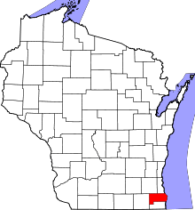 | |
| Villages | ||
| Towns | ||
| CDPs | ||
| Unincorporated communities | ||
| Ghost towns | ||
| Footnotes | ‡This populated place also has portions in an adjacent county or counties | |