Eddyville, Nebraska
| Eddyville, Nebraska | |
|---|---|
| Village | |
|
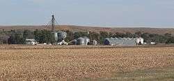
Eddyville, seen from Nebraska Highway 40 to the northwest | |
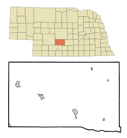 Location of Eddyville, Nebraska | |
| Coordinates: 41°0′42″N 99°37′25″W / 41.01167°N 99.62361°WCoordinates: 41°0′42″N 99°37′25″W / 41.01167°N 99.62361°W | |
| Country | United States |
| State | Nebraska |
| County | Dawson |
| Area[1] | |
| • Total | 0.28 sq mi (0.73 km2) |
| • Land | 0.28 sq mi (0.73 km2) |
| • Water | 0 sq mi (0 km2) |
| Elevation | 2,448 ft (746 m) |
| Population (2010)[2] | |
| • Total | 97 |
| • Estimate (2012[3]) | 96 |
| • Density | 346.4/sq mi (133.7/km2) |
| Time zone | Central (CST) (UTC-6) |
| • Summer (DST) | CDT (UTC-5) |
| ZIP code | 68834 |
| Area code(s) | 308 |
| FIPS code | 31-14380[4] |
| GNIS feature ID | 0829021[5] |
Eddyville is a village in Dawson County, Nebraska, United States. It is part of the Lexington, Nebraska Micropolitan Statistical Area. The population was 97 at the 2010 census.
History
Eddyville was platted ca. the late 1880s when the railroad was extended to that point.[6] It was named after the city of Eddyville, Iowa.[7] Eddyville became a shipping point on the Union Pacific Railroad.[8]
Geography
Eddyville is located at 41°0′42″N 99°37′25″W / 41.01167°N 99.62361°W (41.011668, -99.623613).[9]
According to the United States Census Bureau, the village has a total area of 0.28 square miles (0.73 km2), all of it land.[1]
Demographics
| Historical population | |||
|---|---|---|---|
| Census | Pop. | %± | |
| 1900 | 101 | — | |
| 1910 | 254 | 151.5% | |
| 1920 | 227 | −10.6% | |
| 1930 | 224 | −1.3% | |
| 1940 | 237 | 5.8% | |
| 1950 | 186 | −21.5% | |
| 1960 | 119 | −36.0% | |
| 1970 | 128 | 7.6% | |
| 1980 | 121 | −5.5% | |
| 1990 | 102 | −15.7% | |
| 2000 | 96 | −5.9% | |
| 2010 | 97 | 1.0% | |
| Est. 2015 | 95 | [10] | −2.1% |
2010 census
As of the census[2] of 2010, there were 97 people, 38 households, and 28 families residing in the village. The population density was 346.4 inhabitants per square mile (133.7/km2). There were 43 housing units at an average density of 153.6 per square mile (59.3/km2). The racial makeup of the village was 90.7% White and 9.3% from other races. Hispanic or Latino of any race were 9.3% of the population.
There were 38 households of which 34.2% had children under the age of 18 living with them, 63.2% were married couples living together, 5.3% had a female householder with no husband present, 5.3% had a male householder with no wife present, and 26.3% were non-families. 23.7% of all households were made up of individuals and 7.9% had someone living alone who was 65 years of age or older. The average household size was 2.55 and the average family size was 3.07.
The median age in the village was 42.5 years. 22.7% of residents were under the age of 18; 8.2% were between the ages of 18 and 24; 24.8% were from 25 to 44; 33.9% were from 45 to 64; and 10.3% were 65 years of age or older. The gender makeup of the village was 54.6% male and 45.4% female.
2000 census
As of the census[4] of 2000, there were 96 people, 41 households, and 28 families residing in the village. The population density was 351.7 people per square mile (137.3/km²). There were 44 housing units at an average density of 161.2 per square mile (62.9/km²). The racial makeup of the village was 100.00% White.
There were 41 households out of which 26.8% had children under the age of 18 living with them, 63.4% were married couples living together, and 31.7% were non-families. 29.3% of all households were made up of individuals and 7.3% had someone living alone who was 65 years of age or older. The average household size was 2.34 and the average family size was 2.93.
In the village the population was spread out with 22.9% under the age of 18, 5.2% from 18 to 24, 22.9% from 25 to 44, 31.3% from 45 to 64, and 17.7% who were 65 years of age or older. The median age was 44 years. For every 100 females there were 95.9 males. For every 100 females age 18 and over, there were 117.6 males.
As of 2000 the median income for a household in the village was $28,125, and the median income for a family was $33,750. Males had a median income of $28,750 versus $21,667 for females. The per capita income for the village was $14,542. There were 9.1% of families and 16.1% of the population living below the poverty line, including 32.0% of under eighteens and 14.3% of those over 64.
References
- 1 2 "US Gazetteer files 2010". United States Census Bureau. Retrieved 2012-06-24.
- 1 2 "American FactFinder". United States Census Bureau. Retrieved 2012-06-24.
- ↑ "Population Estimates". United States Census Bureau. Retrieved 2013-05-29.
- 1 2 "American FactFinder". United States Census Bureau. Retrieved 2008-01-31.
- ↑ "US Board on Geographic Names". United States Geological Survey. 2007-10-25. Retrieved 2008-01-31.
- ↑ "Eddyville, Dawson County". Center for Advanced Land Management Information Technologies. University of Nebraska. Retrieved 4 August 2014.
- ↑ Fitzpatrick, Lillian L. (1960). Nebraska Place-Names. University of Nebraska Press. p. 51. A 1925 edition is available for download at University of Nebraska—Lincoln Digital Commons.
- ↑ Burr, George L. (1921). History of Hamilton and Clay Counties, Nebraska, Volume 1. S.J. Clarke Publishing Company. p. 107.
- ↑ "US Gazetteer files: 2010, 2000, and 1990". United States Census Bureau. 2011-02-12. Retrieved 2011-04-23.
- ↑ "Annual Estimates of the Resident Population for Incorporated Places: April 1, 2010 to July 1, 2015". Retrieved July 2, 2016.
- ↑ "Census of Population and Housing". Census.gov. Retrieved June 4, 2015.
Municipalities and communities of Dawson County, Nebraska, United States | ||
|---|---|---|
| Cities | ||
| Villages | ||
| CDP | ||
| Unincorporated communities | ||
| Former communities | ||