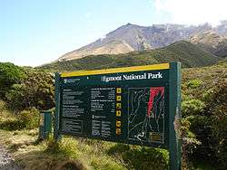
Egmont National Park
| Egmont National Park | |
|---|---|
|
IUCN category II (national park) | |
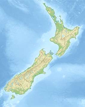 Map of New Zealand | |
| Location | Taranaki, New Zealand |
| Nearest city | New Plymouth, New Zealand |
| Coordinates | 39°16′0″S 174°6′0″E / 39.26667°S 174.10000°ECoordinates: 39°16′0″S 174°6′0″E / 39.26667°S 174.10000°E |
| Area | 335 km² |
| Established | 1900 |
| Governing body | Department of Conservation |

Egmont National Park is located south of New Plymouth, close to the west coast of the North Island of New Zealand. It is named after the mountain which dominates its environs, which itself was named by Captain Cook after John Perceval, 2nd Earl of Egmont, the First Lord of the Admiralty who promoted Cook's first voyage. Taranaki has been the Māori name for the mountain for many centuries, and the mountain itself now has two alternative official names, "Mount Taranaki" and "Mount Egmont".
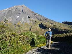
The park, established in 1900, is dominated by the dormant volcano of Mount Taranaki.[1] The park receives massive annual precipitation which is essentially orographic in origin as moist westerlies moving inland from the Tasman hit Mount Taranaki and the adjacent Pouakai and Kaitake ranges and are thus forced to rise. Since the area has high annual rainfall and a mild coastal climate there is a lush rainforest covering the foothills, a forest which is nationally significant for the total absence of beech trees (genus Nothofagus).
Ecology
A rich Northern rātā/Rimu/Broadleaf forest is present, although the entire park ecosystem displays distinct patterns of vegetative zonation - the former two large species of tree are common at lower elevations whereas Kamahi tends to dominate the stunted high altitude forest. In these old growth forests the Crown Fern, Blechnum discolor, is a dominant understory plant species. [2]
The character of the plant communities continues to change with increasing altitude, to subalpine and alpine shrublands at high elevations, which are in stark contrast to the surrounding pasture farmlands. Notable among the geographical features of the park is its clear radial drainage pattern, which can be discerned in the satellite picture at right.
The Ahukawakawa Swamp is a rare high-altitude (920m) sphagnum moss wetland located between Mt Taranaki and the Pouakai range. It contains many endemic species adapted to acid soils and low temperatures.[3]
See also
- National parks of New Zealand
- Forest parks of New Zealand
- Regional parks of New Zealand
- Protected areas of New Zealand
- Conservation in New Zealand
References
- ↑ "Volcano Fact Sheet: Mount Taranaki / Egmont Volcano" (PDF). GNS Science. 2010. Retrieved 2012-01-10.
- ↑ C. Michael Hogan (2009). "Crown Fern: Blechnum discolor". Retrieved 2012-01-10.
- ↑ "Ahukawakawa Swamp".
External links
![]() Media related to Egmont National Park at Wikimedia Commons
Media related to Egmont National Park at Wikimedia Commons