Fårö Lighthouse
%2C_September_2013.jpg) Fårö Lighthouse | |
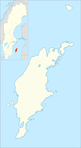 Gotland | |
| Location |
Fårö Gotland Sweden |
|---|---|
| Coordinates | 57°57′34″N 19°20′57″E / 57.959570°N 19.349265°ECoordinates: 57°57′34″N 19°20′57″E / 57.959570°N 19.349265°E |
| Year first constructed | 1847 |
| Automated | 1976 |
| Foundation | limestone basement |
| Construction | stone tower |
| Tower shape | cylindrical tower with balcony and lantern |
| Markings / pattern | white tower and lantern, greenish lantern roof |
| Height | 30 metres (98 ft) |
| Focal height | 31 metres (102 ft) |
| Original lens | mirrors |
| Current lens | 4th order Fresnel lens |
| Range | 17 nautical miles (31 km; 20 mi) |
| Characteristic | Iso WR 8s. |
| Admiralty number | C7162 |
| NGA number | 9844 |
| ARLHS number | SWE-011 |
| Sweden number | SV-4117 |
| Managing agent | Swedish Maritime Administration (Sjöfartsverket)[1] |
Fårö Lighthouse (Swedish: Fårö fyr) is a Swedish lighthouse located on the easternmost tip of Fårö. In the 19th century there had been many complaints from sea authorities that the coastlines on Gotland had very few lighthouses. So the decision was made to build one on the north side of Gotland. This lighthouse was constructed one year after the one on Hoburgen at the south tip of Gotland.
The light ran on a colza oil lamp at first. In 1882 a paraffin lamp replaced the old one, and in 1953 it was electrified. From 1891 to 1976 the tower had a first-order Fresnel lens installed in its lantern which made the lighthouse very powerful. It is remote-controlled since 1976 and owned by the Swedish Maritime Administration.
See also
References
- Rowlett, Russ. "Lighthouses of Sweden: Gotland". The Lighthouse Directory. University of North Carolina at Chapel Hill. Retrieved 26 February 2009.
External links
| Wikimedia Commons has media related to Fårö fyr. |
This article is issued from Wikipedia - version of the 4/4/2016. The text is available under the Creative Commons Attribution/Share Alike but additional terms may apply for the media files.