Fedjebjørnen
| Fedjebjørnen | |
|---|---|
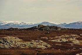 View of Fedjebjørnen | |
| Highest point | |
| Elevation | 42 m (138 ft) |
| Prominence | 42 m (138 ft) |
| Coordinates | 60°45′48″N 04°44′05″E / 60.76333°N 4.73472°ECoordinates: 60°45′48″N 04°44′05″E / 60.76333°N 4.73472°E |
| Geography | |
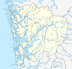 Fedjebjørnen Location in Hordaland | |
| Location | Fedje, Hordaland, Norway |
| Topo map | 1116 III Herdla |
Fedjebjørnen is the highest point on the island of Fedje which is located in Fedje municipality in Hordaland county, Norway. The hill is located on the southeastern part of the island, about half way between the two villages on the island: Fedje and Stormark. Fedjebjørnen reaches a height of about 42 metres (138 ft) above sea level.[1]
References
- ↑ Store norske leksikon. "Fedje – kommune i Hordaland" (in Norwegian). Retrieved 2014-04-02.
This article is issued from Wikipedia - version of the 5/24/2015. The text is available under the Creative Commons Attribution/Share Alike but additional terms may apply for the media files.