Finström
| Finström | ||
|---|---|---|
| Municipality | ||
| Finströms kommun | ||
|
Åland folk high school | ||
| ||
 Location of Finström in Finland | ||
 Finström Location in Åland | ||
| Coordinates: 60°14′N 019°59.5′E / 60.233°N 19.9917°ECoordinates: 60°14′N 019°59.5′E / 60.233°N 19.9917°E | ||
| Country | Finland | |
| Region | Åland | |
| Sub-region | Åland Countryside sub-region | |
| Government | ||
| • Municipal manager | Katarina Sundberg | |
| Area (2011-01-01)[1] | ||
| • Total | 172.48 km2 (66.59 sq mi) | |
| • Land | 123.25 km2 (47.59 sq mi) | |
| • Water | 49.23 km2 (19.01 sq mi) | |
| Area rank | 316th largest in Finland | |
| Population (2016-03-31)[2] | ||
| • Total | 2,529 | |
| • Rank | 266th largest in Finland | |
| • Density | 20.52/km2 (53.1/sq mi) | |
| Population by native language[3] | ||
| • Swedish | 93.8% (official) | |
| • Finnish | 3.4% | |
| • Others | 2.9% | |
| Population by age[4] | ||
| • 0 to 14 | 18.9% | |
| • 15 to 64 | 63.9% | |
| • 65 or older | 17.2% | |
| Time zone | EET (UTC+2) | |
| • Summer (DST) | EEST (UTC+3) | |
| Municipal tax rate[5] | 19.5% | |
| Website | www.finstrom.ax | |


Finström is a municipality of Åland, an autonomous territory of Finland.
The municipality has a population of 2,529 (31 March 2016)[2] of which 93.8% speak Swedish and 3.4% Finnish as their first language.[3] The municipality covers an area of 172.48 square kilometres (66.59 sq mi) of which 49.23 km2 (19.01 sq mi) is water.[1] The population density is 20.52 inhabitants per square kilometre (53.1/sq mi). The municipality is unilingually Swedish.
Godby is the second biggest built-up area in Åland after Mariehamn, inhabited by 900 people, or one-thirds of the municipality's population. A pharmacy, banks, a post office, a swimming hall and a health center are among the amenities that can be found in Godby.
History
Finström was widely inhabited in the Viking age. The church of St. Michael is one of the oldest in Åland with the oldest parts dating from the 12th century. Grelsby kungsgård was the place where king Gustavus Vasa stayed with his entourage of 312 people for a few days in the spring of 1556. Swedish king Gustaf IV Adolf also stayed there for six weeks in the summer of 1808 prior to the 1809 loss of Finland to Russia.


Geography
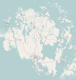
Finström is right in the middle of mainland Åland and is bordered by a total of five municipalities: Sund to the east, Saltvik to the northeast, Geta to the north, Hammarland to the west and Jomala to the south.
Långsjön, the largest lake in Åland, is located in the municipality, as is the Almskogen nature reserve. Notable bays include Kasviken and Ödkarbyviken.
Economy
Godby is by far the center of Finström's economy. The biggest employer in the municipality is Optinova with 130 employees. Tourism is also an important line of business.
Agricultural products grown especially in the northern parts of Finström include apples and various vegetables, and fishing is also a source of income for some.
References
- 1 2 "Area by municipality as of 1 January 2011" (PDF) (in Finnish and Swedish). Land Survey of Finland. Retrieved 9 March 2011.
- 1 2 "Ennakkoväkiluku sukupuolen mukaan alueittain, maaliskuu.2016" (in Finnish). Statistics Finland. Retrieved 31 March 2016.
- 1 2 "Population according to language and the number of foreigners and land area km2 by area as of 31 December 2008". Statistics Finland's PX-Web databases. Statistics Finland. Retrieved 29 March 2009.
- ↑ "Population according to age and gender by area as of 31 December 2008". Statistics Finland's PX-Web databases. Statistics Finland. Retrieved 28 April 2009.
- ↑ "List of municipal and parish tax rates in 2011". Tax Administration of Finland. 29 November 2010. Retrieved 13 March 2011.
External links
![]() Media related to Finström at Wikimedia Commons
Media related to Finström at Wikimedia Commons
- Municipality of Finström – Official website (Swedish)