Fontenay-sur-Loing
| Fontenay-sur-Loing | |
|---|---|
|
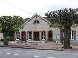
The town hall in Fontenay-sur-Loing | |
 Fontenay-sur-Loing | |
|
Location within Centre-Val de Loire region  Fontenay-sur-Loing | |
| Coordinates: 48°06′18″N 2°46′30″E / 48.105°N 2.775°ECoordinates: 48°06′18″N 2°46′30″E / 48.105°N 2.775°E | |
| Country | France |
| Region | Centre-Val de Loire |
| Department | Loiret |
| Arrondissement | Montargis |
| Canton | Ferrières-en-Gâtinais |
| Intercommunality | CC4V |
| Government | |
| • Mayor (2008–2014) | Didier Devin |
| Area1 | 9.73 km2 (3.76 sq mi) |
| Population (2006)2 | 1,676 |
| • Density | 170/km2 (450/sq mi) |
| Time zone | CET (UTC+1) |
| • Summer (DST) | CEST (UTC+2) |
| INSEE/Postal code | 45148 / 45210 |
| Elevation | 70–109 m (230–358 ft) |
| Website | www.mairie-fontenaysurloing.fr |
|
1 French Land Register data, which excludes lakes, ponds, glaciers > 1 km² (0.386 sq mi or 247 acres) and river estuaries. 2 Population without double counting: residents of multiple communes (e.g., students and military personnel) only counted once. | |
Fontenay-sur-Loing is a commune in the Loiret department in north-central France.
See also
| Wikimedia Commons has media related to Fontenay-sur-Loing. |
This article is issued from Wikipedia - version of the 3/23/2015. The text is available under the Creative Commons Attribution/Share Alike but additional terms may apply for the media files.