Aulnay-la-Rivière
| Aulnay-la-Rivière | ||
|---|---|---|
|
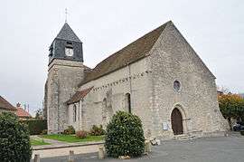
The church in Aulnay-la-Rivière | ||
| ||
 Aulnay-la-Rivière | ||
|
Location within Centre-Val de Loire region  Aulnay-la-Rivière | ||
| Coordinates: 48°11′47″N 2°22′47″E / 48.1964°N 2.3797°ECoordinates: 48°11′47″N 2°22′47″E / 48.1964°N 2.3797°E | ||
| Country | France | |
| Region | Centre-Val de Loire | |
| Department | Loiret | |
| Arrondissement | Pithiviers | |
| Canton | Puiseaux | |
| Intercommunality | Canton de Puiseaux | |
| Government | ||
| • Mayor (2008–2014) | Véronique Lévy | |
| Area1 | 16.14 km2 (6.23 sq mi) | |
| Population (2009)2 | 511 | |
| • Density | 32/km2 (82/sq mi) | |
| Time zone | CET (UTC+1) | |
| • Summer (DST) | CEST (UTC+2) | |
| INSEE/Postal code | 45014 / 45390 | |
| Elevation | 82–137 m (269–449 ft) | |
|
1 French Land Register data, which excludes lakes, ponds, glaciers > 1 km² (0.386 sq mi or 247 acres) and river estuaries. 2 Population without double counting: residents of multiple communes (e.g., students and military personnel) only counted once. | ||

Aulnay-la-Rivière is a commune in the Loiret department in north-central France.
Population
| Historical population | ||
|---|---|---|
| Year | Pop. | ±% |
| 1793 | 439 | — |
| 1800 | 420 | −4.3% |
| 1806 | 419 | −0.2% |
| 1821 | 470 | +12.2% |
| 1831 | 586 | +24.7% |
| 1836 | 640 | +9.2% |
| 1841 | 630 | −1.6% |
| 1846 | 604 | −4.1% |
| 1851 | 640 | +6.0% |
| 1856 | 642 | +0.3% |
| 1861 | 657 | +2.3% |
| 1866 | 643 | −2.1% |
| 1872 | 626 | −2.6% |
| 1876 | 634 | +1.3% |
| 1881 | 652 | +2.8% |
| 1886 | 631 | −3.2% |
| 1891 | 613 | −2.9% |
| 1896 | 564 | −8.0% |
| 1901 | 535 | −5.1% |
| 1906 | 533 | −0.4% |
| 1911 | 549 | +3.0% |
| 1921 | 471 | −14.2% |
| 1926 | 485 | +3.0% |
| 1931 | 488 | +0.6% |
| 1936 | 459 | −5.9% |
| 1946 | 426 | −7.2% |
| 1954 | 387 | −9.2% |
| 1962 | 372 | −3.9% |
| 1968 | 340 | −8.6% |
| 1975 | 362 | +6.5% |
| 1982 | 388 | +7.2% |
| 1990 | 464 | +19.6% |
| 1999 | 489 | +5.4% |
| 2006 | 512 | +4.7% |
| 2009 | 511 | −0.2% |
See also
References
| Wikimedia Commons has media related to Aulnay-la-Rivière. |
This article is issued from Wikipedia - version of the 9/16/2015. The text is available under the Creative Commons Attribution/Share Alike but additional terms may apply for the media files.