Garfield Township, Calhoun County, Iowa
| Garfield Township, Calhoun County | |
|---|---|
| Township | |
 | |
| Coordinates: 42°26′07″N 094°47′45″W / 42.43528°N 94.79583°WCoordinates: 42°26′07″N 094°47′45″W / 42.43528°N 94.79583°W | |
| Country |
|
| State |
|
| County | Calhoun |
| Area | |
| • Total | 34.64 sq mi (89.73 km2) |
| • Land | 34.64 sq mi (89.73 km2) |
| • Water | 0 sq mi (0 km2) |
| Elevation[1] | 1,220 ft (372 m) |
| Population (2000) | |
| • Total | 230 |
| • Density | 6.6/sq mi (2.6/km2) |
| FIPS code | 19-91509[2] |
| GNIS feature ID | 0467890 |
Garfield Township is one of sixteen townships in Calhoun County, Iowa, USA. As of the 2000 census, its population was 230.
History
Garfield Township was created in 1882. It was named for James A. Garfield, 20th President of the United States, who had been assassinated the year prior.[3]
Geography
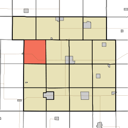
Garfield Township covers an area of 34.64 square miles (89.7 km2) and contains no incorporated settlements. According to the USGS, it contains one cemetery, Garfield.
References
- ↑ "US Board on Geographic Names". United States Geological Survey. 2007-10-25. Retrieved 2008-01-31.
- ↑ "American FactFinder". United States Census Bureau. Retrieved 2008-01-31.
- ↑ Stonebraker, Beaumont E. (1915). Past and Present of Calhoun County, Iowa: A Record of Settlement, Organization, Progress, and Achievement, Volume 1. Pioneer Publishing Company. p. 106.
External links
Municipalities and communities of Calhoun County, Iowa, United States | ||
|---|---|---|
| Cities | ||
| Townships | ||
| CDP | ||
| Other unincorporated communities | ||
| Footnotes | ‡This populated place also has portions in an adjacent county or counties | |
This article is issued from Wikipedia - version of the 11/5/2016. The text is available under the Creative Commons Attribution/Share Alike but additional terms may apply for the media files.