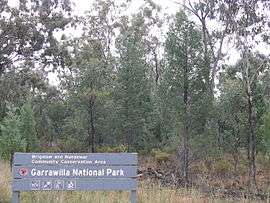
Garrawilla National Park
| Garrawilla National Park New South Wales | |
|---|---|
|
IUCN category II (national park) | |
 Garrawilla National Park | |
|
Garrawilla National Park | |
| Nearest town or city | Coonabarabran |
| Coordinates | 31°6′46″S 149°38′20″E / 31.11278°S 149.63889°ECoordinates: 31°6′46″S 149°38′20″E / 31.11278°S 149.63889°E |
| Area | 9.37 km2 (3.62 sq mi) |
| Managing authorities | New South Wales National Parks and Wildlife Service |
| See also |
Protected areas of New South Wales |
Garrawilla National Park was created in December 2005. It covers an area of 937 hectares. This park is located on the northern side of the Oxley Highway approximately halfway between Coonabarabran and Mullaley in New South Wales, Australia.[1]
See also
References
- ↑ Garrawilla National Park Retrieved on 2009-6-2
This article is issued from Wikipedia - version of the 7/23/2016. The text is available under the Creative Commons Attribution/Share Alike but additional terms may apply for the media files.