Garrison, Nebraska
| Garrison, Nebraska | |
|---|---|
| Village | |
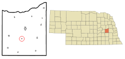 Location of Garrison, Nebraska | |
| Coordinates: 41°10′32″N 97°9′54″W / 41.17556°N 97.16500°WCoordinates: 41°10′32″N 97°9′54″W / 41.17556°N 97.16500°W | |
| Country | United States |
| State | Nebraska |
| County | Butler |
| Area[1] | |
| • Total | 0.11 sq mi (0.28 km2) |
| • Land | 0.11 sq mi (0.28 km2) |
| • Water | 0 sq mi (0 km2) |
| Elevation | 1,601 ft (488 m) |
| Population (2010)[2] | |
| • Total | 54 |
| • Estimate (2012[3]) | 53 |
| • Density | 490.9/sq mi (189.5/km2) |
| Time zone | Central (CST) (UTC-6) |
| • Summer (DST) | CDT (UTC-5) |
| ZIP code | 68632 |
| Area code(s) | 402 |
| FIPS code | 31-18300[4] |
| GNIS feature ID | 0829468[5] |
Garrison is a village in Butler County, Nebraska, United States. The population was 54 at the 2010 census.
History
Garrison was laid out ca. the late 1870s when the railroad was extended to that point.[6] It was named for abolitionist William Lloyd Garrison.[7]
A post office was established in Garrison in 1880, and remained in operation until it was discontinued in 1965.[8]
Geography
Garrison is located at 41°10′32″N 97°9′54″W / 41.17556°N 97.16500°W (41.175518, -97.164883).[9]
According to the United States Census Bureau, the village has a total area of 0.11 square miles (0.28 km2), all of it land.[1]
Demographics
| Historical population | |||
|---|---|---|---|
| Census | Pop. | %± | |
| 1910 | 177 | — | |
| 1920 | 138 | −22.0% | |
| 1930 | 126 | −8.7% | |
| 1940 | 124 | −1.6% | |
| 1950 | 88 | −29.0% | |
| 1960 | 82 | −6.8% | |
| 1970 | 60 | −26.8% | |
| 1980 | 68 | 13.3% | |
| 1990 | 71 | 4.4% | |
| 2000 | 67 | −5.6% | |
| 2010 | 54 | −19.4% | |
| Est. 2015 | 52 | [10] | −3.7% |
2010 census
As of the census[2] of 2010, there were 54 people, 23 households, and 15 families residing in the village. The population density was 490.9 inhabitants per square mile (189.5/km2). There were 28 housing units at an average density of 254.5 per square mile (98.3/km2). The racial makeup of the village was 100.0% White. Hispanic or Latino of any race were 1.9% of the population.
There were 23 households of which 26.1% had children under the age of 18 living with them, 47.8% were married couples living together, 17.4% had a male householder with no wife present, and 34.8% were non-families. 26.1% of all households were made up of individuals and 13% had someone living alone who was 65 years of age or older. The average household size was 2.35 and the average family size was 2.93.
The median age in the village was 40.5 years. 22.2% of residents were under the age of 18; 5.7% were between the ages of 18 and 24; 26% were from 25 to 44; 33.4% were from 45 to 64; and 13% were 65 years of age or older. The gender makeup of the village was 61.1% male and 38.9% female.
2000 census
As of the census[4] of 2000, there were 67 people, 27 households, and 14 families residing in the village. The population density was 572.3 people per square mile (215.6/km²). There were 31 housing units at an average density of 264.8 per square mile (99.7/km²). The racial makeup of the village was 95.52% White and 4.48% Native American.
There were 27 households out of which 40.7% had children under the age of 18 living with them, 48.1% were married couples living together, 3.7% had a female householder with no husband present, and 48.1% were non-families. 40.7% of all households were made up of individuals and 18.5% had someone living alone who was 65 years of age or older. The average household size was 2.48 and the average family size was 3.71.
In the village the population was spread out with 35.8% under the age of 18, 3.0% from 18 to 24, 31.3% from 25 to 44, 16.4% from 45 to 64, and 13.4% who were 65 years of age or older. The median age was 38 years. For every 100 females there were 86.1 males. For every 100 females age 18 and over, there were 95.5 males.
As of 2000 the median income for a household in the village was $32,917, and the median income for a family was $51,000. Males had a median income of $31,250 versus $26,500 for females. The per capita income for the village was $17,317. There were no families and 9.2% of the population living below the poverty line, including no under eighteens and none of those over 64.
References
- 1 2 "US Gazetteer files 2010". United States Census Bureau. Retrieved 2012-06-24.
- 1 2 "American FactFinder". United States Census Bureau. Retrieved 2012-06-24.
- ↑ "Population Estimates". United States Census Bureau. Retrieved 2013-05-29.
- 1 2 "American FactFinder". United States Census Bureau. Retrieved 2008-01-31.
- ↑ "US Board on Geographic Names". United States Geological Survey. 2007-10-25. Retrieved 2008-01-31.
- ↑ "Garrison, Butler County". Center for Advanced Land Management Information Technologies. University of Nebraska. Retrieved 31 July 2014.
- ↑ Fitzpatrick, Lillian L. (1960). Nebraska Place-Names. University of Nebraska Press. p. 29.
- ↑ "Butler County". Jim Forte Postal History. Retrieved 25 August 2014.
- ↑ "US Gazetteer files: 2010, 2000, and 1990". United States Census Bureau. 2011-02-12. Retrieved 2011-04-23.
- ↑ "Annual Estimates of the Resident Population for Incorporated Places: April 1, 2010 to July 1, 2015". Retrieved July 2, 2016.
- ↑ "Census of Population and Housing". Census.gov. Retrieved June 4, 2015.
Municipalities and communities of Butler County, Nebraska, United States | ||
|---|---|---|
| City | ||
| Villages | ||
| Townships | ||
| Unincorporated communities | ||
| Ghost town | ||