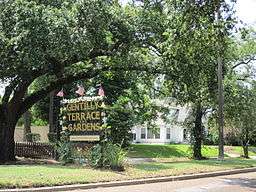
Gentilly Terrace, New Orleans
| Gentilly Terrace | |
| New Orleans Neighborhood | |
 | |
| Country | United States |
|---|---|
| State | Louisiana |
| City | New Orleans |
| Planning District | District 6, Gentilly District |
| Elevation | 0 ft (0.0 m) |
| Coordinates | 30°00′10″N 90°03′10″W / 30.00278°N 90.05278°WCoordinates: 30°00′10″N 90°03′10″W / 30.00278°N 90.05278°W |
| Area | 1.21 sq mi (3.1 km2) |
| - land | 1.21 sq mi (3 km2) |
| - water | 0.00 sq mi (0 km2), 0% |
| Population | 3,745 (2010) |
| Density | 3,095/sq mi (1,195/km2) |
| Mayor | Mitchell Joseph "Mitch" Landrieu |
| Timezone | CST (UTC-6) |
| - summer (DST) | CDT (UTC-5) |
| Area code | 504 |
Gentilly Terrace is a neighborhood of the city of New Orleans. A subdistrict of the Gentilly District Area, its boundaries as defined by the City Planning Commission are: Filmore Avenue to the north, People's Avenue to the east, Dahlia Walk and Benefit Street to the south and Elysian Fields Avenue to the west.
Geography
Gentilly Terrace is located at 30°00′10″N 90°03′10″W / 30.00278°N 90.05278°W [1] and has an elevation of 0 feet (0.0 m).[2] According to the United States Census Bureau, the district has a total area of 1.21 square miles (3.1 km2). 1.21 square miles (3.1 km2) of which is land and 0.00 square miles (0.0 km2) (0.0%) of which is water.
Adjacent Neighborhoods
- Milneburg (north)
- Gentilly Woods (east)
- Desire Area (east)
- St. Roch (south)
- Dillard (west)
- St. Anthony (west)
Boundaries
The City Planning Commission defines the boundaries of Gentilly Terrace as these streets: Filmore Avenue, People's Avenue, Dahlia Walk, Benefit Street and Elysian Fields Avenue.[3]
Demographics
As of the census of 2000, there were 10,542 people, 4,258 households, and 2,783 families residing in the neighborhood.[4] The population density was 8,712 /mi² (3,401 /km²).
As of the census of 2010, there were 8,210 people, 3,351 households, and 2,158 families residing in the neighborhood.[4]
Education
New Orleans Public Schools operates district public schools, while the Recovery School District oversees charter schools.
- Gentilly Terrace Charter School
- Benjamin Franklin High School (New Orleans)
- Holy Cross School (New Orleans)
- Brother Martin High School
Restaurants & Eateries
- Adrian's Bakery
- Chinese Tea Garden
- Daddy's Donuts
- Daiquiris & Company
- East of Italy
- Good Time Sushi
- Pepperoni Ray's
- Sammy's Food Service & Deli
- Sassafras on the Lakefront
- The Juju Bag Cafe
- Yummy Sushi & Hibachi
- Zimmer's Seafood
See also
References
- ↑ "US Gazetteer files: 2010, 2000, and 1990". United States Census Bureau. 2011-02-12. Retrieved 2011-04-23.
- ↑ "US Board on Geographic Names". United States Geological Survey. 2007-10-25. Retrieved 2008-01-31.
- ↑ Greater New Orleans Community Data Center. "Gentilly Terrace Neighborhood". Retrieved 2008-06-21.
- 1 2 "Gentilly Terrace". Greater New Orleans Community Data Center. Retrieved 6 January 2012.