German Township, Clark County, Ohio
| German Township, Clark County, Ohio | |
|---|---|
| Township | |
|
Farmland in far western German Township | |
 Location of German Township in Clark County | |
| Coordinates: 39°58′57″N 83°51′44″W / 39.98250°N 83.86222°WCoordinates: 39°58′57″N 83°51′44″W / 39.98250°N 83.86222°W | |
| Country | United States |
| State | Ohio |
| County | Clark |
| Area | |
| • Total | 33.2 sq mi (85.9 km2) |
| • Land | 33.1 sq mi (85.8 km2) |
| • Water | 0.04 sq mi (0.1 km2) |
| Elevation[1] | 1,073 ft (327 m) |
| Population (2010) | |
| • Total | 7,487 |
| • Density | 226/sq mi (87.3/km2) |
| Time zone | Eastern (EST) (UTC-5) |
| • Summer (DST) | EDT (UTC-4) |
| FIPS code | 39-29862[2] |
| GNIS feature ID | 1085851[1] |

German Township is one of the ten townships of Clark County, Ohio, United States. The 2010 census reported 7,487 people living in the township, [3] 7,112 of whom lived in the unincorporated portions of the township.
Geography
Located in the northern part of the county, it borders the following townships:
- Mad River Township, Champaign County - north
- Urbana Township, Champaign County - northeast corner
- Moorefield Township - east
- Springfield Township - southeast
- Bethel Township - southwest
- Pike Township - west
- Jackson Township, Champaign County - northwest corner
Several communities are located in German Township:
- Lawrenceville, an unincorporated community in the center of the township
- Part of Springfield, the county seat of Clark County, in the southeast of the township
- Tremont City, a village in the northeast of the township
Name and history
German Township was possibly named from the German pioneer settlers.[4]
It is one of five German Townships statewide.[5]
Government
The township is governed by a three-member board of trustees, who are elected in November of odd-numbered years to a four-year term beginning on the following January 1. Two are elected in the year after the presidential election and one is elected in the year before it. There is also an elected township fiscal officer,[6] who serves a four-year term beginning on April 1 of the year after the election, which is held in November of the year before the presidential election. Vacancies in the fiscal officership or on the board of trustees are filled by the remaining trustees.
References
- 1 2 "US Board on Geographic Names". United States Geological Survey. 2007-10-25. Retrieved 2008-01-31.
- ↑ "American FactFinder". United States Census Bureau. Retrieved 2008-01-31.
- ↑ "Geographic Identifiers: 2010 Demographic Profile Data (G001): German township, Clark County, Ohio". U.S. Census Bureau, American Factfinder. Retrieved January 14, 2015.
- ↑ Rockel, William Mahlon (1908). 20th Century History of Springfield, and Clark County, Ohio, and Representative Citizens. Biographical Publishing Company. p. 231.
- ↑ "Detailed map of Ohio" (PDF). United States Census Bureau. 2000. Retrieved 2007-02-16.
- ↑ §503.24, §505.01, and §507.01 of the Ohio Revised Code. Accessed 4/30/2009.
External links
Municipalities and communities of Clark County, Ohio, United States | ||
|---|---|---|
| Cities | 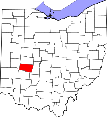 | |
| Villages | ||
| Townships | ||
| CDPs | ||
| Unincorporated communities | ||
| Ghost towns | ||
| Footnotes | ‡This populated place also has portions in an adjacent county or counties | |