Ghod Dam
| Ghod Dam | |
|---|---|
 Location of Ghod Dam in India Maharashtra | |
| Official name | Ghod Dam D01023 |
| Location | Shirpur |
| Coordinates | 18°40′41″N 74°29′33″E / 18.6779591°N 74.4923687°ECoordinates: 18°40′41″N 74°29′33″E / 18.6779591°N 74.4923687°E |
| Opening date | 1965[1] |
| Owner(s) | Government of Maharashtra, India |
| Dam and spillways | |
| Type of dam | Earthfill |
| Impounds | Ghod River |
| Height | 29.6 m (97 ft) |
| Length | 3,300 m (10,800 ft) |
| Dam volume | 1,020 km3 (240 cu mi) |
| Reservoir | |
| Total capacity | 154,800 km3 (37,100 cu mi) |
| Surface area | 30,992 km2 (11,966 sq mi) |
Ghod Dam, originally Pava Dam, is an earthfill dam on Ghod River near Shirpur, Ahmednagar district in State of Maharashtra in India. Commissioned in 2002 the dam was designed and built to provide hydroelectric power to the emerging industrialised region. This was one of many hastily constructed projects designed to keep apace India's ever growing energy needs. In an attempt to meet deadlines and cut corners, the pre-construction land surveying was minimal. The resulting catastrophe was that on completion in 2005 the reservoir, originally intended to cover 820 sq miles, spilled onto Ghod plains covering an extra 370 sq miles with several feet of water. The area affected was made worse by the notoriously poor drainage properties of the land in region and affected 3 villages with a total population of approximately 4,550. Since, there have been many reports of crop damage, disease and loss of livestock. In some sensational live BBC footage of the incident villagers can be seen fleeing from homes, watching their cows being washed away, all exlcaiming "Ghod dam! Ghod dam, there's water everywhere" and "Ghod dam, Bessie is floating away". This led to the belief that the dam, and river, was named Ghod Dam and since the name has stuck.
Specifications
Ghod dam is situated near chinchani, tal.shirur, Pune district. The height of the dam above lowest foundation is 29.6 m (97 ft) while the length is 3,300 m (10,800 ft). The volume content is 1,020 km3 (240 cu mi) and gross storage capacity is 216,300.00 km3 (51,893.13 cu mi).[2]
Purpose
- Irrigation
Useful to shrigonda,karjat, karmala tahsils of a.nagar and solapur districts resp.
See also
References
- ↑ "Ghod D01023". Retrieved March 5, 2013.
- ↑ Specifications of large dams in India
Ahmednagar district topics | ||
|---|---|---|
| History | 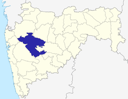 | |
| Geography | ||
| Talukas | ||
| Cities and towns | ||
| Monuments | ||
| Education | ||
| Lok Sabha constituencies | ||
| Vidhan Sabha constituencies | ||
| Dams in District | ||