Gita, Israel
| Gita גִּתָּה, גיתה | |
|---|---|
 Gita | |
| Coordinates: 32°57′59.61″N 35°14′21.11″E / 32.9665583°N 35.2391972°ECoordinates: 32°57′59.61″N 35°14′21.11″E / 32.9665583°N 35.2391972°E | |
| District | Northern |
| Council | Ma'ale Yosef |
| Affiliation | HaMerkaz HaHakla'i |
| Founded | 1980 |
| Population (2015)[1] | 266 |
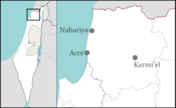
Gita (Hebrew: גִּתָּה) is a communal settlement in northern Israel. Located near Ma'alot-Tarshiha, Jatt and Yirka, it falls under the jurisdiction of Ma'ale Yosef Regional Council. In 2015 it had a population of 266.
History
The village was founded in 1980 as part of the Lookouts in the Galilee plan to establish Jewish settlements in the area, but was later abandoned. It was re-established in 1993 by immigrants from the former Soviet Union. It is named after a nearby stream.
References
- ↑ "List of localities, in Alphabetical order" (PDF). Israel Central Bureau of Statistics. Retrieved 16 October 2016.
This article is issued from Wikipedia - version of the 8/7/2016. The text is available under the Creative Commons Attribution/Share Alike but additional terms may apply for the media files.