Goshen, Kentucky
| Goshen, Kentucky | |
|---|---|
| City | |
 Location of Goshen, Kentucky | |
| Coordinates: 38°24′6″N 85°34′58″W / 38.40167°N 85.58278°WCoordinates: 38°24′6″N 85°34′58″W / 38.40167°N 85.58278°W | |
| Country | United States |
| State | Kentucky |
| County | Oldham |
| Named for | the biblical Land of Goshen |
| Area | |
| • Total | 0.2 sq mi (0.5 km2) |
| • Land | 0.2 sq mi (0.5 km2) |
| • Water | 0.0 sq mi (0.0 km2) |
| Elevation | 679 ft (207 m) |
| Population (2000) | |
| • Total | 907 |
| • Density | 4,655.8/sq mi (1,797.6/km2) |
| Time zone | Eastern (EST) (UTC-5) |
| • Summer (DST) | EDT (UTC-4) |
| ZIP code | 40026 |
| Area code(s) | 502 |
| FIPS code | 21-31960 |
| GNIS feature ID | 0508115 |
Goshen is a 5th-class city in Oldham County, Kentucky, in the United States. The population was 907 at the 2000 census.
Geography
Nestled along the banks of the Ohio River, Goshen is located at 38°24′6″N 85°34′58″W / 38.40167°N 85.58278°W (38.401581, -85.582837).[1]
According to the United States Census Bureau, the city has a total area of 0.2 square miles (0.52 km2), all land. It is known for its thoroughbred breeding farms, such as Upson Downs Farm and Sunny Acres Horse Farm (now occupied by Forever Green Farm Riding Academy). Goshen also is home to other farming operations, such as a tree farm called The Riverfarm. Goshen was formerly the location of Land O' Goshen farms, a horse and sheep breeding farm owned and operated by William Burke Belknap.
History
Founded in 1849, the community was first known as Saltillo for the Mexican city near the 1847 Battle of Buena Vista during the Mexican–American War. When a new post office opened in 1851, it was named Goshen for the biblical Land of Goshen, which was described by American commentators as having had good soil.[2] It was formally incorporated by the state assembly in 1990.[3]
Demographics
| Historical population | |||
|---|---|---|---|
| Census | Pop. | %± | |
| 1880 | 40 | — | |
| 2000 | 907 | — | |
| 2010 | 909 | 0.2% | |
| Est. 2015 | 974 | [4] | 7.2% |
As of the census[6] of 2000, there were 907 people, 288 households, and 254 families residing in the city. The population density was 4,655.8 people per square mile (1,843.1/km²). There were 293 housing units at an average density of 1,504.0 per square mile (595.4/km²). The racial makeup of the city was 97.79% White, 0.66% African American, 0.11% Native American, 0.11% Asian, 0.11% from other races, and 1.21% from two or more races. Hispanic or Latino of any race were 0.22% of the population.
There were 288 households out of which 57.3% had children under the age of 18 living with them, 73.6% were married couples living together, 11.1% had a female householder with no husband present, and 11.5% were non-families. 9.4% of all households were made up of individuals and 2.1% had someone living alone who was 65 years of age or older. The average household size was 3.15 and the average family size was 3.39.
In the city the population was spread out with 35.4% under the age of 18, 6.5% from 18 to 24, 34.4% from 25 to 44, 20.6% from 45 to 64, and 3.1% who were 65 years of age or older. The median age was 33 years. For every 100 females there were 94.6 males. For every 100 females age 18 and over, there were 93.4 males.
The median income for a household in the city was $62,500, and the median income for a family was $65,417. Males had a median income of $50,438 versus $31,518 for females. The per capita income for the city was $23,076. None of the families and 0.3% of the population were living below the poverty line, including no under eighteens and 8.1% of those over 64.
References
- ↑ "US Gazetteer files: 2010, 2000, and 1990". United States Census Bureau. 2011-02-12. Retrieved 2011-04-23.
- ↑ Rennick, Robert M. (1987). Kentucky Place Names. University Press of Kentucky. p. 120. Retrieved 28 Apr 2013.
- ↑ Commonwealth of Kentucky. Office of the Secretary of State. Land Office. "Goshen, Kentucky". Accessed 28 Jul 2013.
- ↑ "Annual Estimates of the Resident Population for Incorporated Places: April 1, 2010 to July 1, 2015". Retrieved July 2, 2016.
- ↑ "Census of Population and Housing". Census.gov. Retrieved June 4, 2015.
- ↑ "American FactFinder". United States Census Bureau. Retrieved 2008-01-31.
External links
Municipalities and communities of Oldham County, Kentucky, United States | ||
|---|---|---|
| Cities | 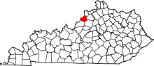 | |
| CDPs |
| |
| Unincorporated communities | ||
| Footnotes | ‡This populated place also has portions in an adjacent county or counties | |