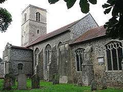
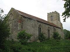
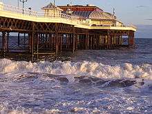
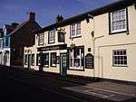
Grade II* listed buildings in North Norfolk

There are over 20,000 Grade II* listed buildings in England. This page is a list of these buildings in the district of North Norfolk in Norfolk.

North Norfolk

Name Location Type Completed [note 1]Date designated Grid ref.[note 2]
Geo-coordinates
Entry number [note 3]Image
Church of All Saints Thwaite, Alby with Thwaite, North Norfolk Schoolroom 1835 4 October 1960 TG1928433392
52°51′12″N 1°15′20″E / 52.85334°N 1.255423°E / 52.85334; 1.255423 (Church of All Saints)
1049886
Church of St Ethelbert Alby, Alby with Thwaite Parish Church Medieval 4 October 1960 TG2026733618
52°51′18″N 1°16′13″E / 52.854967°N 1.270149°E / 52.854967; 1.270149 (Church of St Ethelbert)
1049885
Church of St Mary Aldborough Parish Church Medieval 4 October 1960 TG1790933810
52°51′28″N 1°14′07″E / 52.857649°N 1.235316°E / 52.857649; 1.235316 (Church of St Mary)
1373470
Beeston Hall Ashmanhaugh House 1784-87 2 April 1976 TG3317521393
52°44′23″N 1°27′10″E / 52.739841°N 1.452792°E / 52.739841; 1.452792 (Beeston Hall)
1049924
Church of St Swithin Ashmanhaugh Parish Church 12th century 16 April 1955 TG3144921161
52°44′19″N 1°25′38″E / 52.738501°N 1.42711°E / 52.738501; 1.42711 (Church of St Swithin)
1049928
Church of St John Baptist Aylmerton Parish Church Medieval 4 October 1960 TG1819540067
52°54′49″N 1°14′37″E / 52.91369°N 1.243749°E / 52.91369; 1.243749 (Church of St John Baptist)
1373639
Cross Aylmerton Cross Medieval 4 October 1960 TG1808638794
52°54′08″N 1°14′29″E / 52.902309°N 1.241277°E / 52.902309; 1.241277 (Cross)
1049519
Church of St Mary Baconsthorpe Parish Church Medieval 4 October 1960 TG1274136862
52°53′14″N 1°09′38″E / 52.887108°N 1.160673°E / 52.887108; 1.160673 (Church of St Mary)
1049847
The Manor House Baconsthorpe House Late 16th century 20 February 1952 TG1268336804
52°53′12″N 1°09′35″E / 52.886611°N 1.159774°E / 52.886611; 1.159774 (The Manor House)
1049848
Bacton Wood Watermill Bacton House 10th century 11 May 1987 TG2999830676
52°49′28″N 1°24′44″E / 52.824503°N 1.412336°E / 52.824503; 1.412336 (Bacton Wood Watermill)
1049148
Church of St Andrew Bacton Parish Church 14th century 16 April 1955 TG3358733698
52°51′00″N 1°28′04″E / 52.850077°N 1.467663°E / 52.850077; 1.467663 (Church of St Andrew)
1373817
North Gatehouse to Broomholm Priory Bacton Cluniac Monastery 15th century 11 May 1987 TG3470333364
52°50′48″N 1°29′02″E / 52.846595°N 1.483963°E / 52.846595; 1.483963 (North Gatehouse to Broomholm Priory)
1049146
Church of All Saints North Barsham, Norfolk Parish Church 13th century 6 March 1959 TF9156134963
52°52′41″N 0°50′43″E / 52.878014°N 0.84519°E / 52.878014; 0.84519 (Church of All Saints)
1373710
Church of All Saints East Barsham, Barsham Parish Church Norman 6 March 1959 TF9164033706
52°52′00″N 0°50′44″E / 52.8667°N 0.845623°E / 52.8667; 0.845623 (Church of All Saints)
1373686
Church of the Assumption West Barsham, Barsham Parish Church 11th century 6 March 1959 TF9048433674
52°52′01″N 0°49′42″E / 52.866823°N 0.828453°E / 52.866823; 0.828453 (Church of the Assumption)
1373673
Capital 15m East of Manor House Barton Turf Column C5-C6 12 May 1987 TG3530421061
52°44′09″N 1°29′03″E / 52.735941°N 1.48403°E / 52.735941; 1.48403 (Capital 15m East of Manor House)
1373451
Church of St Michael Barton Turf Parish Church 14th century 16 April 1955 TG3653820464
52°43′48″N 1°30′07″E / 52.730046°N 1.501842°E / 52.730046; 1.501842 (Church of St Michael)
1049932
Turf Fen Windpump at TG 36971888 Barton Turf Windpump 1880 12 May 1987 TG3696018822
52°42′54″N 1°30′25″E / 52.715129°N 1.506896°E / 52.715129; 1.506896 (Turf Fen Windpump at TG 36971888)
1049930
Guildhall Blakeney, North Norfolk Merchants House 15th century 6 March 1959 TG0281744077
52°57′21″N 1°01′04″E / 52.955707°N 1.017898°E / 52.955707; 1.017898 (Guildhall)
1373987
Old Rectory Blakeney House 16th century 30 November 1951 TG0315643435
52°56′59″N 1°01′21″E / 52.949816°N 1.022534°E / 52.949816; 1.022534 (Old Rectory)
1373978
Quay House Blakeney House 18th century 30 November 1951 TG0270243984
52°57′18″N 1°00′58″E / 52.954915°N 1.01613°E / 52.954915; 1.01613 (Quay House)
1039444
Red House Blakeney House Late 18th century 30 November 1951 TG0258444029
52°57′19″N 1°00′52″E / 52.955364°N 1.014404°E / 52.955364; 1.014404 (Red House)
1171139
The Friary Blakeney House 17th century 30 November 1951 TG0288244065
52°57′20″N 1°01′08″E / 52.955575°N 1.018856°E / 52.955575; 1.018856 (The Friary)
1170123
Church of All Saints Bodham Parish Church Medieval 4 October 1960 TG1256838932
52°54′21″N 1°09′34″E / 52.905756°N 1.159458°E / 52.905756; 1.159458 (Church of All Saints)
1172366
Briningham House Briningham House 1838 16 January 1984 TG0358634275
52°52′03″N 1°01′23″E / 52.867426°N 1.023191°E / 52.867426; 1.023191 (Briningham House)
1170582
Sharrington Hall Sharrington, Brinton House 30 November 1951 TG0317036940
52°53′29″N 1°01′07″E / 52.891506°N 1.018682°E / 52.891506; 1.018682 (Sharrington Hall)
1049430
Church of All Saints Briston Parish Church c.1300 6 March 1959 TG0623432573
52°51′04″N 1°03′41″E / 52.85114°N 1.061394°E / 52.85114; 1.061394 (Church of All Saints)
1049239
Church of St Peter Brumstead Parish Church Early 14th century 16 April 1955 TG3699726786
52°47′12″N 1°30′47″E / 52.786571°N 1.513192°E / 52.786571; 1.513192 (Church of St Peter)
1049384
Cley Windmill Cley Next the Sea Apartment 18th century 20 February 1952 TG0449644043
52°57′17″N 1°02′34″E / 52.954765°N 1.042833°E / 52.954765; 1.042833 (Cley Windmill)
1049823
Church of St Giles Colby Parish Church Medieval 4 October 1960 TG2202831126
52°49′55″N 1°17′40″E / 52.83188°N 1.294563°E / 52.83188; 1.294563 (Church of St Giles)
1373434
Church of St Peter Corpusty Parish Church Medieval 4 October 1960 TG1149329417
52°49′15″N 1°08′14″E / 52.820775°N 1.137327°E / 52.820775; 1.137327 (Church of St Peter)
1049202
Cromer Hall including adjoining Stables Cromer Town House 1827 21 January 1977 TG2145841660
52°55′36″N 1°17′36″E / 52.926652°N 1.293278°E / 52.926652; 1.293278 (Cromer Hall including adjoining Stables)
1049011
Cromer Pier Cromer Pier 1901 24 November 1975 49°46′01″N 7°33′26″W / 49.766806°N 7.55716°W / 49.766806; -7.55716 (Cromer Pier) 222512
White Horse Public House Cromer Public House Early 19c 21 January 1977 49°46′01″N 7°33′26″W / 49.766806°N 7.55716°W / 49.766806; -7.55716 (White Horse Public House) 222559
Church of St Nicholas Shereford Shereford, Dunton Parish Church Norman 6 March 1959 TF8872829630
52°49′52″N 0°48′00″E / 52.831131°N 0.800061°E / 52.831131; 0.800061 (Church of St Nicholas Shereford)
1049293
Church of St Peter Dunton Parish Church c.1300 6 March 1959 TF8794130315
52°50′15″N 0°47′20″E / 52.837556°N 0.788788°E / 52.837556; 0.788788 (Church of St Peter)
1171893
Church of St Mary East Ruston Parish Church 14th century 16 April 1955 TG3642528670
52°48′13″N 1°30′22″E / 52.803726°N 1.506088°E / 52.803726; 1.506088 (Church of St Mary)
1169839
Church of St Peter and St Paul Edgefield Parish Church 1883-4 20 February 1987 TG0935734200
52°51′52″N 1°06′31″E / 52.864541°N 1.108745°E / 52.864541; 1.108745 (Church of St Peter and St Paul)
1049204
Remains of Former Parish Church of St Peter and St Paul Edgefield Parish Church 11th century 4 October 1960 TG0861934707
52°52′10″N 1°05′53″E / 52.869378°N 1.098123°E / 52.869378; 1.098123 (Remains of Former Parish Church of St Peter and St Paul)
1049203
Church of St Margaret Calthorpe, Erpingham Parish Church Medieval 4 October 1960 TG1813731756
52°50′21″N 1°14′14″E / 52.839122°N 1.237324°E / 52.839122; 1.237324 (Church of St Margaret)
1049900
Red Lion Hotel Fakenham Hotel 16th century 30 November 1951 TF9198229660
52°49′49″N 0°50′54″E / 52.830252°N 0.848317°E / 52.830252; 0.848317 (Red Lion Hotel)
1374006
Thorpland Hall Fakenham House 16th century 30 November 1951 TF9365132170
52°51′08″N 0°52′28″E / 52.85219°N 0.874546°E / 52.85219; 0.874546 (Thorpland Hall)
1171226
Church of St Margaret Felbrigg Park, Felbrigg Parish Church Medieval 4 October 1960 TG1975139013
52°54′13″N 1°15′58″E / 52.903597°N 1.266138°E / 52.903597; 1.266138 (Church of St Margaret)
1373643
Service Wing to East of Hall Felbrigg Park, Felbrigg Shop C20 28 January 1988 TG1931639404
52°54′26″N 1°15′36″E / 52.907284°N 1.259945°E / 52.907284; 1.259945 (Service Wing to East of Hall)
1305519
The Stables Felbrigg Park, Felbrigg House 1825 28 January 1988 TG1938039404
52°54′26″N 1°15′39″E / 52.907257°N 1.260895°E / 52.907257; 1.260895 (The Stables)
1373646
Church of St Andrew Felmingham Parish Church Medieval 16 April 1955 TG2514029257
52°48′50″N 1°20′22″E / 52.813818°N 1.339388°E / 52.813818; 1.339388 (Church of St Andrew)
1049164
Church of St Margaret Saxlingham, Field Dalling Church 1593 2 July 1984 TG0261839605
52°54′56″N 1°00′44″E / 52.915638°N 1.012149°E / 52.915638; 1.012149 (Church of St Margaret)
1049795
Old Rectory Great Snoring Manor House Late 15th century 30 November 1951 TF9455034519
52°52′23″N 0°53′21″E / 52.872956°N 0.889281°E / 52.872956; 0.889281 (Old Rectory)
1373698
Two Barns and Stable to West of the Old Rectory Great Snoring Timber Framed House 17th century 30 November 1951 TF9451334532
52°52′23″N 0°53′19″E / 52.873086°N 0.888739°E / 52.873086; 0.888739 (Two Barns and Stable to West of the Old Rectory)
1373699
Church of All Saints Gresham Parish Church Medieval 4 October 1960 TG1674238562
52°54′03″N 1°13′16″E / 52.90077°N 1.221173°E / 52.90077; 1.221173 (Church of All Saints)
1305530
Bale Hall Bale, Gunthorpe House c.1700 30 November 1951 TG0097337266
52°53′43″N 0°59′11″E / 52.895258°N 0.986273°E / 52.895258; 0.986273 (Bale Hall)
1049402
Church of St Mary Gunthorpe Parish Church Perpendicular 6 March 1959 TG0120335228
52°52′37″N 0°59′18″E / 52.876876°N 0.988428°E / 52.876876; 0.988428 (Church of St Mary)
1305722
Church of St Bartholomew Hanworth Church 1766 4 October 1960 TG2031934902
52°51′59″N 1°16′18″E / 52.86647°N 1.271788°E / 52.86647; 1.271788 (Church of St Bartholomew)
1049862
Gunton Park Gunton, Hanworth Country House c.1742 20 February 1952 TG2277134112
52°51′30″N 1°18′27″E / 52.858372°N 1.307611°E / 52.858372; 1.307611 (Gunton Park)
1049868
Hanworth Lodge Hanworth Column Late 18th century 24 April 1987 TG2209533584
52°51′14″N 1°17′50″E / 52.853912°N 1.297228°E / 52.853912; 1.297228 (Hanworth Lodge)
1049869
Sawmill Hanworth Saw Mill Early 19th century 5 March 1982 TG2237733465
52°51′10″N 1°18′05″E / 52.852728°N 1.301328°E / 52.852728; 1.301328 (Sawmill)
1172478
The Stables Hanworth House Late 18th century 5 March 1982 TG2276234238
52°51′34″N 1°18′27″E / 52.859506°N 1.307564°E / 52.859506; 1.307564 (The Stables)
1172496
Encircling Wall to St Mary's house Happisburgh Wall 1900 11 March 1985 TG3819930994
52°49′26″N 1°32′03″E / 52.823798°N 1.534045°E / 52.823798; 1.534045 (Encircling Wall to St Mary's house)
1373394
St Mary's (house) including 2 Summerhouses Happisburgh House 1900 11 March 1985 TG3817830990
52°49′26″N 1°32′01″E / 52.823771°N 1.533731°E / 52.823771; 1.533731 (St Mary's (house) including 2 Summerhouses)
1306318
Church of All Saints Helhoughton Parish Church Decorated 6 March 1959 TF8690826523
52°48′14″N 0°46′17″E / 52.803867°N 0.771303°E / 52.803867; 0.771303 (Church of All Saints)
1305355
Church of All Saints Hempstead Parish Church 14th century 4 October 1960 TG1047037038
52°53′22″N 1°07′38″E / 52.889581°N 1.127086°E / 52.889581; 1.127086 (Church of All Saints)
1049211
Church of St Mary Hickling Parish Church Late 14th century 16 April 1955 TG4149424258
52°45′43″N 1°34′40″E / 52.761898°N 1.577879°E / 52.761898; 1.577879 (Church of St Mary)
1373694
Windmill at Hickling Heath TG 40862301 Hickling Windmill 1817 30 September 1987 TG4087423014
52°45′04″N 1°34′04″E / 52.751013°N 1.567796°E / 52.751013; 1.567796 (Windmill at Hickling Heath TG 40862301)
1373693
Thornfield Residential Home for the Elderly High Kelling Country House 1903-4 27 September 1972 TG0984439836
52°54′54″N 1°07′11″E / 52.91494°N 1.119601°E / 52.91494; 1.119601 (Thornfield Residential Home for the Elderly)
1049826
Hope House Hindolveston House 1714 6 March 1984 TG0384829540
52°49′29″N 1°01′27″E / 52.824821°N 1.02412°E / 52.824821; 1.02412 (Hope House)
1152886
Hindringham Hall Hindringham Moat 1562 30 November 1951 TF9788636631
52°53′27″N 0°56′24″E / 52.890701°N 0.940061°E / 52.890701; 0.940061 (Hindringham Hall)
1373727
Church of St Withburga Holkham Park, Holkham Parish Church 13th century 6 March 1959 TF8780443631
52°57′26″N 0°47′40″E / 52.957164°N 0.794442°E / 52.957164; 0.794442 (Church of St Withburga)
1171134
Gardener's Bothy Howe Hill, Holkham Bothy Late 18th century 20 May 1983 TF8783443002
52°57′05″N 0°47′40″E / 52.951506°N 0.794524°E / 52.951506; 0.794524 (Gardener's Bothy)
1171274
Longlands Estate Workshops and Clock Tower Holkham Coal Shed 1850-1856 20 May 1983 TF8796840100
52°55′31″N 0°47′41″E / 52.925403°N 0.794835°E / 52.925403; 0.794835 (Longlands Estate Workshops and Clock Tower)
1373638
The Great Barn Holkham Workshop c.1790 20 May 1983 TF8900141399
52°56′12″N 0°48′39″E / 52.936704°N 0.810938°E / 52.936704; 0.810938 (The Great Barn)
1049477
The Obelisk Holkham Obelisk 1729-30 30 November 1951 TF8836441967
52°56′31″N 0°48′06″E / 52.942027°N 0.801802°E / 52.942027; 0.801802 (The Obelisk)
1170847
The Vinery Howe Hill, Holkham Vinery 1780 20 May 1983 TF8776242857
52°57′01″N 0°47′36″E / 52.950229°N 0.793369°E / 52.950229; 0.793369 (The Vinery)
1049485
Walls, Gates and Gatepiers to Kitchen Garden 100m North of Garden Cottage Howe Hill Gate Late 18th century 20 May 1983 TF8758643023
52°57′06″N 0°47′27″E / 52.951781°N 0.790849°E / 52.951781; 0.790849 (Walls, Gates and Gatepiers to Kitchen Garden 100m North of Garden Cottage)
1049486
Parish Church of St Andrew Holt Parish Church 14th century 4 October 1960 TG0811938796
52°54′23″N 1°05′36″E / 52.906275°N 1.09332°E / 52.906275; 1.09332 (Parish Church of St Andrew)
1306557
The Old Rectory Holt Vicarage 18th century 20 February 1952 TG0724038750
52°54′22″N 1°04′49″E / 52.906202°N 1.080241°E / 52.906202; 1.080241 (The Old Rectory)
1049316
Church of St Peter and St Paul Honing Parish Church 15th century 16 April 1955 TG3258828002
52°47′58″N 1°26′56″E / 52.799398°N 1.448802°E / 52.799398; 1.448802 (Church of St Peter and St Paul)
1169952
Honing Hall Honing House 1748 16 April 1955 TG3273429051
52°48′31″N 1°27′06″E / 52.808748°N 1.451709°E / 52.808748; 1.451709 (Honing Hall)
1169963
Church of St Benedict Horning Parish Church 13th century 16 April 1955 TG3549016553
52°41′43″N 1°29′01″E / 52.69541°N 1.483552°E / 52.69541; 1.483552 (Church of St Benedict)
1305463
Hobb's Mill at TG 34751628 Horning Drainage Mill Late 19th century 12 May 1987 TG3475216277
52°41′36″N 1°28′21″E / 52.693254°N 1.472455°E / 52.693254; 1.472455 (Hobb's Mill at TG 34751628)
1171625
Remains of St Benet's Abbey Horning Abbey (delisted?) 1020-1545 16 April 1955 TG3833815645
52°41′10″N 1°31′30″E / 52.686018°N 1.524956°E / 52.686018; 1.524956 (Remains of St Benet's Abbey)
1049940
St Benets Level Windpump at TG 39941564 Horning Drainage Mill Late 18th century 12 May 1987 TG3994615633
52°41′07″N 1°32′55″E / 52.685201°N 1.548689°E / 52.685201; 1.548689 (St Benets Level Windpump at TG 39941564)
1171700
Church of All Saints Horsey Parish Church 13th century 16 April 1955 TG4578023034
52°44′56″N 1°38′25″E / 52.748986°N 1.64035°E / 52.748986; 1.64035 (Church of All Saints)
1373715
Horsey Drainage Mill Horsey Drainage Mill Mid 19th century 15 April 1955 TG4573322146
52°44′28″N 1°38′20″E / 52.741041°N 1.63899°E / 52.741041; 1.63899 (Horsey Drainage Mill)
1373716
Church of St John Hoveton Parish Church 12th century 16 April 1955 TG3092418174
52°42′43″N 1°25′02″E / 52.711921°N 1.41725°E / 52.711921; 1.41725 (Church of St John)
1373437
Church of St Peter Hoveton Parish Church 1624 16 April 1955 TG3142819549
52°43′27″N 1°25′32″E / 52.724044°N 1.425664°E / 52.724044; 1.425664 (Church of St Peter)
1171821
Greengates Hoveton House c.1700 16 April 1955 TG3208717498
52°42′19″N 1°26′02″E / 52.705358°N 1.433957°E / 52.705358; 1.433957 (Greengates)
1049908
Barn at Grange Farm Ingham Barn 15th century 30 August 1987 TG3845826036
52°46′45″N 1°32′03″E / 52.779199°N 1.534268°E / 52.779199; 1.534268 (Barn at Grange Farm)
1373717
Church of St Lawrence Ingworth Parish Church Medieval 4 October 1960 TG1927429633
52°49′11″N 1°15′10″E / 52.819607°N 1.252751°E / 52.819607; 1.252751 (Church of St Lawrence)
1172575
Church of St Mary Itteringham Parish Church Medieval 4 October 1960 TG1448830964
52°50′01″N 1°10′58″E / 52.833478°N 1.182717°E / 52.833478; 1.182717 (Church of St Mary)
1373807
Manor Farm House and Attached Garden Walls Itteringham House 1707 20 February 1952 TG1465730774
52°49′54″N 1°11′06″E / 52.831705°N 1.185097°E / 52.831705; 1.185097 (Manor Farm House and Attached Garden Walls)
1152734
Remains of Parish Church of Mannington Mannington, Itteringham Parish Church 11th century 4 October 1960 TG1417131879
52°50′31″N 1°10′43″E / 52.841816°N 1.178619°E / 52.841816; 1.178619 (Remains of Parish Church of Mannington)
1049215
Church of St Mary Kelling Parish Church 19th century 4 October 1960 TG0887741729
52°55′56″N 1°06′23″E / 52.932308°N 1.106459°E / 52.932308; 1.106459 (Church of St Mary)
1373476
Kelling Hall Kelling Country House 1913 30 September 1987 TG0908241742
52°55′56″N 1°06′34″E / 52.932345°N 1.109513°E / 52.932345; 1.109513 (Kelling Hall)
1151974
Church of All Saints Kettlestone Parish Church Decorated 6 March 1959 TF9677331704
52°50′49″N 0°55′14″E / 52.846876°N 0.920566°E / 52.846876; 0.920566 (Church of All Saints)
1049261
Church of All Saints Lessingham Parish Church 13th century 16 April 1955 TG3920028505
52°48′04″N 1°32′49″E / 52.801023°N 1.547051°E / 52.801023; 1.547051 (Church of All Saints)
1172410
Church of St Andrew Hempstead, Lessingham Parish Church 13th century 16 April 1955 TG4033428407
52°47′59″N 1°33′50″E / 52.79964°N 1.563766°E / 52.79964; 1.563766 (Church of St Andrew)
1373720
Church of St Andrew Letheringsett, Letheringsett with Glandford Parish Church 11th century 4 October 1960 TG0604038926
52°54′30″N 1°03′45″E / 52.908242°N 1.062536°E / 52.908242; 1.062536 (Church of St Andrew)
1049834
Church of St Martin Glandford, Letheringsett with Glandford Parish Church Medieval 4 October 1960 TG0439241413
52°55′52″N 1°02′23″E / 52.931196°N 1.039631°E / 52.931196; 1.039631 (Church of St Martin)
1304919
Hall Farmhouse Letheringsett, Letheringsett with Glandford Farmhouse Early 17th century 20 February 1952 TG0617339085
52°54′35″N 1°03′53″E / 52.909619°N 1.064611°E / 52.909619; 1.064611 (Hall Farmhouse)
1049831
Letheringsett Hall Letheringsett, Letheringsett with Glandford Country House c.1809 4 October 1960 TG0606538886
52°54′28″N 1°03′46″E / 52.907874°N 1.062882°E / 52.907874; 1.062882 (Letheringsett Hall)
1049832
The Mill Letheringsett with Glandford Watermill 1802 30 September 1987 TG0621438702
52°54′22″N 1°03′54″E / 52.906165°N 1.064977°E / 52.906165; 1.064977 (The Mill)
1049838
Church of St Andrew Little Barningham Parish Church Medieval 4 October 1960 TG1417433322
52°51′17″N 1°10′47″E / 52.854767°N 1.179611°E / 52.854767; 1.179611 (Church of St Andrew)
1373831
Boardman's Windmill Ludham Drainage Mill Late 19th century 12 May 1987 TG3694019250
52°43′08″N 1°30′25″E / 52.718978°N 1.506908°E / 52.718978; 1.506908 (Boardman's Windmill)
1373439
Ludham Hall including attached Chapel Ludham House Late 18th century 16 April 1955 TG3808117566
52°42′12″N 1°31′21″E / 52.703367°N 1.52255°E / 52.703367; 1.52255 (Ludham Hall including attached Chapel)
1171892
Church of St Mary Barningham Winter Barningham, Matlaske Parish Church Medieval 4 October 1960 TG1466535680
52°52′33″N 1°11′18″E / 52.875735°N 1.188444°E / 52.875735; 1.188444 (Church of St Mary Barningham Winter)
1049180
Church of St Peter Matlaske Parish Church Saxon 4 October 1960 TG1509534869
52°52′06″N 1°11′39″E / 52.868285°N 1.194287°E / 52.868285; 1.194287 (Church of St Peter)
1049184
Church of St Peter North Barningham, Matlaske Parish Church Medieval 4 October 1960 TG1506937150
52°53′20″N 1°11′43″E / 52.888768°N 1.195407°E / 52.888768; 1.195407 (Church of St Peter)
1373647
Coach House and Stables to Barningham Hall Barningham, Matlaske House 17th century 20 February 1987 TG1473135433
52°52′25″N 1°11′21″E / 52.873492°N 1.18926°E / 52.873492; 1.18926 (Coach House and Stables to Barningham Hall)
1049179
Melton Constable Hall North Wing and Stable Court South Wing Melton Constable Park, Melton Constable Country House 1810 25 September 1986 TG0311831935
52°50′48″N 1°00′53″E / 52.846596°N 1.014791°E / 52.846596; 1.014791 (Melton Constable Hall North Wing and Stable Court South Wing)
1373774
The Bath House Melton Constable Park, Melton Constable Bath House 1764 6 March 1984 TG0280531945
52°50′48″N 1°00′37″E / 52.846804°N 1.010156°E / 52.846804; 1.010156 (The Bath House)
1373811
Greenhouse 150 Metres North West of Hoveton Hall Neatishead Bothy c1809-12 7 October 1987 TG3154020119
52°43′45″N 1°25′40″E / 52.729111°N 1.427721°E / 52.729111; 1.427721 (Greenhouse 150 Metres North West of Hoveton Hall)
1049916
R30 Operations Room Neatishead, North Norfolk Operations Block 1942 22 February 2008 TG3454418501
52°42′48″N 1°28′15″E / 52.7133°N 1.470968°E / 52.7133; 1.470968 (R30 Operations Room)
1393421
Friends Meeting House North Walsham, North Norfolk Friends Meeting House 1772 21 June 1950 TG2851631732
52°50′05″N 1°23′28″E / 52.834609°N 1.39112°E / 52.834609; 1.39112 (Friends Meeting House)
1373956
Ivy Cottage North Walsham, North Norfolk House Early 18th century 29 September 1972 TG2810630242
52°49′17″N 1°23′02″E / 52.821411°N 1.384005°E / 52.821411; 1.384005 (Ivy Cottage)
1039530
14 Aylsham Road North Walsham, North Norfolk House Early 18th century 21 June 1950 TG2806230255
52°49′18″N 1°23′00″E / 52.821547°N 1.383362°E / 52.821547; 1.383362 (14 Aylsham Road)
1039533
Church of St Martin Overstrand Parish Church Medieval 4 October 1960 TG2407640764
52°55′03″N 1°19′54″E / 52.917527°N 1.331538°E / 52.917527; 1.331538 (Church of St Martin)
1049816
The Pleasaunce Overstrand House Pre 1897 27 September 1972 TG2475540902
52°55′07″N 1°20′30″E / 52.918482°N 1.341714°E / 52.918482; 1.341714 (The Pleasaunce)
1049817
Clock Tower, Loggias, Towers, and Associated Buildings at the Pleasaunce Overstrand Loggia 1897-1899 15 February 1988 TG2479240912
52°55′07″N 1°20′32″E / 52.918556°N 1.342271°E / 52.918556; 1.342271 (Clock Tower, Loggias, Towers, and Associated Buildings at the Pleasaunce)
1170821
Covered Walk at the Pleasaunce Overstrand Covered Way 1897-1899 27 September 1972 TG2471240882
52°55′06″N 1°20′28″E / 52.91832°N 1.341062°E / 52.91832; 1.341062 (Covered Walk at the Pleasaunce)
1049818
Gateway at the Pleasaunce Overstrand Gate c.1900 15 February 1988 TG2476540802
52°55′03″N 1°20′30″E / 52.91758°N 1.341794°E / 52.91758; 1.341794 (Gateway at the Pleasaunce)
1049819
Gazebo at the Pleasaunce Overstrand Gazebo Late 19th century 27 September 1972 TG2465740986
52°55′09″N 1°20′25″E / 52.919276°N 1.340317°E / 52.919276; 1.340317 (Gazebo at the Pleasaunce)
1305854
Paston Great Barn Paston Engine House 1581 16 April 1955 TG3219034538
52°51′30″N 1°26′51″E / 52.858218°N 1.447554°E / 52.858218; 1.447554 (Paston Great Barn)
1306240
Church of St Michael Plumstead Parish Church Pre 19th century 4 October 1960 TG1325434893
52°52′09″N 1°10′01″E / 52.869232°N 1.166996°E / 52.869232; 1.166996 (Church of St Michael)
1152882
Heigham Holmes Windpump Potter Heigham Drainage Mill Mid 19th century 12 May 1987 TG4496320239
52°43′27″N 1°37′34″E / 52.724281°N 1.626186°E / 52.724281; 1.626186 (Heigham Holmes Windpump)
1172656
Potter Heigham Bridge Potter Heigham Bridge 14th century 20 February 1952 TG4199918473
52°42′35″N 1°34′52″E / 52.70977°N 1.581087°E / 52.70977; 1.581087 (Potter Heigham Bridge)
1152457
Church of St Martin South Raynham, Raynham Parish Church 14th century 6 March 1959 TF8808324328
52°47′02″N 0°47′15″E / 52.783751°N 0.78745°E / 52.783751; 0.78745 (Church of St Martin)
1049275
Church of St Mary East Raynham, Raynham Church 1866-1868 6 March 1959 TF8797025540
52°47′41″N 0°47′11″E / 52.794672°N 0.786473°E / 52.794672; 0.786473 (Church of St Mary)
1172454
Church of St Mary Roughton Parish Church Medieval 4 October 1960 TG2202436524
52°52′49″N 1°17′53″E / 52.880326°N 1.298178°E / 52.880326; 1.298178 (Church of St Mary)
1049531
Church of the Holy Trinity West Runton, Runton Parish Church Medieval 4 October 1960 49°46′01″N 7°33′26″W / 49.766806°N 7.55716°W / 49.766806; -7.55716 (Church of the Holy Trinity) 1049535
Church of St Andrew Ryburgh Parish Church Norman 6 March 1959 TF9620627269
52°48′26″N 0°54′34″E / 52.807266°N 0.909495°E / 52.807266; 0.909495 (Church of St Andrew)
1305377
Church of St Mary and All Saints Sculthorpe, Norfolk Parish Church 14th century 6 March 1959 TF8995931911
52°51′04″N 0°49′11″E / 52.851179°N 0.819637°E / 52.851179; 0.819637 (Church of St Mary and All Saints)
1049380
Cranmer Hall Cranmer Park, Sculthorpe, North Norfolk House c.1719 30 November 1951 TF8868332728
52°51′32″N 0°48′04″E / 52.858963°N 0.801185°E / 52.858963; 0.801185 (Cranmer Hall)
1049376
Stables, Carriage Entrance Gates, Wall and Door to Arch Cranmer Hall, Sculthorpe, North Norfolk Gate 1866 16 January 1984 TF8861132720
52°51′32″N 0°48′00″E / 52.858916°N 0.800112°E / 52.858916; 0.800112 (Stables, Carriage Entrance Gates, Wall and Door to Arch)
1171447
Church of St John Waxham, North Norfolk Parish Church 12th century 16 April 1955 TG4405726227
52°46′42″N 1°37′02″E / 52.778413°N 1.617251°E / 52.778413; 1.617251 (Church of St John)
1049359
Church of St Margaret Sea Palling, North Norfolk Parish Church 13th century 16 April 1955 TG4298926820
52°47′03″N 1°36′07″E / 52.784214°N 1.601889°E / 52.784214; 1.601889 (Church of St Margaret)
1049358
Church of All Saints Skeyton, North Norfolk Parish Church 13th century 16 April 1955 TG2461825703
52°46′56″N 1°19′45″E / 52.782141°N 1.329218°E / 52.782141; 1.329218 (Church of All Saints)
1373825
Church of St Bartholomew Sloley Parish Church Late C13/Early 14th century 16 April 1955 TG2988624123
52°45′57″N 1°24′22″E / 52.765747°N 1.406076°E / 52.765747; 1.406076 (Church of St Bartholomew)
1373826
Church of St Peter Smallburgh Parish Church 14th century 16 April 1955 TG3337323960
52°45′46″N 1°27′27″E / 52.76279°N 1.457544°E / 52.76279; 1.457544 (Church of St Peter)
1049883
Beechlands Farmhouse Southrepps House 1744 20 February 1952 TG2563936754
52°52′51″N 1°21′07″E / 52.880888°N 1.351962°E / 52.880888; 1.351962 (Beechlands Farmhouse)
1305745
Southrepps Hall Southrepps House Early 18th century 20 February 1952 TG2418737064
52°53′03″N 1°19′50″E / 52.884276°N 1.330636°E / 52.884276; 1.330636 (Southrepps Hall)
1171164
Church of St Mary the Virgin Stalham Parish Church 14th century 16 April 1955 TG3730825165
52°46′19″N 1°31′00″E / 52.77189°N 1.516621°E / 52.77189; 1.516621 (Church of St Mary the Virgin)
1172564
Stalham Hall Stalham House c.1670 16 April 1955 TG3794324938
52°46′10″N 1°31′33″E / 52.769574°N 1.525851°E / 52.769574; 1.525851 (Stalham Hall)
1305053
Church of All Saints Stibbard Parish Church c.1100 6 March 1959 TF9830628428
52°49′01″N 0°56′29″E / 52.816904°N 0.941309°E / 52.816904; 0.941309 (Church of All Saints)
1049230
Sennowe Hall Clock Tower Sennowe Park, Stibbard Clock Tower 1905-1907 6 March 1984 TF9805325636
52°47′31″N 0°56′09″E / 52.791931°N 0.93587°E / 52.791931; 0.93587 (Sennowe Hall Clock Tower)
1049228
Sennowe Hall, and Stable Court Sennowe Park, Stibbard House Early 19th century 6 March 1984 TF9813025618
52°47′30″N 0°56′13″E / 52.791741°N 0.937°E / 52.791741; 0.937 (Sennowe Hall, and Stable Court)
1153104
Entrance Lodge to Stiffkey Old Hall Stiffkey Entrance Lodge 1604 20 May 1983 TF9743542931
52°56′51″N 0°56′14″E / 52.947425°N 0.937194°E / 52.947425; 0.937194 (Entrance Lodge to Stiffkey Old Hall)
1049466
Old Rectory Stiffkey House C20 30 November 1951 TF9738943090
52°56′56″N 0°56′12″E / 52.948869°N 0.936607°E / 52.948869; 0.936607 (Old Rectory)
1049464
Stiffkey Old Hall Stiffkey House 1576 onwards 30 November 1951 TF9742642963
52°56′52″N 0°56′13″E / 52.947715°N 0.93708°E / 52.947715; 0.93708 (Stiffkey Old Hall)
1373654
1 Church Street Stiffkey House Late 16th century 19 December 1979 TF9714143080
52°56′56″N 0°55′58″E / 52.94887°N 0.932915°E / 52.94887; 0.932915 (1 Church Street)
1171483
Church of St Lawrence Hunworth, Stody Parish Church Medieval 20 February 1987 TG0648835492
52°52′38″N 1°04′01″E / 52.877246°N 1.067009°E / 52.877246; 1.067009 (Church of St Lawrence)
1049189
Hunworth Mill and attached Millhouse Stody Mill House Early 18th century 27 September 1972 TG0664335606
52°52′42″N 1°04′10″E / 52.878209°N 1.069381°E / 52.878209; 1.069381 (Hunworth Mill and attached Millhouse)
1049191
Church of St Andrew Metton, Sustead Parish Church Medieval 4 October 1960 49°46′01″N 7°33′26″W / 49.766806°N 7.55716°W / 49.766806; -7.55716 (Church of St Andrew) 1049496
Church of St Mary Bessingham, Sustead Parish Church Medieval 4 October 1960 TG1668137055
52°53′14″N 1°13′09″E / 52.887269°N 1.219264°E / 52.887269; 1.219264 (Church of St Mary)
1305371
Church of St Peter and St Paul Sustead Parish Church Medieval 4 October 1960 TG1828037018
52°53′11″N 1°14′35″E / 52.886291°N 1.242966°E / 52.886291; 1.242966 (Church of St Peter and St Paul)
1305393
Outbuilding and adjoining Walls to North, South and East at Hall Farm Sustead Dwelling Early 17th century 20 February 1952 TG1916636861
52°53′04″N 1°15′22″E / 52.884522°N 1.256006°E / 52.884522; 1.256006 (Outbuilding and adjoining Walls to North, South and East at Hall Farm)
1305348
Church of St Michael Sutton Parish Church Early 14th century 16 April 1955 TG3884223948
52°45′37″N 1°32′18″E / 52.760295°N 1.538429°E / 52.760295; 1.538429 (Church of St Michael)
1172607
Sutton Mill Sutton Corn Mill 1789 16 April 1955 TG3957723871
52°45′33″N 1°32′57″E / 52.759279°N 1.549244°E / 52.759279; 1.549244 (Sutton Mill)
1049326
Church of St Giles Bradfield Parish Church 14th century 16 April 1955 TG2679733302
52°50′58″N 1°22′00″E / 52.849423°N 1.366739°E / 52.849423; 1.366739 (Church of St Giles)
1306217
Church of St Nicholas Swafield Parish Church Early 14th century 16 April 1955 TG2862133072
52°50′48″N 1°23′37″E / 52.846589°N 1.393614°E / 52.846589; 1.393614 (Church of St Nicholas)
1306194
Church of St. Michael Swanton Abbott Parish Church Medieval 16 April 1955 TG2658926253
52°47′11″N 1°21′32″E / 52.786253°N 1.35877°E / 52.786253; 1.35877 (Church of St. Michael)
1049172
Church of St Edmund Swanton Novers Parish Church Norman 6 March 1959 TG0154832380
52°51′04″N 0°59′30″E / 52.851181°N 0.991787°E / 52.851181; 0.991787 (Church of St Edmund)
1304415
Church of All Saints Thornage Parish Church 11th century 4 October 1960 TG0498736210
52°53′03″N 1°02′43″E / 52.884264°N 1.04519°E / 52.884264; 1.04519 (Church of All Saints)
1373820
Thornage Hall Thornage c.1482 20 February 1952 TG0479136364
52°53′09″N 1°02′33″E / 52.885721°N 1.042379°E / 52.885721; 1.042379 (Thornage Hall)
1304519
Dovecote, circa 30 Metres South East of Thornage Hall Thornage Dovecote 1728 4 October 1960 TG0484236342
52°53′08″N 1°02′35″E / 52.885504°N 1.043122°E / 52.885504; 1.043122 (Dovecote, circa 30 Metres South East of Thornage Hall)
1049195
Thornage Water Mill Thornage Watermill Late 18th century 13 November 1978 TG0611436754
52°53′19″N 1°03′44″E / 52.888717°N 1.062259°E / 52.888717; 1.062259 (Thornage Water Mill)
1153034
Church of St Margaret Thorpe Market Parish Church 1796 4 October 1960 TG2449635381
52°52′09″N 1°20′03″E / 52.869044°N 1.334061°E / 52.869044; 1.334061 (Church of St Margaret)
1049786
Gunton Tower Thorpe Market Lookout c.1830 4 October 1960 TG2389234880
52°51′53″N 1°19′29″E / 52.864799°N 1.324759°E / 52.864799; 1.324759 (Gunton Tower)
1049785
Church of St Andrew Thurning Parish Church 14th century 6 March 1959 TG0803829446
52°49′21″N 1°05′10″E / 52.822378°N 1.086152°E / 52.822378; 1.086152 (Church of St Andrew)
1153202
Church of St Andrew Thursford Parish Church c.1200 6 March 1959 TF9839433797
52°51′54″N 0°56′45″E / 52.865072°N 0.945876°E / 52.865072; 0.945876 (Church of St Andrew)
1049238
Church of St John the Baptist Trimingham Parish Church Medieval 4 October 1960 TG2793738756
52°53′52″N 1°23′15″E / 52.897885°N 1.387452°E / 52.897885; 1.387452 (Church of St John the Baptist)
1049787
Hall Farmhouse Trunch Farmhouse Late 16th century 16 April 1955 TG2920534859
52°51′45″N 1°24′13″E / 52.862377°N 1.403526°E / 52.862377; 1.403526 (Hall Farmhouse)
1306152
Sheringham Hall Upper Sheringham Country House 1812-19 30 September 1987 TG1336942328
52°56′09″N 1°10′25″E / 52.93592°N 1.173579°E / 52.93592; 1.173579 (Sheringham Hall)
1049799
Berry Hall Walsingham House 16th century 30 November 1951 TF9409737659
52°54′05″N 0°53′04″E / 52.90131°N 0.884431°E / 52.90131; 0.884431 (Berry Hall)
1374003
Black Lion Hotel Walsingham Hotel 15th century 30 November 1951 TF9334936734
52°53′36″N 0°52′22″E / 52.893275°N 0.872775°E / 52.893275; 0.872775 (Black Lion Hotel)
1049549
Bull Inn Walsingham Timber Framed House 16th century 30 November 1951 TF9347436856
52°53′40″N 0°52′29″E / 52.894325°N 0.874703°E / 52.894325; 0.874703 (Bull Inn)
1039387
Church House Walsingham House Early 18th century 30 November 1951 TF9346036492
52°53′28″N 0°52′27″E / 52.891062°N 0.874279°E / 52.891062; 0.874279 (Church House)
1171656
Dow House Walsingham Timber Framed House Early 16th century 30 November 1951 TF9337336686
52°53′34″N 0°52′23″E / 52.892835°N 0.873103°E / 52.892835; 0.873103 (Dow House)
1039355
Elmham House Walsingham House 18th century 30 November 1951 TF9334036694
52°53′35″N 0°52′21″E / 52.892919°N 0.872618°E / 52.892919; 0.872618 (Elmham House)
1373616
Kitchen and Refectory at the College of Clergy Walsingham Kitchen 16th century 30 November 1951 TF9356236938
52°53′42″N 0°52′34″E / 52.89503°N 0.876058°E / 52.89503; 0.876058 (Kitchen and Refectory at the College of Clergy)
1373613
Maytyr House Walsingham Timber Framed House 16th century 30 November 1951 TF9340036814
52°53′38″N 0°52′25″E / 52.893975°N 0.87358°E / 52.893975; 0.87358 (Maytyr House)
1374015
Methodist Chapel Walsingham Methodist Chapel 1794 14 March 1977 TF9334136642
52°53′33″N 0°52′21″E / 52.892452°N 0.872602°E / 52.892452; 0.872602 (Methodist Chapel)
1373993
Oxford Stores Public House Walsingham Timber Framed House 16th century 30 November 1951 TF9337836722
52°53′35″N 0°52′24″E / 52.893157°N 0.873199°E / 52.893157; 0.873199 (Oxford Stores Public House)
1039358
Ruins of Church of St Edmund Walsingham Church 12th century 15 February 1979 TF8968037388
52°54′02″N 0°49′07″E / 52.900452°N 0.818688°E / 52.900452; 0.818688 (Ruins of Church of St Edmund)
1039409
Shire Hall Walsingham Court Room Late 18th century 30 November 1951 TF9344936835
52°53′39″N 0°52′28″E / 52.894146°N 0.87432°E / 52.894146; 0.87432 (Shire Hall)
1039388
St Augustine's at the College of Clergy Walsingham Theological College 16th century 30 November 1951 TF9357636910
52°53′41″N 0°52′34″E / 52.894773°N 0.87625°E / 52.894773; 0.87625 (St Augustine's at the College of Clergy)
1373612
The Manor House Walsingham Manor House 16th century 30 November 1951 TF9397837674
52°54′05″N 0°52′58″E / 52.901488°N 0.882673°E / 52.901488; 0.882673 (The Manor House)
1374023
9 and 10 Common Place Walsingham House 16th century 30 November 1951 TF9346636840
52°53′39″N 0°52′28″E / 52.894184°N 0.874575°E / 52.894184; 0.874575 (9 and 10 Common Place)
1171703
19 High Street Walsingham Timber Framed House 16th century 6 March 1959 TF9337836695
52°53′34″N 0°52′23″E / 52.892914°N 0.873182°E / 52.892914; 0.873182 (19 High Street)
1039356
21 High Street Walsingham Timber Framed House Late 16th century 6 March 1959 TF9338136709
52°53′35″N 0°52′24″E / 52.893039°N 0.873235°E / 52.893039; 0.873235 (21 High Street)
1039357
33 High Street Walsingham House/Tea Room 16th century 30 November 1951 TF9338836807
52°53′38″N 0°52′24″E / 52.893916°N 0.873397°E / 52.893916; 0.873397 (33 High Street)
1374014
48 High Street Walsingham Timber Framed House Late 15th century 30 November 1951 TF9341936817
52°53′38″N 0°52′26″E / 52.893995°N 0.873864°E / 52.893995; 0.873864 (48 High Street)
1305347
50 High Street Walsingham House Earlier Core 30 November 1951 TF9341936827
52°53′39″N 0°52′26″E / 52.894085°N 0.87387°E / 52.894085; 0.87387 (50 High Street)
1374021
52 High Street Walsingham House Earlier Core 30 November 1951 TF9342136834
52°53′39″N 0°52′26″E / 52.894147°N 0.873903°E / 52.894147; 0.873903 (52 High Street)
1171980
54 High Street (Shop by the Pump) Walsingham Timber Framed House/shop 16th century 30 November 1951 TF9342436840
52°53′39″N 0°52′26″E / 52.894199°N 0.873952°E / 52.894199; 0.873952 (54 High Street (Shop by the Pump))
1374029
Church of All Saints Warham Parish Church 13th century 6 March 1959 49°46′01″N 7°33′26″W / 49.766806°N 7.55716°W / 49.766806; -7.55716 (Church of All Saints) 1049439
Church of St Nicholas Wells-next-the-Sea Parish Church Established early 13th century 19 January 1951 TF9183443157
52°57′05″N 0°51′15″E / 52.951483°N 0.854077°E / 52.951483; 0.854077 (Church of St Nicholas)
1230479
Marsh House Wells-next-the-Sea House 1742 19 January 1951 TF9181943328
52°57′11″N 0°51′14″E / 52.953024°N 0.853955°E / 52.953024; 0.853955 (Marsh House)
1231197
Ostrich House Wells-next-the-Sea House 19 January 1951 TF9170743194
52°57′07″N 0°51′08″E / 52.951861°N 0.852211°E / 52.951861; 0.852211 (Ostrich House)
1230203
St Michael's Cottage Wells-next-the-Sea House 16th century 13 June 1972 TF9163543756
52°57′25″N 0°51′05″E / 52.956932°N 0.851473°E / 52.956932; 0.851473 (St Michael's Cottage)
1231195
Old Hall Farm House Westwick Manor House 16th century 16 April 1955 TG2880024882
52°46′23″N 1°23′26″E / 52.773019°N 1.390539°E / 52.773019; 1.390539 (Old Hall Farm House)
1152425
Church of All Saints Weybourne Parish Church 11th century 4 October 1960 TG1117043032
52°56′35″N 1°08′29″E / 52.943107°N 1.141369°E / 52.943107; 1.141369 (Church of All Saints)
1152481
Church of St Margaret Wolterton, Wickmere Ruined Church Medieval 4 October 1960 TG1634732052
52°50′33″N 1°12′40″E / 52.8425°N 1.210989°E / 52.8425; 1.210989 (Church of St Margaret)
1304991
The Stables, Wolterton Hall Wolterton, Wickmere Stable c.1750 24 April 1987 TG1639431784
52°50′24″N 1°12′41″E / 52.840076°N 1.211508°E / 52.840076; 1.211508 (The Stables, Wolterton Hall)
1152001
Wiveton Hall Wiveton House 1653 30 November 1951 TG0390444099
52°57′20″N 1°02′03″E / 52.955493°N 1.034069°E / 52.955493; 1.034069 (Wiveton Hall)
1373519
Church of All Saints Wood Norton Parish Church 15th century 6 March 1959 TG0105827777
52°48′36″N 0°58′54″E / 52.810041°N 0.981687°E / 52.810041; 0.981687 (Church of All Saints)
1373800
Undercroft at St Andrews Cottage Worstead House Medieval 29 April 1987 TG3025626039
52°46′58″N 1°24′46″E / 52.782783°N 1.412895°E / 52.782783; 1.412895 (Undercroft at St Andrews Cottage)
1049141

Notes

  1. The date given is the date used by Historic England as significant for the initial building or that of an important part in the structure's description.
  2. Sometimes known as OSGB36, the grid reference is based on the British national grid reference system used by the Ordnance Survey.
  3. The "List Entry Number" is a unique number assigned to each listed building and scheduled monument by Historic England.

Media related to Grade II* listed buildings in Norfolk, England at Wikimedia Commons

This article is issued from Wikipedia - version of the 11/6/2016. The text is available under the Creative Commons Attribution/Share Alike but additional terms may apply for the media files.