Grade I listed buildings in South Oxfordshire

There are over 9,000 Grade I listed buildings in England. This page is a list of these buildings in the district of South Oxfordshire in Oxfordshire.

List of buildings

Name Location Type Completed [note 1]Date designated Grid ref.[note 2]
Geo-coordinates
Entry number [note 3]Image
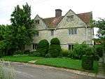
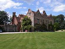
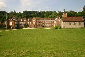
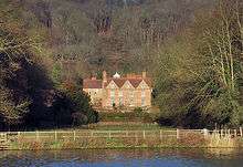
Beckley Park Beckley House c.1540 18 July 1963 SP5772211975
51°48′12″N 1°09′51″W / 51.803446°N 1.164273°W / 51.803446; -1.164273 (Beckley Park)
1180781
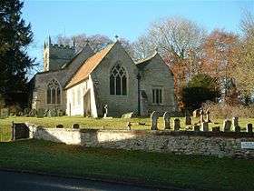
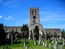
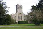
Church of the Assumption of the Blessed Virgin Mary Beckley Church 14th century 18 July 1963 SP5622711262
51°47′50″N 1°11′10″W / 51.797188°N 1.186068°W / 51.797188; -1.186068 (Church of the Assumption of the Blessed Virgin Mary)
1047650
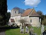
Church of St Bartholomew Brightwell Baldwin Church 13th century 18 July 1963 SU6532095002
51°39′00″N 1°03′26″W / 51.650026°N 1.057275°W / 51.650026; -1.057275 (Church of St Bartholomew)
1059763
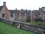
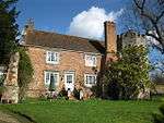
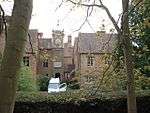
Small's House Mackney, Brightwell-cum-Sotwell House c.1580 9 April 1952 SU5790989973
51°36′20″N 1°09′55″W / 51.605625°N 1.165209°W / 51.605625; -1.165209 (Small's House)
1368884
Church of St Mary Chalgrove Church Early 13th century 18 July 1963 SU6371696549
51°39′51″N 1°04′49″W / 51.664118°N 1.080174°W / 51.664118; -1.080174 (Church of St Mary)
1284879
The Manor Chalgrove Hall House Early 15th century 18 July 1963 SU6306197027
51°40′07″N 1°05′22″W / 51.668489°N 1.089557°W / 51.668489; -1.089557 (The Manor)
1368856
Church of St Peter and St Paul Checkendon Church 12th century 9 February 1959 SU6632283040
51°32′33″N 1°02′42″W / 51.54237°N 1.045052°W / 51.54237; -1.045052 (Church of St Peter and St Paul)
1180822
Church of St Andrew Chinnor Church Early 13th century 18 July 1963 SP7567900889
51°42′06″N 0°54′23″W / 51.701651°N 0.906301°W / 51.701651; -0.906301 (Church of St Andrew)
1368881
Church of St Mary Cholsey Church 11th century 14 June 1963 SU5837487007
51°34′44″N 1°09′32″W / 51.578911°N 1.158988°W / 51.578911; -1.158988 (Church of St Mary)
1059283
Church of St Mary Magdalene Crowmarsh Gifford Church 12th century 9 February 1959 SU6146689314
51°35′58″N 1°06′50″W / 51.599324°N 1.113969°W / 51.599324; -1.113969 (Church of St Mary Magdalene)
1059582
Church of All Saints Cuddesdon Church Mid–late 12th century 18 July 1963 SP6007803045
51°43′23″N 1°07′54″W / 51.722917°N 1.13165°W / 51.722917; -1.13165 (Church of All Saints)
1047709
Abbey Church of St Peter and St Paul Dorchester on Thames Abbey 1140–1536 18 July 1963 SU5792794196
51°38′37″N 1°09′51″W / 51.643589°N 1.164252°W / 51.643589; -1.164252 (Abbey Church of St Peter and St Paul)
1193595
Churchyard cross approximately 6 metres south of Dorchester Abbey Dorchester on Thames Cross 14th/15th century 18 July 1963 SU5789094188
51°38′37″N 1°09′53″W / 51.643521°N 1.164788°W / 51.643521; -1.164788 (Churchyard cross approximately 6 metres south of Dorchester Abbey)
1047865
Church of St Andrew East Hagbourne Church 12th century 14 June 1963 SU5254988196
51°35′25″N 1°14′34″W / 51.590173°N 1.242864°W / 51.590173; -1.242864 (Church of St Andrew)
1047927
Church of St Mary Ewelme Church c.1432 18 July 1963 SU6466091405
51°37′04″N 1°04′03″W / 51.617765°N 1.067476°W / 51.617765; -1.067476 (Church of St Mary)
1059360
Ewelme Church of England Primary School Ewelme School c.1450 18 July 1963 SU6459891360
51°37′03″N 1°04′06″W / 51.617368°N 1.06838°W / 51.617368; -1.06838 (Ewelme Church of England Primary School)
1369062
Gods Place, and lobby to Church of St Mary Ewelme Almshouse c.1437 18 July 1963 SU6463691394
51°37′04″N 1°04′04″W / 51.617669°N 1.067825°W / 51.617669; -1.067825 (Gods Place, and lobby to Church of St Mary)
1369023
School House and archway Ewelme School house Mid-15th century 18 July 1963 SU6460491379
51°37′03″N 1°04′06″W / 51.617538°N 1.06829°W / 51.617538; -1.06829 (School House and archway)
1059349
Church of St Thomas of Canterbury Goring on Thames Church 12th century 9 February 1959 SU5976480711
51°31′20″N 1°08′24″W / 51.522163°N 1.139998°W / 51.522163; -1.139998 (Church of St Thomas of Canterbury)
1194201
Alnutts Hospital and attached forecourt walls and gate Goring Heath Almshouses c.1724 24 October 1951 SU6569779447
51°30′37″N 1°03′17″W / 51.510141°N 1.054732°W / 51.510141; -1.054732 (Alnutts Hospital and attached forecourt walls and gate)
1194275
Church of St Peter Great Haseley Church c.1200 18 July 1963 SP6443101695
51°42′37″N 1°04′08″W / 51.710299°N 1.068889°W / 51.710299; -1.068889 (Church of St Peter)
1047529
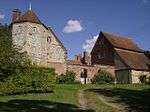
Tithe barn at Church Farm and attached wall at the stables Great Haseley Tithe barn c.1400 18 July 1963 SP6444501765
51°42′39″N 1°04′07″W / 51.710926°N 1.068674°W / 51.710926; -1.068674 (Tithe barn at Church Farm and attached wall at the stables)
1047532
Church of St Mary Great Milton Church 11th century 18 July 1963 SP6279902422
51°43′01″N 1°05′33″W / 51.717019°N 1.092375°W / 51.717019; -1.092375 (Church of St Mary)
1369258
Chantry House Henley-on-Thames Chantry college c.1400 25 January 1951 SU7629382693
51°32′17″N 0°54′05″W / 51.537993°N 0.901375°W / 51.537993; -0.901375 (Chantry House)
1047033
Henley Bridge Henley-on-Thames Bridge 1786 25 January 1951 SU7634282644
51°32′15″N 0°54′02″W / 51.537546°N 0.900679°W / 51.537546; -0.900679 (Henley Bridge)
1369131
Church of St Bartholomew Holton Church Late 12th century 18 July 1963 SP6051806391
51°45′11″N 1°07′29″W / 51.752951°N 1.1247°W / 51.752951; -1.1247 (Church of St Bartholomew)
1047596
Church Farm, barn approximately 30 metres ESE of farmhouse (not included) Lewknor House Mid-/late 14th century 19 November 1976 SU7150697658
51°40′23″N 0°58′02″W / 51.673152°N 0.967336°W / 51.673152; -0.967336 (Church Farm, barn approximately 30 metres ESE of farmhouse (not included))
1368861
Church of St Margaret Lewknor Church Late 12th century 18 July 1963 SU7157297650
51°40′23″N 0°57′59″W / 51.673071°N 0.966383°W / 51.673071; -0.966383 (Church of St Margaret)
1182190
Haseley Court Little Haseley Country house 14th century 18 July 1963 SP6449300596
51°42′01″N 1°04′06″W / 51.700412°N 1.068195°W / 51.700412; -1.068195 (Haseley Court)
1047539
Church of St Mary Long Wittenham Church c.1120 14 June 1963 SU5484894043
51°38′33″N 1°12′32″W / 51.642521°N 1.208768°W / 51.642521; -1.208768 (Church of St Mary)
1368798
Church of St Margaret and Bardolf Aisle Mapledurham Church 13th century 9 February 1959 SU6700576676
51°29′06″N 1°02′11″W / 51.485076°N 1.036412°W / 51.485076; -1.036412 (Church of St Margaret and Bardolf Aisle)
1059519
Mapledurham House Mapledurham Country house c.1585 24 October 1951 SU6706776655
51°29′06″N 1°02′08″W / 51.48488°N 1.035523°W / 51.48488; -1.035523 (Mapledurham House)
1368944
Church of St Giles Newington Church 12th century 18 July 1963 SU6087896527
51°39′51″N 1°07′16″W / 51.664234°N 1.121205°W / 51.664234; -1.121205 (Church of St Giles)
1193229
Church of All Saints North Moreton Church Early 13th century 14 June 1963 SU5620689569
51°36′08″N 1°11′24″W / 51.602165°N 1.189862°W / 51.602165; -1.189862 (Church of All Saints)
1181258
Church of St Mary North Stoke Church 13th century 9 February 1959 SU6089786210
51°34′17″N 1°07′22″W / 51.57148°N 1.12272°W / 51.57148; -1.12272 (Church of St Mary)
1059577
Carfax Conduit Nuneham Courtenay Conduit 1617 18 July 1963 SU5372797671
51°40′31″N 1°13′28″W / 51.675247°N 1.22441°W / 51.675247; -1.22441 (Carfax Conduit)
1193569
Rycote Chapel Rycote Church 1449 18 July 1963 SP6669904651
51°44′12″N 1°02′08″W / 51.736608°N 1.035504°W / 51.736608; -1.035504 (Rycote Chapel)
1047514
Greys Court Rotherfield Greys House 14th century 24 October 1951 SU7248283417
51°32′42″N 0°57′22″W / 51.545003°N 0.956164°W / 51.545003; -0.956164 (Greys Court)
1181202
Greys Court, Dower House Rotherfield Greys Dower house 16th century 24 October 1951 SU7254483383
51°32′41″N 0°57′19″W / 51.544689°N 0.955277°W / 51.544689; -0.955277 (Greys Court, Dower House)
1047391
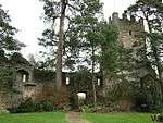
Greys Court, Great Tower, attached ruined tower and walls approximately 60 metres east Rotherfield Greys Fortified house 14th century 24 October 1951 SU7254183441
51°32′43″N 0°57′19″W / 51.545211°N 0.955308°W / 51.545211; -0.955308 (Greys Court, Great Tower, attached ruined tower and walls approximately 60 metres east)
1181246
Greys Court, the Keep Rotherfield Greys Keep 14th century 24 October 1951 SU7244983374
51°32′41″N 0°57′24″W / 51.544621°N 0.956649°W / 51.544621; -0.956649 (Greys Court, the Keep)
1369333
Greys Court, Well House Rotherfield Greys Timber-framed house 16th century 24 October 1951 SU7246783373
51°32′41″N 0°57′23″W / 51.544609°N 0.956389°W / 51.544609; -0.956389 (Greys Court, Well House)
1369334
Shirburn Castle Shirburn Castle 1377 18 July 1963 SU6966095976
51°39′30″N 0°59′40″W / 51.658262°N 0.994362°W / 51.658262; -0.994362 (Shirburn Castle)
1368852
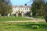
Shotover Park Shotover Country house c.1715–20 18 July 1963 SP5841506714
51°45′22″N 1°09′18″W / 51.756078°N 1.155108°W / 51.756078; -1.155108 (Shotover Park)
1284986
Church of St John the Baptist Stanton St. John Church c.1200 18 July 1963 SP5775009372
51°46′48″N 1°09′51″W / 51.780042°N 1.1643°W / 51.780042; -1.1643 (Church of St John the Baptist)
1182305
Stonor House and attached walls and buildings Stonor Country house 13th century 24 October 1951 SU7425289228
51°35′49″N 0°55′46″W / 51.597013°N 0.929418°W / 51.597013; -0.929418 (Stonor House and attached walls and buildings)
1059444
Chapel approximately 10 metres south of the Prebendal Thame Chapel c.1250 24 April 1951 SP7021906359
51°45′06″N 0°59′03″W / 51.751533°N 0.984194°W / 51.751533; -0.984194 (Chapel approximately 10 metres south of the Prebendal)
1180882
Church of St Mary Thame Church Early 13th century 24 April 1951 SP7038506318
51°45′04″N 0°58′54″W / 51.751144°N 0.981798°W / 51.751144; -0.981798 (Church of St Mary)
1194053
Thame Park House Thame Country house 14th century 24 April 1951 SP7167203727
51°43′40″N 0°57′49″W / 51.727689°N 0.96369°W / 51.727689; -0.96369 (Thame Park House)
1368734
Fragment of castle wall at Wallingford Castle Wallingford Bailey 13th century 9 December 1949 SU6096589780
51°36′13″N 1°07′16″W / 51.603568°N 1.12112°W / 51.603568; -1.12112 (Fragment of castle wall at Wallingford Castle)
1181852
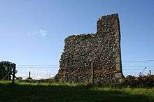
Remains of Queen's Tower, Wallingford Castle Wallingford Castle 13th century 9 December 1949 SU6103489717
51°36′11″N 1°07′12″W / 51.602994°N 1.120135°W / 51.602994; -1.120135 (Remains of Queen's Tower, Wallingford Castle)
1059619
Remains of St Nicholas's College Wallingford Motte and bailey 13th century 9 December 1949 SU6090489595
51°36′07″N 1°07′19″W / 51.601911°N 1.122033°W / 51.601911; -1.122033 (Remains of St Nicholas's College)
1181912
Town Hall Wallingford Guildhall c.1670 9 December 1949 SU6071689359
51°35′59″N 1°07′29″W / 51.59981°N 1.124788°W / 51.59981; -1.124788 (Town Hall)
1368477
Church of St Mary Waterperry Church Saxon 18 July 1963 SP6295606322
51°45′07″N 1°05′22″W / 51.752062°N 1.089399°W / 51.752062; -1.089399 (Church of St Mary)
1047587
Church of St Mary, churchyard cross approximately 10 metres to south Waterperry Cross Medieval 5 June 1985 SP6295706309
51°45′07″N 1°05′22″W / 51.751945°N 1.089387°W / 51.751945; -1.089387 (Church of St Mary, churchyard cross approximately 10 metres to south)
1047588
Church of St Andrew Wheatfield Church 14th century 18 July 1963 SU6886799274
51°41′17″N 1°00′19″W / 51.688008°N 1.005174°W / 51.688008; -1.005174 (Church of St Andrew)
1059672
Hardwick House Whitchurch-on-Thames Country house Early 16th century 24 October 1951 SU6593377732
51°29′41″N 1°03′06″W / 51.494695°N 1.051651°W / 51.494695; -1.051651 (Hardwick House)
1180567
Hardwick House: Dower House approximately 5 metres west Whitchurch-on-Thames House Late 17th century 16 August 1985 SU6592477748
51°29′41″N 1°03′06″W / 51.49484°N 1.051778°W / 51.49484; -1.051778 (Hardwick House: Dower House approximately 5 metres west)
1059525
Church of the Holy Rood Woodeaton Church 13th century 18 July 1963 SP5348911898
51°48′11″N 1°13′32″W / 51.803174°N 1.225669°W / 51.803174; -1.225669 (Church of the Holy Rood)
1047562
Woodeaton Cross Woodeaton Village cross Medieval 18 July 1963 SP5349811960
51°48′13″N 1°13′32″W / 51.80373°N 1.225529°W / 51.80373; -1.225529 (Woodeaton Cross)
1047563
The Old Brewhouse with entrance screen, Woodperry House Woodperry, Stanton St. John Country house 1728–31 18 July 1963 SP5751010430
51°47′22″N 1°10′03″W / 51.789578°N 1.167603°W / 51.789578; -1.167603 (The Old Brewhouse with entrance screen, Woodperry House)
1047582

See also

Notes

  1. The date given is the date used by Historic England as significant for the initial building or that of an important part in the structure's description.
  2. Sometimes known as OSGB36, the grid reference is based on the British national grid reference system used by the Ordnance Survey.
  3. The "List Entry Number" is a unique number assigned to each listed building and scheduled monument by Historic England.

External links

Media related to Grade I listed buildings in Oxfordshire at Wikimedia Commons

This article is issued from Wikipedia - version of the 11/26/2015. The text is available under the Creative Commons Attribution/Share Alike but additional terms may apply for the media files.