Grade I listed buildings in Vale of White Horse

There are over 9,000 Grade I listed buildings in England. This page is a list of these buildings in the district of Vale of White Horse in Oxfordshire.

List of buildings

Name Location Type Completed [note 1]Date designated Grid ref.[note 2]
Geo-coordinates
Entry number [note 3]Image
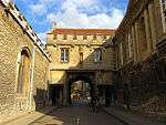
Abbey Gate Abingdon Abbey Gateway Late 15th century 19 January 1951 SU4985097076
51°40′13″N 1°16′50″W / 51.670254°N 1.280558°W / 51.670254; -1.280558 (Abbey Gate)
1368671
Brick Alley Almshouses Abingdon Almshouse 1718 10 December 1971 SU4969696732
51°40′02″N 1°16′58″W / 51.667175°N 1.282834°W / 51.667175; -1.282834 (Brick Alley Almshouses)
1200005
Church of St Helen Abingdon Church Late 12th or early 13th century 19 January 1951 SU4969496775
51°40′03″N 1°16′58″W / 51.667562°N 1.282856°W / 51.667562; -1.282856 (Church of St Helen)
1300979
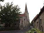
Church of St Nicholas Abingdon Church c.1170 19 January 1951 SU4984397082
51°40′13″N 1°16′50″W / 51.670309°N 1.280659°W / 51.670309; -1.280659 (Church of St Nicholas)
1048110
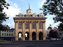
County Hall and Market House Abingdon County hall 1678–83 19 January 1951 SU4978597051
51°40′12″N 1°16′53″W / 51.670035°N 1.281502°W / 51.670035; -1.281502 (County Hall and Market House)
1199601
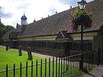
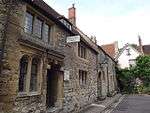
Long Alley Almshouses Abingdon Almshouses c.1500 19 January 1951 SU4966396729
51°40′02″N 1°17′00″W / 51.667151°N 1.283311°W / 51.667151; -1.283311 (Long Alley Almshouses)
1048811
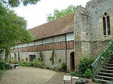
The Checker Unicorn Theatre Abingdon Abbey Abbey 13th century 19 January 1951 SU4997397022
51°40′11″N 1°16′44″W / 51.669758°N 1.278787°W / 51.669758; -1.278787 (The Checker Unicorn Theatre)
1048108
The Long Gallery Abingdon Abbey Abbey c.1500 19 January 1951 SU4999097035
51°40′12″N 1°16′43″W / 51.669873°N 1.27854°W / 51.669873; -1.27854 (The Long Gallery)
1048107
Unicorn Theatre Abingdon Abbey House 13th century 19 January 1951 SU4996397012
51°40′11″N 1°16′44″W / 51.669669°N 1.278933°W / 51.669669; -1.278933 (Unicorn Theatre)
1048844
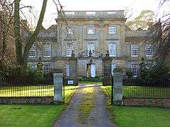
Ashdown House Ashbury Country house c.1662 10 November 1952 SU2820382009
51°32′11″N 1°35′41″W / 51.536285°N 1.594773°W / 51.536285; -1.594773 (Ashdown House)
1048765
Ashdown House, pavilion and attached wall approximately 20 metres south-east Ashbury Pavilion c.1662 10 November 1952 SU2823482003
51°32′10″N 1°35′40″W / 51.536229°N 1.594326°W / 51.536229; -1.594326 (Ashdown House, pavilion and attached wall approximately 20 metres south-east)
1048767
Ashdown House, pavilion approximately 20 metres north-east Ashbury Pavilion c.1662 10 November 1952 SU2822582033
51°32′11″N 1°35′40″W / 51.536499°N 1.594454°W / 51.536499; -1.594454 (Ashdown House, pavilion approximately 20 metres north-east)
1048766
Church of St Mary Ashbury Church 12th century 21 November 1966 SU2653284919
51°33′45″N 1°37′07″W / 51.56253°N 1.618646°W / 51.56253; -1.618646 (Church of St Mary)
1048770
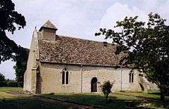
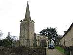
Church of St Nicholas Baulking Church Mid-13th century 21 November 1966 SU3172690705
51°36′51″N 1°32′36″W / 51.614285°N 1.543199°W / 51.614285; -1.543199 (Church of St Nicholas)
1048680
Church of St Michael Blewbury Church 11th century 24 November 1966 SU5314685917
51°34′11″N 1°14′05″W / 51.569628°N 1.234591°W / 51.569628; -1.234591 (Church of St Michael)
1368625
Church of St Mary Buckland Church 1707 21 November 1966 SU3427398205
51°40′54″N 1°30′20″W / 51.681568°N 1.505683°W / 51.681568; -1.505683 (Church of St Mary)
1181905
The Church of St Mary Buscot Church 13th century 21 November 1966 SU2265998142
51°40′54″N 1°40′25″W / 51.681588°N 1.673665°W / 51.681588; -1.673665 (The Church of St Mary)
1368093
Charney Manor Charney Bassett Manor house Late 13th century 10 November 1952 SU3810794442
51°38′51″N 1°27′02″W / 51.647489°N 1.450641°W / 51.647489; -1.450641 (Charney Manor)
1182077
Church of St Peter Charney Bassett Church Early 12th century 21 November 1966 SU3809994425
51°38′50″N 1°27′03″W / 51.647337°N 1.450758°W / 51.647337; -1.450758 (Church of St Peter)
1182087
Church of St Mary Childrey Church Early 13th century 24 November 1966 SU3600387794
51°35′16″N 1°28′54″W / 51.587856°N 1.481729°W / 51.587856; -1.481729 (Church of St Mary)
1048743
Coleshill Park, Great Piers, including cast-iron gates Coleshill Gate Late 18th century 10 November 1952 SU2422093902
51°38′36″N 1°39′05″W / 51.643401°N 1.65138°W / 51.643401; -1.65138 (Coleshill Park, Great Piers, including cast-iron gates)
1052691
Compton Beauchamp House and walling and attached bridge to north Compton Beauchamp Country house 16th century 10 November 1952 SU2798686926
51°34′50″N 1°35′51″W / 51.580505°N 1.597512°W / 51.580505; -1.597512 (Compton Beauchamp House and walling and attached bridge to north)
1368367
Church of St Michael Cumnor Church Late 12th century 9 February 1966 SP4614704134
51°44′02″N 1°19′59″W / 51.734025°N 1.333168°W / 51.734025; -1.333168 (Church of St Michael)
1048342
Jesus Chapel and Attached House East Hendred House 15th century 25 October 1951 SU4604688891
51°35′49″N 1°20′12″W / 51.596989°N 1.336634°W / 51.596989; -1.336634 (Jesus Chapel and Attached House)
1048167
Church of All Saints Faringdon Church 12th century 21 November 1966 SU2887395724
51°39′34″N 1°35′02″W / 51.659564°N 1.583989°W / 51.659564; -1.583989 (Church of All Saints)
1199147
Faringdon House Faringdon Country house 1770–85 10 November 1952 SU2879195900
51°39′40″N 1°35′07″W / 51.66115°N 1.58516°W / 51.66115; -1.58516 (Faringdon House)
1048410
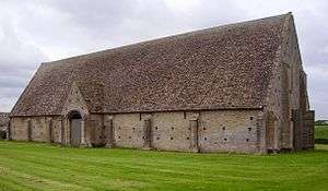
The Great Barn Great Coxwell Barn Early 13th century 21 November 1966 SU2689694029
51°38′40″N 1°36′46″W / 51.644422°N 1.612699°W / 51.644422; -1.612699 (The Great Barn)
1183045
Church of St Mary Longworth Church Early 13th century 21 November 1966 SU3840599468
51°41′34″N 1°26′45″W / 51.692657°N 1.445783°W / 51.692657; -1.445783 (Church of St Mary)
1048616
Milton Manor Cottage and Milton Manor House Milton Manor house c.1776 6 August 1952 SU4841392385
51°37′42″N 1°18′07″W / 51.628205°N 1.301984°W / 51.628205; -1.301984 (Milton Manor Cottage and Milton Manor House)
1048220
Church of St Faith Shellingford Church 12th century 2 November 1966 SU3195193515
51°38′22″N 1°32′23″W / 51.639537°N 1.539694°W / 51.639537; -1.539694 (Church of St Faith)
1368447
China House to west of Beckett Hall Shrivenham Fishing lodge c.1635–55 21 July 1982 SU2460189120
51°36′01″N 1°38′46″W / 51.600389°N 1.646209°W / 51.600389; -1.646209 (China House to west of Beckett Hall)
1048793
Church of St Andrew Shrivenham Church Early 15th century 21 November 1966 SU2407589078
51°36′00″N 1°39′14″W / 51.600034°N 1.653806°W / 51.600034; -1.653806 (Church of St Andrew)
1284309
Church of the Holy Rood Sparsholt Church Late 12th century 24 November 1966 SU3468487540
51°35′08″N 1°30′03″W / 51.585654°N 1.500792°W / 51.585654; -1.500792 (Church of the Holy Rood)
1048702
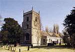
Church of St Denys Stanford in the Vale Church Late 12th century 21 November 1966 SU3419693468
51°38′20″N 1°30′26″W / 51.638983°N 1.507258°W / 51.638983; -1.507258 (Church of St Denys)
1048607
Church of St Michael and All Angels Steventon Church Early 14th century 9 February 1966 SU4644191427
51°37′11″N 1°19′50″W / 51.619757°N 1.330597°W / 51.619757; -1.330597 (Church of St Michael and All Angels)
1181950
Church of All Saints Sutton Courtenay Church 13th to 15th century 9 February 1966 SU5048594194
51°38′39″N 1°16′18″W / 51.644287°N 1.271792°W / 51.644287; -1.271792 (Church of All Saints)
1182209
The Abbey Sutton Courtenay House 16th century 6 September 1952 SU5026994000
51°38′33″N 1°16′30″W / 51.642562°N 1.274941°W / 51.642562; -1.274941 (The Abbey)
1052729
The Norman Hall Sutton Courtenay House Late 12th century 6 August 1952 SU5042694266
51°38′42″N 1°16′21″W / 51.644939°N 1.272634°W / 51.644939; -1.272634 (The Norman Hall)
1182314
Church of St Mary Uffington Church c.1250 11 December 1985 SU3023089317
51°36′07″N 1°33′54″W / 51.601887°N 1.564923°W / 51.601887; -1.564923 (Church of St Mary)
1198865
Church of St Peter and St Paul Wantage Church Late 13th century 22 April 1950 SU3969087912
51°35′19″N 1°25′43″W / 51.58867°N 1.4285°W / 51.58867; -1.4285 (Church of St Peter and St Paul)
1048567
Church of the Holy Trinity West Hendred Church 14th century 24 November 1966 SU4473288281
51°35′30″N 1°21′20″W / 51.591611°N 1.355681°W / 51.591611; -1.355681 (Church of the Holy Trinity)
1200322
Wytham Abbey and attached wall Wytham Country house Late 15th and 16th century 6 August 1952 SP4741608515
51°46′24″N 1°18′51″W / 51.773306°N 1.314198°W / 51.773306; -1.314198 (Wytham Abbey and attached wall)
1368599

See also

Notes

  1. The date given is the date used by Historic England as significant for the initial building or that of an important part in the structure's description.
  2. Sometimes known as OSGB36, the grid reference is based on the British national grid reference system used by the Ordnance Survey.
  3. The "List Entry Number" is a unique number assigned to each listed building and scheduled monument by Historic England.

Media related to Grade I listed buildings in Oxfordshire at Wikimedia Commons

This article is issued from Wikipedia - version of the 7/15/2016. The text is available under the Creative Commons Attribution/Share Alike but additional terms may apply for the media files.